
Minneapolis and Saint Anthony
$250.00
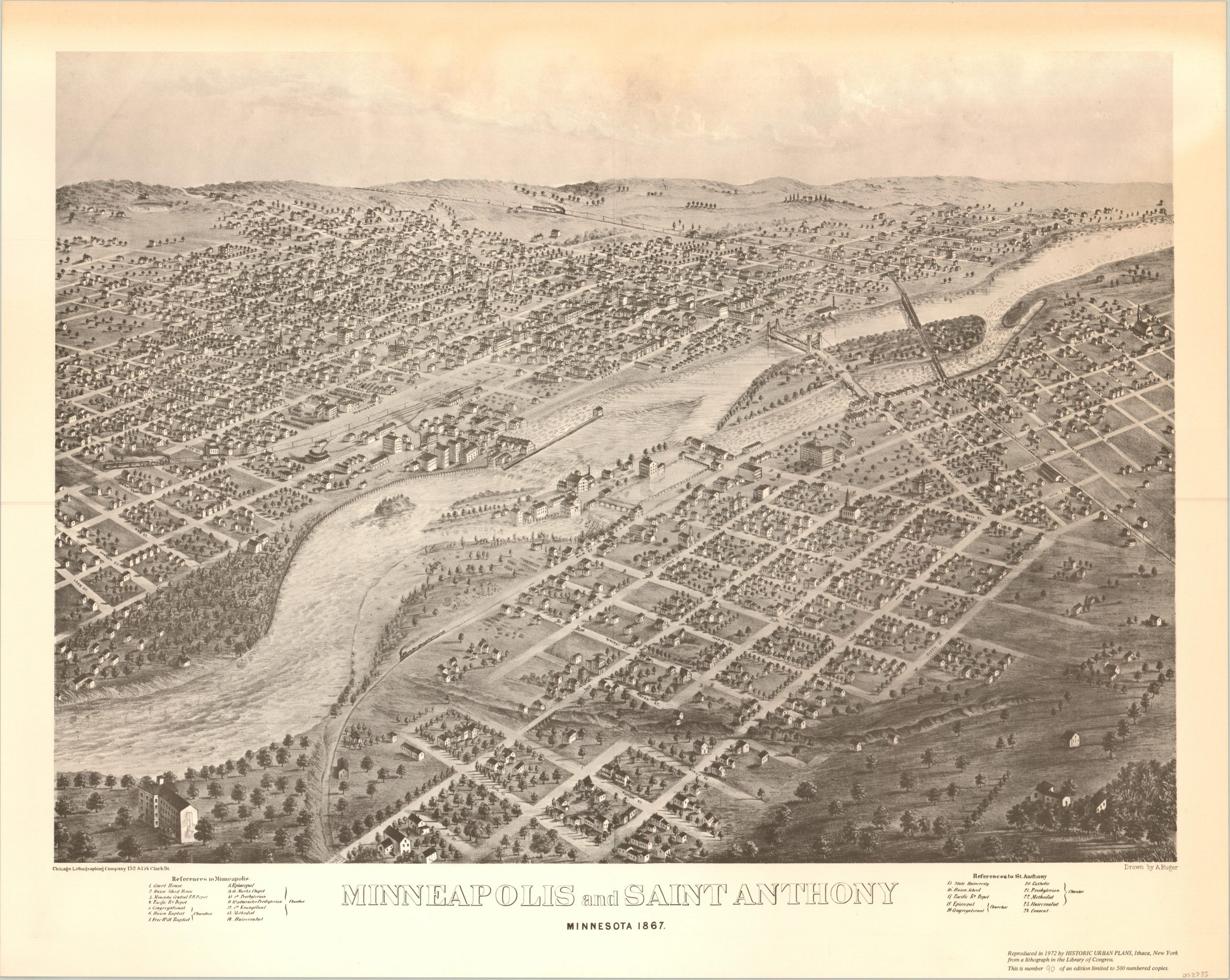
A 20th century reproduction of a magnificent bird’s eye view of Minneapolis.
1 in stock
Description
This spectacular view of the fledgling towns of Minneapolis and Saint Anthony was originally drawn by A. Ruger and published by the Chicago Lithographic Company in 1867. This example is a later reproduction, number 90 of a limited issue of 500 prints created by Historic Urban Plans of Ithaca, New York in 1972.
The image captures the Minneapolis area the same year it was established as a city by the state legislature, and about five years before Saint Anthony was incorporated. The Mississippi River can be seen bisecting the scene, with the Falls of St. Anthony (the site of original European settlement) squarely in the middle of the page. Streets are labeled individually, and twenty-four separate locations of interest are numbered within the map and outlined in two legends along the bottom of the sheet.
Of particular interest is an early iteration of the University of Minnesota (Number 15) and the Union Pacific Railway Depot (Number 4). The myriad of churches is also emblematic of the religiously cosmopolitan nature of the city at the time of publication.
Map Details
Publication Date: 1972
Author: Historic Urban Plans
Sheet Width (in): 28.75
Sheet Height (in): 23
Condition: B+
Condition Description: Moderate toning visible in the margins and along the right side of the sheet. Otherwise in very good condition overall.
$250.00
1 in stock