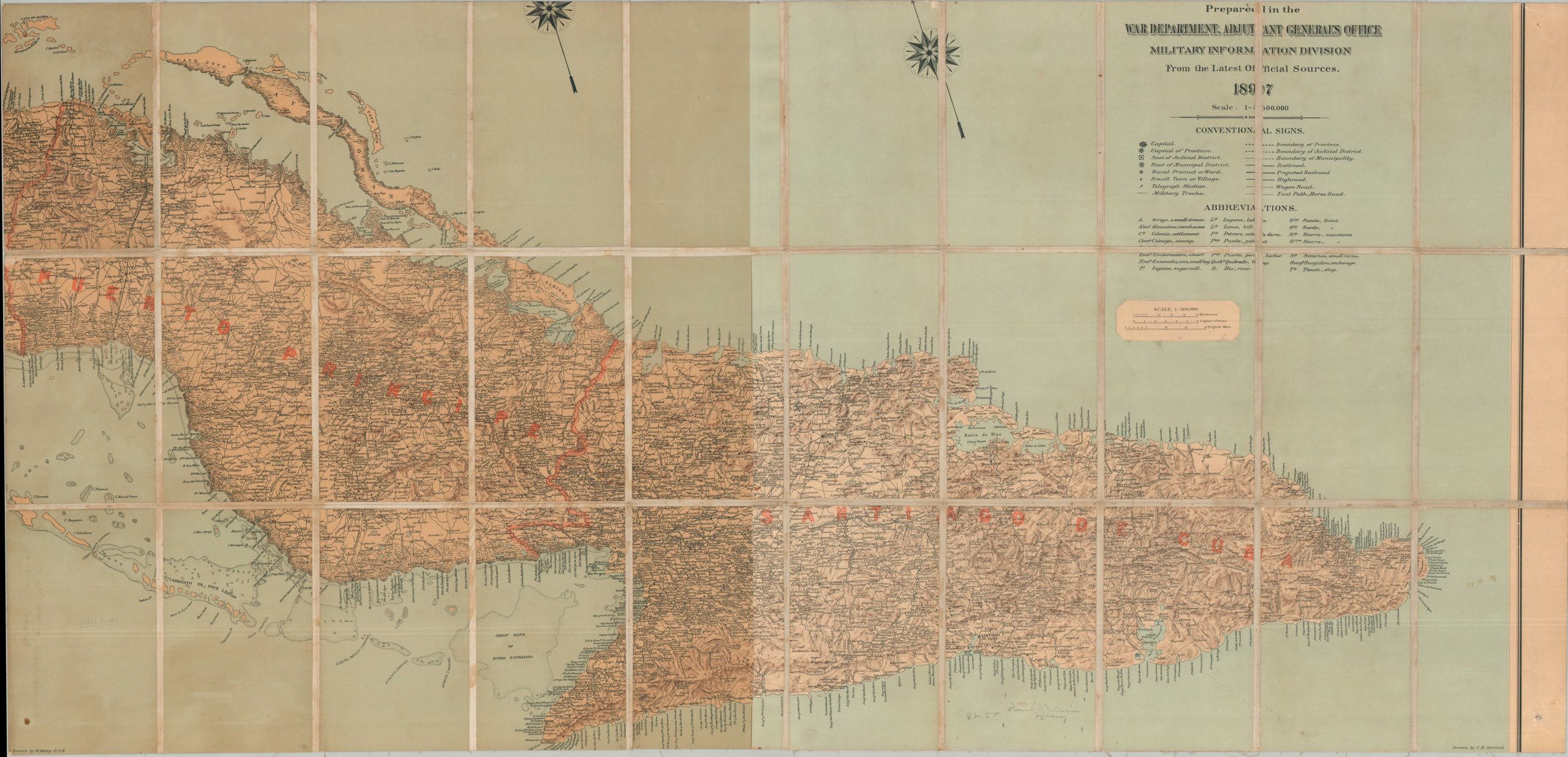
Military Map of the Island of Cuba Prepared in the War Department, Adjutant General’s Office Military Information Division From The Latest Official Sources. 1897
$1,500.00
Eastern Cuba, shortly before the outbreak of the Spanish-America War.
1 in stock

Description
This dissected and linen-backed military map of Eastern Cuba was published by Julius Bien & Co. in 1897 on behalf of the U.S. War Department. These two sheets (of an original four-sheet set covering the entire island) were compiled by engineers William Morey, Jr., and Charles Ourand. They capture the provinces of Puerto Príncipe and Santiago de Cuba in extreme detail, noting critical infrastructure, settlements, and transportation routes according to the extensive legend and abbreviations in the upper right. Expertly shaded relief delineates the island’s rugged topography, an unforgiving environment that made large-scale military operations exceptionally difficult.
The region depicted here became the primary theater for some of the heaviest fighting of the Spanish-American War, which broke out just one year after this map’s publication. Using the topographical intelligence provided by such surveys, U.S. forces and Cuban insurgents launched a coordinated inland strike to seize the strategic heights surrounding the Spanish stronghold of Santiago de Cuba. This campaign culminated in the decisive, bloody victories at San Juan Hill and El Caney, effectively trapping the Spanish army between American land forces and a naval blockade. The subsequent destruction of the Spanish fleet as it attempted to flee Santiago Harbor forced a total surrender of the eastern provinces.
This customized example has writing on the verso, in old ink, Personal Property of Lt. Col. Frank D. Baldwin. Baldwin (1842 – 1923) was a distinguished career Army officer who remains one of only 19 individuals to be awarded the Medal of Honor on two separate occasions. He earned his first award for his actions at the Battle of Peachtree Creek during Sherman’s March to the Sea. His second MOH came for his courageous rescue of two young captives during the Indian Wars in 1874. Baldwin’s storied military service spanned over five decades, seeing him rise from a volunteer lieutenant to a major general through the Spanish-American War and into World War I. It’s impossible to be certain that the signature is Baldwin’s, but it seems possible given the course of his promotion schedule and the dates of his various assignments.
Map Details
Publication Date: 1897
Author: C.H. Ourand/W. Morey, Jr.
Sheet Width (in): 50.50
Sheet Height (in): 24.25
Condition: B
Condition Description: Custom production composed of two of the four total sheets covering the eastern end of the island, dissected and mounted onto linen for convenient field use. Upper and lower margins have also been trimmed. Some color differentiation between the tow sheets and moderate toning visible on the far left side. Light scattered surface soiling and some wear to the sheet along the outer edges. Marked, in old ink on the verso, Personal Property of Lt. Col. Francis? [Illegible]. Good condition overall.
$1,500.00
1 in stock