Military Map, Island of Puerto Rico
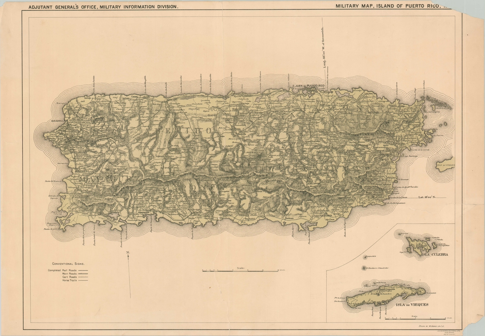
Military map of Puerto Rico shortly after the successful U.S. invasion.
Out of stock
Description
The United States invasion of Puerto Rico in the summer of 1898 was one theater in the broader Spanish-American War. An unopposed landing of troops in July was followed by brief fighting in the island’s interior, with the Spanish defenders capitulating by mid-August.
This map was issued later that year and shows the network of transportation routes available to the conquerors as a result of recent surveys. Topography is shown in hachure and depicts a rugged, mountainous terrain, while inset maps in the lower right show Culebra and Vieques islands.
The map was drawn by William Morey, Jr. and lithographed in 1898 by Julius Bien & Company of New York. Published originally as Enclosure E to accompany the report of Nov. 3, 1898, W.M. Black, Lt. Col. Chief Eng. U.V.
Map Details
Publication Date: 1898
Author: W. Morey Jr.
Sheet Width (in): 31.75
Sheet Height (in): 21.75
Condition: B
Condition Description: Nearly separated along the center, with significant archival repairs on the verso. An additional irregular tear is present in the lower right, and both right corners of the sheet are missing, affecting some of the image in the upper right. Light soiling scattered in a few places, but remains in fair to good condition overall.
Out of stock

