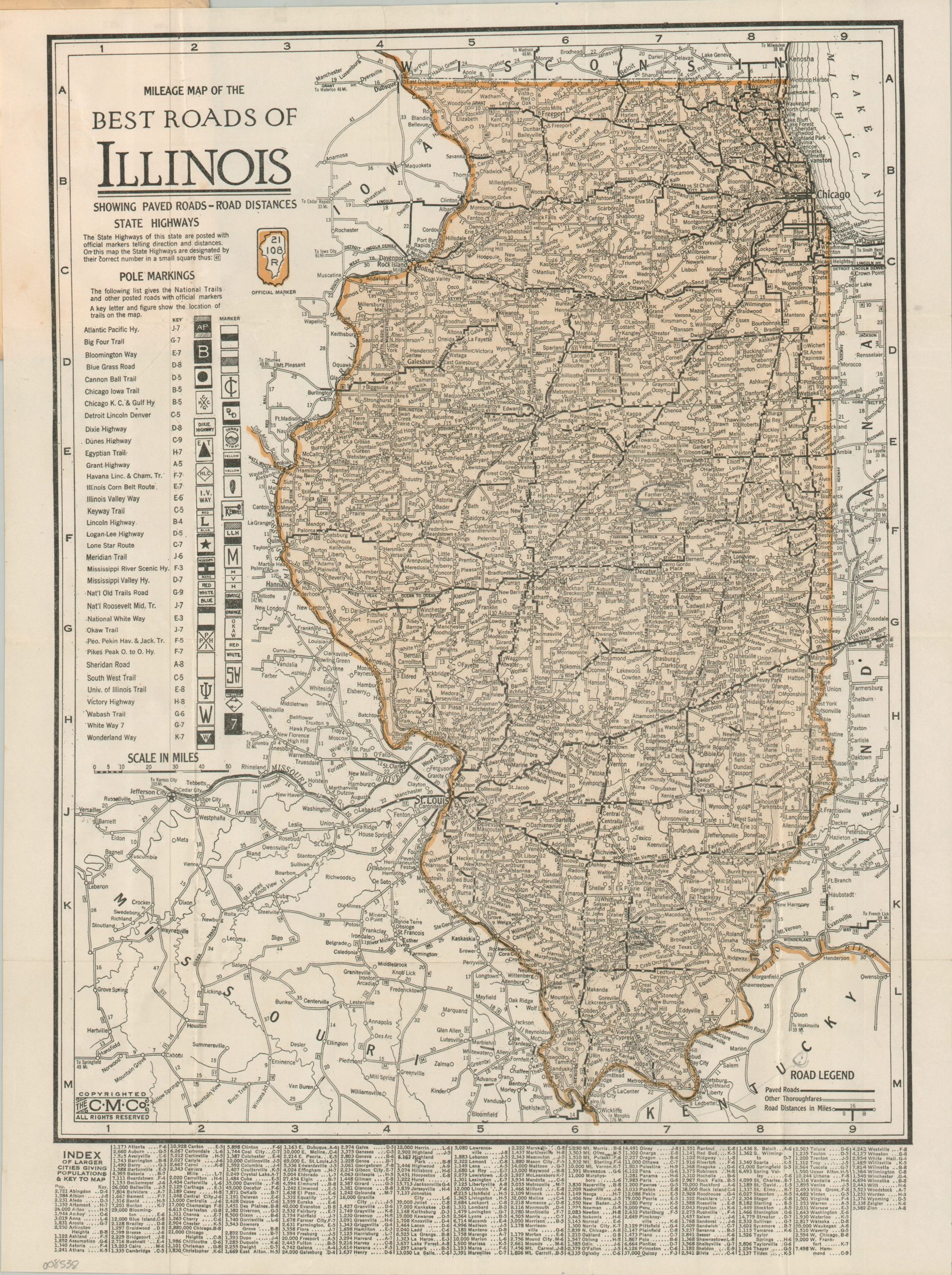
Mileage Map of the Best Roads of Illinois
$125.00
An uncommon mid-1920s road map of Illinois.
1 in stock
Description
This fascinating pocket map of Illinois presents the road network across the Land of Lincoln, just a few years before the introduction of the U.S. Numbered Highway System would standardize the national numbering method. A somewhat confusing mix of State Highways and Auto Trails is noted throughout the image. The former are numbered and marked with a uniform sign, shown in the upper left corner. The latter collection of privately organized auto trails is evidently less practical – they are roughly approximated across the state with a corresponding grid entry. Of particular interest is the University of Illinois Trail – a booster-organized route that connected the campus to Chicago. The mish-mash of markers, inefficient routing, and significant overlap helped to doom the Auto Trails just a few years after the map was issued.
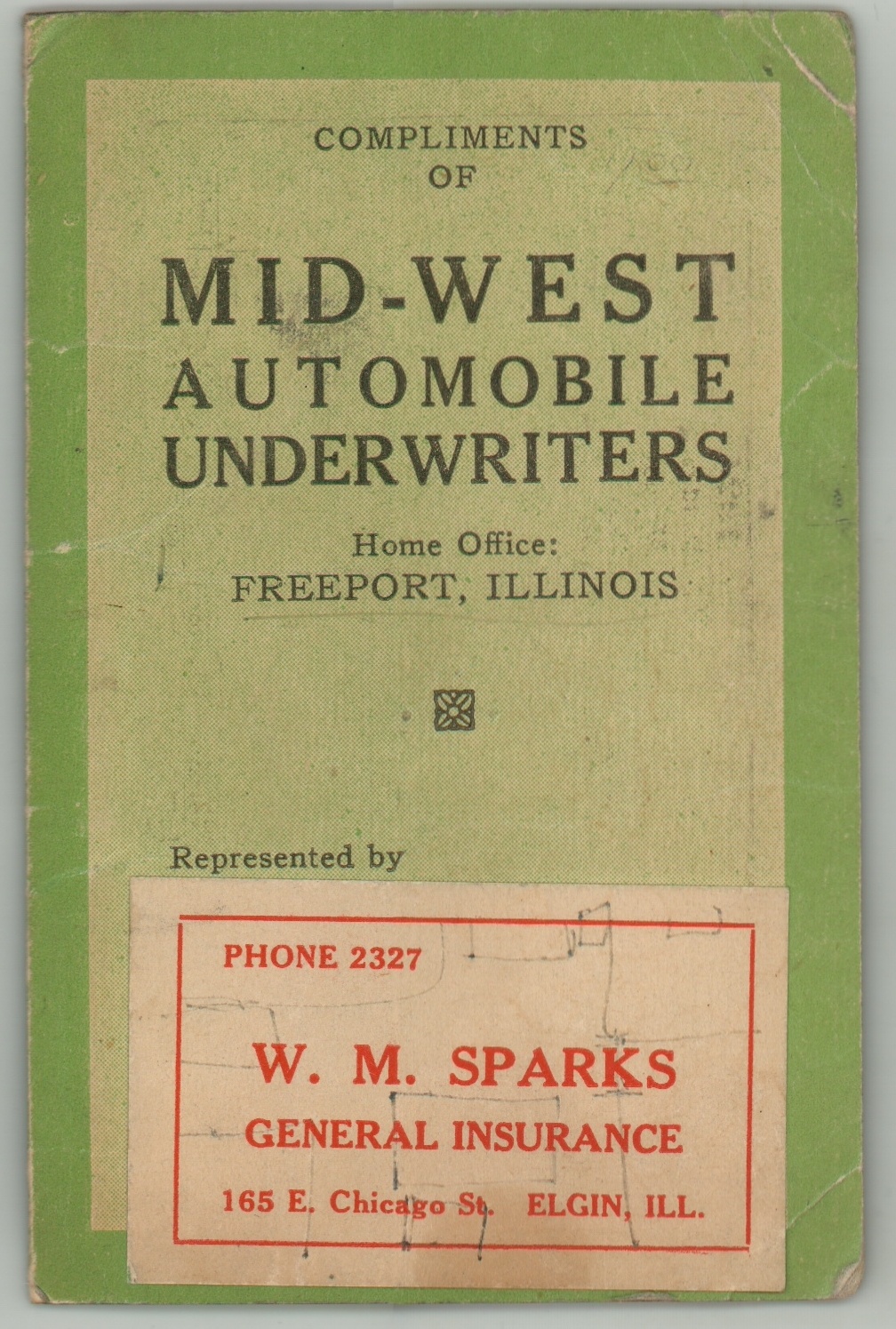
Published in 1924 by the Clason Map Company, with company offices in Denver and Chicago. According to the promotional text on the front cover, this example was distributed compliments of the Mid-West Automobile Underwriters of Freeport, Illinois. An additional sticker shows they are represented by W.M. Sparks, a general insurance agent in Elgin.
Map Details
Publication Date: 1924
Author: Clason Map Company
Sheet Width (in): 12.30
Sheet Height (in): 16.30
Condition: A
Condition Description: Single-sided pocket map folded and attached to original stiff green paper wraps, slightly soiled. A bit of light wear, consistent with age, but overall in very good condition.
$125.00
1 in stock