
Mileage Map of the Best Roads of Florida
$350.00
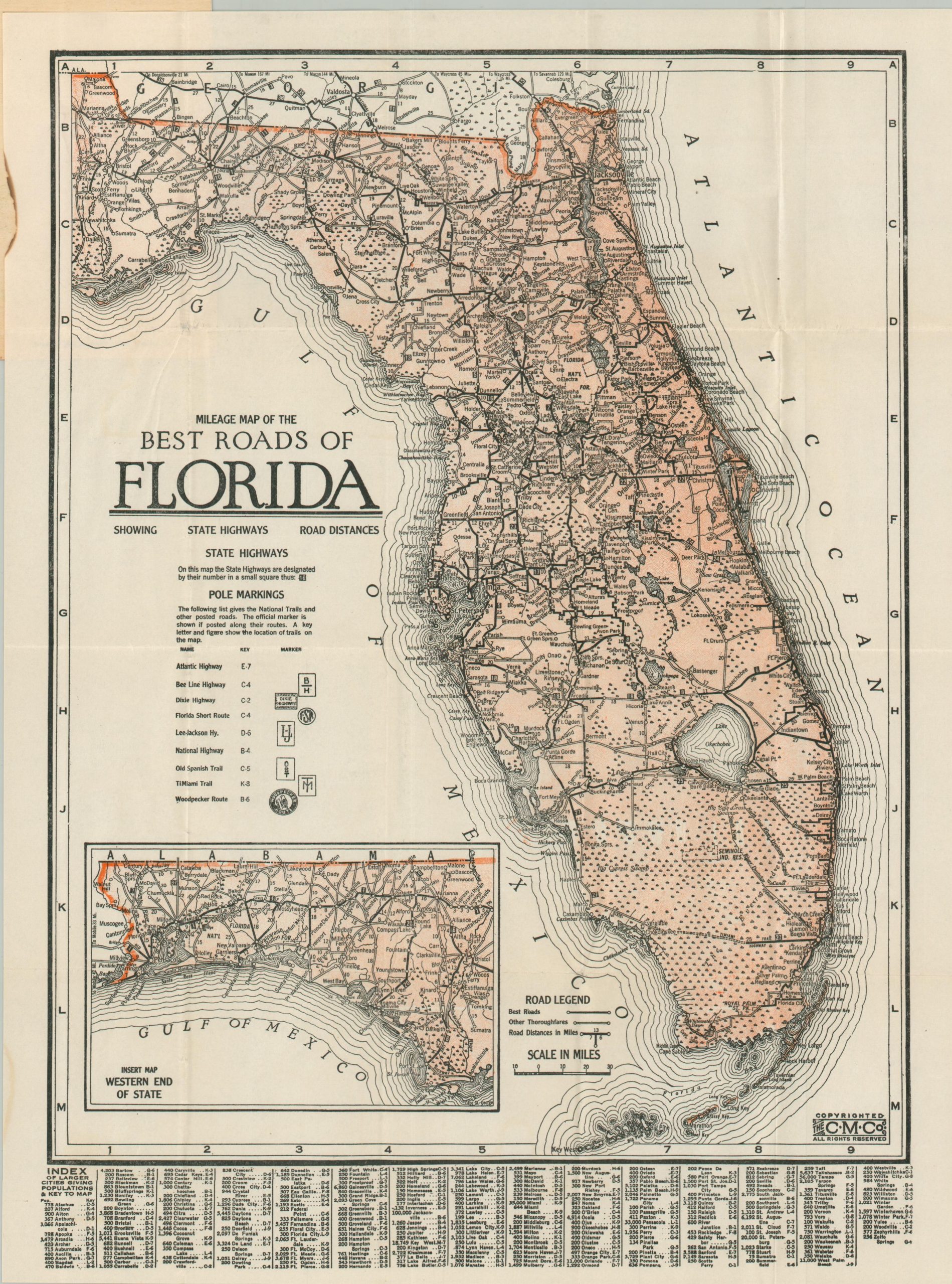
The roads of Florida during the mid-1920s.
1 in stock
Description
This scarce and early road map of Florida was published by the Clason Map Company around 1925. At the time, the network of paved routes was in its relative infancy, and only ‘best roads’ and ‘other thoroughfares’ are noted with solid and empty lines, respectively. Numbered state highways (introduced in 1923) are shown in small blue boxes. Additional highways, historic routes, and sponsored trails were posted on utility poles – their respective markings are shown in the center left. Notable examples include the Dixie Highway, the Old Spanish Trail, and the Atlantic Highway. An index of cities, each with its estimated population, is provided at the bottom of the pocket map.
The inside of the front covers (titled Pleasant Journeys) offers an advertisement for Orwin Manor, the ‘Million Dollar Development of Orlando and Winter Park’. The subdivision, owned by the Central Florida Development Company, began selling parcels in 1924 (in the midst of the Florida Land Boom) and remains a distinctive historic neighborhood in Orlando. A handwritten note reads “why not motor down here – fine roads – 7 day trip – Mary.”
Sources: Michigan State University Library; Orwin Manor
Map Details
Publication Date: c. 1925
Author: Clason Map Company
Sheet Width (in): 12.25
Sheet Height (in): 16.30
Condition: A-
Condition Description: Single-sided color printed map on a folded sheet, affixed to original stiff paper wraps. Lightly wrinkled along folds, with an irregular curl in the left margin. Handwritten note on the faintly worn covers. Very good condition overall. Handwritten note in black ink on the faintly worn covers.
$350.00
1 in stock