Mileage Map of Pennsylvania and Ohio
$95.00
The best roads of Ohio and Pennsylvania during the mid-1920s.
1 in stock
Description
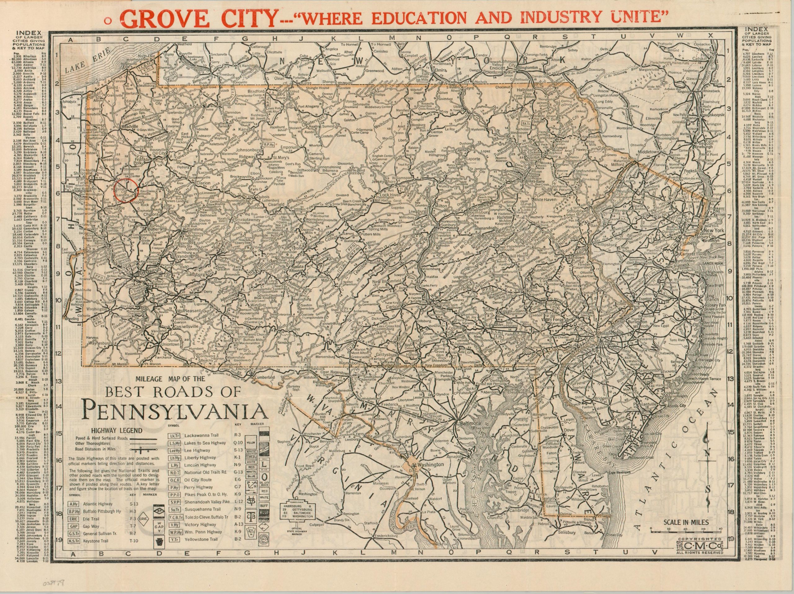
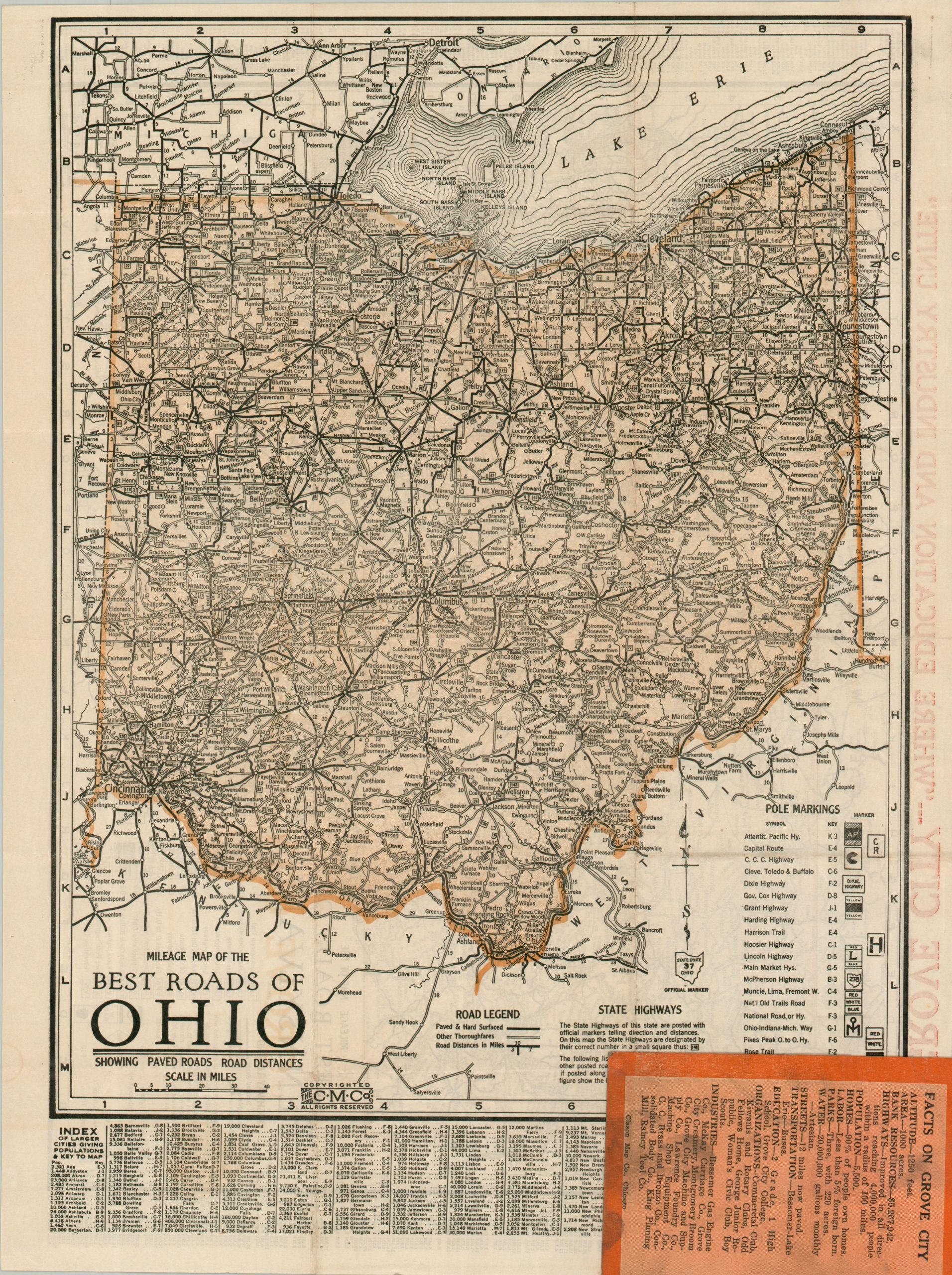
This detailed road map showing Pennsylvania on one side and Ohio on the opposite was issued in 1924 by the Clason Map Company of Chicago. Paved & hard surface roads are shown with solid black lines, while “other thoroughfares” are empty. Distances between points are noted and a number of named automobile trails (predecessors to the numbered highway system) are provided in the accompanying key. The small symbols would have been affixed to utility poles to help motorists find their way.
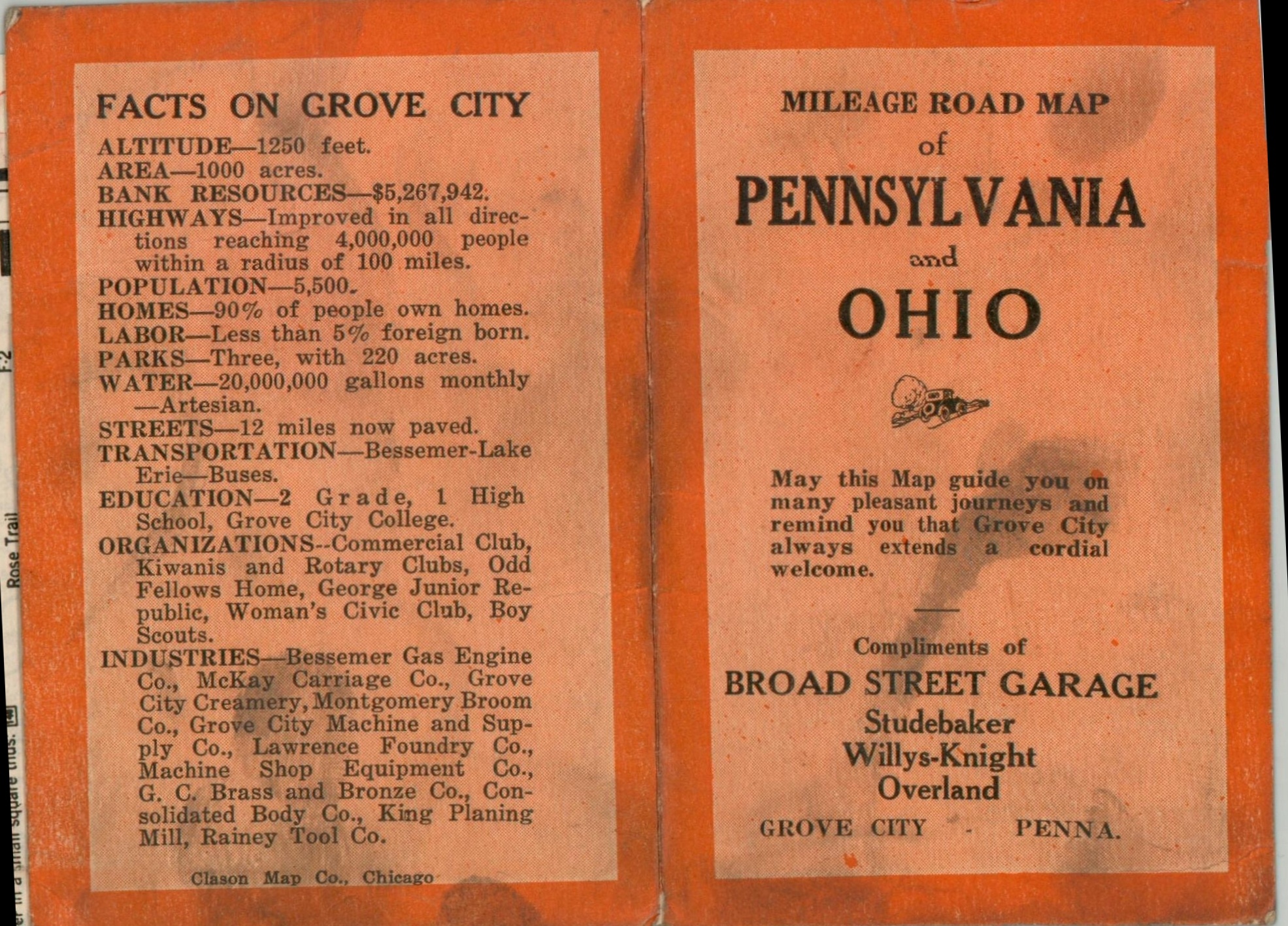
This particular example of the map was distributed compliments of the Broad Street Garage in Grove City, Pennsylvania. A large red circle rings the town, while bold text at the top of the sheet announces it is “Where Education and Industry Unite.” A list of ‘progressive firms’ in Grove City is provided on the inside of the front cover, while the back lists various facts and statistics.
Map Details
Publication Date: 1924
Author: Clason Map Company
Sheet Width (in): 16.40
Sheet Height (in): 12.40
Condition: A-
Condition Description: Double-sided pocket map folded and affixed to original stiff paper wraps (scuffed and soiled). Light wear along original folds and faint scattered spotting, consistent with age. Very good condition overall.
$95.00
1 in stock