Miami Miami Beach
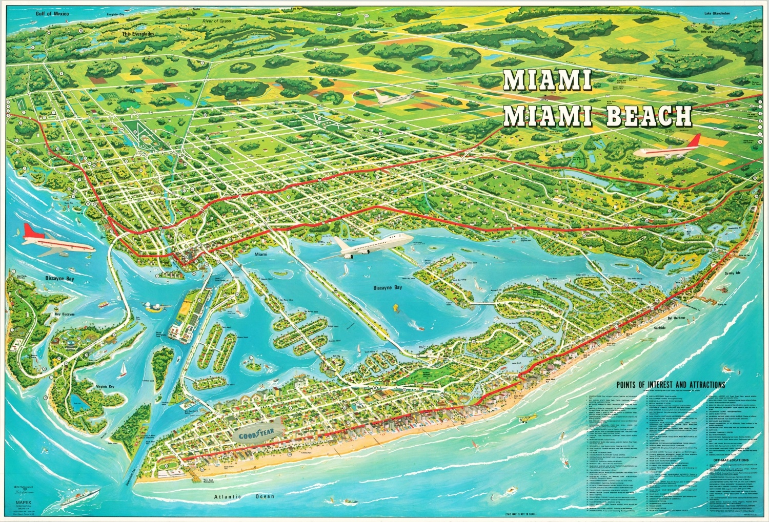
Huge aerial view of Miami Beach, Florida.
Out of stock
Description
One can imagine themselves soaring thousands of feet above the soft sands of Miami Beach with this bird’s eye view of the city and surrounding area. It was drawn by Paul Desormiers (signature lower left) and published locally by the MAPEX Corporation in 1976.
Primary roads (interstates and state highways) are highlighted with bold red lines and colorful details depict numerous islands, citrus groves, recreational opportunities, oceanfront density, and transportation facilities. Nearly 100 different points of interest and attractions are numbered; each corresponding to an individual entry in the accompanying index (lower right). Many more locations are also labeled within the image.
Map Details
Publication Date: 1976
Author: Paul Desormiers
Sheet Width (in): 41.00
Sheet Height (in): 27.75
Condition: A
Condition Description: Light creasing where the map was previously rolled. Near fine overall.
Out of stock