Mexico
$129.00
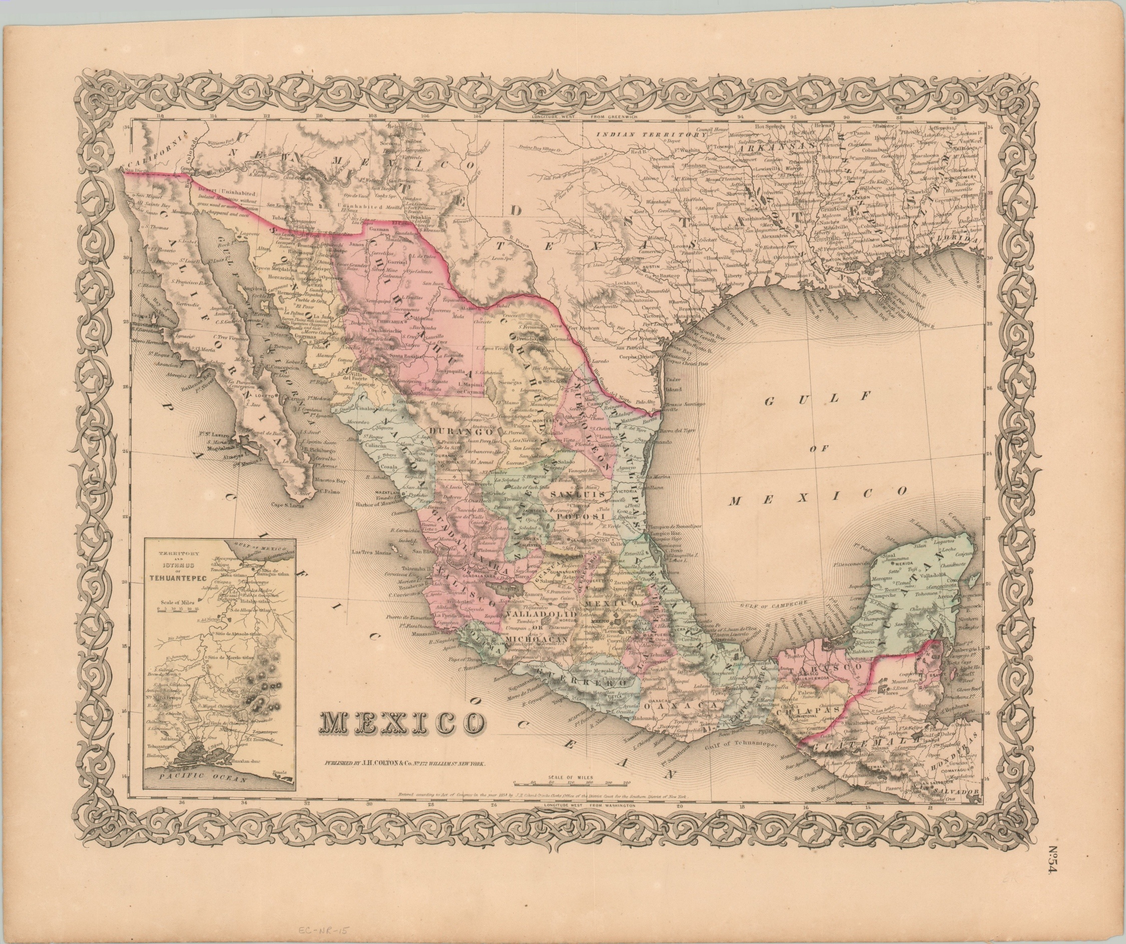
Map of Mexico published the same year as the Gadsden Purchase.
1 in stock
Description
This interesting map of the southwestern United States and Mexico was published in New York in 1854 by J.H. Colton & Company. That same year saw the finalization of the Gadsden Purchase, the last substantial territorial acquisition of the contiguous 48 states. In exchange for $10 million, the U.S. received approximately 30,000 square miles across which a southern transcontinental railroad route was planned.
The modified national borders are reflected near the top of the sheet, with the angled portion of land adjacent to the Mexican states of Sonora and Chihuahua. Several annotations indicate the area as largely uninhabited.
A further provision of the negotiations included transit rights across the Isthmus of Tehuantepec, seen in an inset in the lower left. The British bought the rights to construct a railroad linking the Atlantic and Pacific Oceans in 1847, and the U.S. was eager to avoid English commercial and political influence in Central America pursuant to the Monroe Doctrine.
Map Details
Publication Date: 1854
Author: J.H. Colton & Co.
Sheet Width (in): 18.10
Sheet Height (in): 15.00
Condition: A
Condition Description: Faint toning around the outer edges of the sheet, consistent with age. Near fine overall, with original hand color.
$129.00
1 in stock

