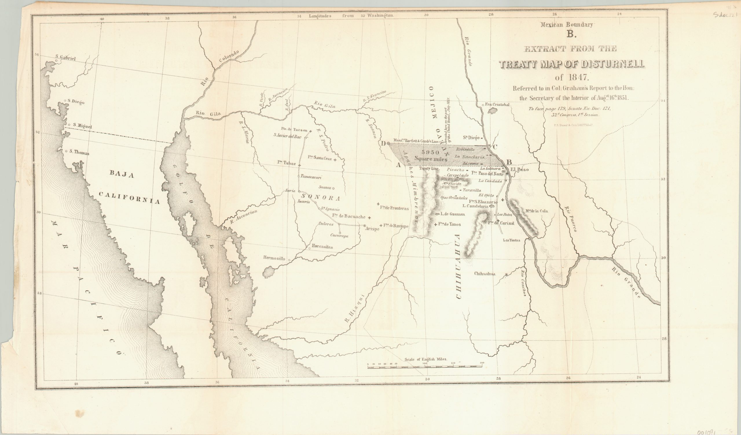
Mexican Boundary B. Extract from the Treaty Map of Disturnell of 1847
Government report on a disputed boundary with Mexico.
Out of stock
Description
This map shows an area in northern Mexico and the southwestern United States along the Rio Grand River. Though it includes information like geographic features, forts, transportation routes, and place names; the real emphasis is on a disputed border between Mexico and New Mexico.
The map was created by engineer and surveyor James Duncan Graham, who used it to persuasively argue that the line was previously fixed too far north. The resulting 5,950 square miles of additional U.S. territory is shaded; between The Treaty Line and that of “Messr’s Bartlett & Conde” (referring to James Bartlett and Mexican General Pedro García Conde).
Lithography by P.S. Duval & Co. in Philadelphia. Issued as a report to the Secretary of the Interior and printed as Senate Document 121 for the 1st Session of the 32nd Congress.
Map Details
Publication Date: 1851
Author: James Duncan Graham
Sheet Width (in): 17.50
Sheet Height (in): 10.50
Condition: A-
Condition Description: Narrow upper margin and an uneven left edge to the sheet. Faint discoloration along the upper portion of the sheet and along the left vertical fold. Elsewhere, the fold lines are clean and only slightly creased. Very good to excellent condition overall.
Out of stock