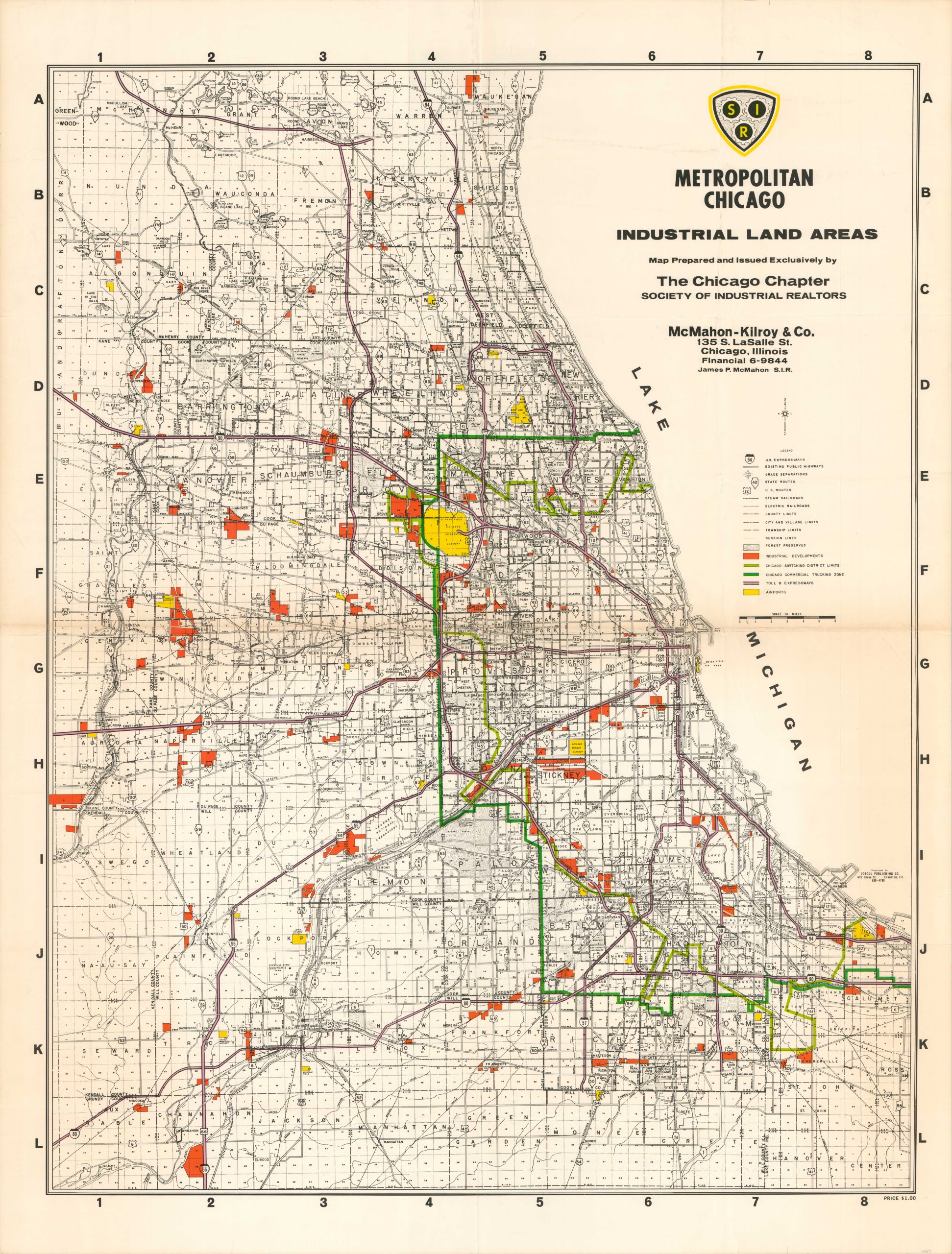
Metropolitan Chicago Industrial Land Areas
$175.00
Chicago’s commercial infrastructure during the 1960s.
1 in stock
Description
This large map of the Metropolitan Chicago Area was prepared and issued by The Chicago Chapter of the Society of Industrial Realtors, probably in the mid to late 1960s. The boundaries of the Switching District and Commercial Trucking Zones are outlined in light and dark green respectively.
Numerous parcels of land designated for industrial development are highlighted in red, while a surprising number of regional airports are colored brightly with yellow. A robust transportation network comprised of railroads and highways is also noted throughout the image.
Published in Evanston by the Joboul Publishing Company (note the 10-digit phone number, compared to the alpha-numeric format by the sponsoring real estate organization).
Map Details
Publication Date: c. 1968
Author: Society of Industrial Realtors - Chicago Chapter
Sheet Width (in): 41
Sheet Height (in): 54
Condition: B+
Condition Description: Creased and worn along old fold lines, most evident along the horizontal centerfold. A 3" tear on the left side has been repaired on the verso with archival tape. Several other small tears remain around the edges of the sheet, confined to the margins. About good condition overall.
$175.00
1 in stock

