Mendenhall’s New Standard Map of Cincinnati Showing Latest Annexations
Scarce pocket map of Cincinnati published shortly before the Great Depression.
Out of stock

Description
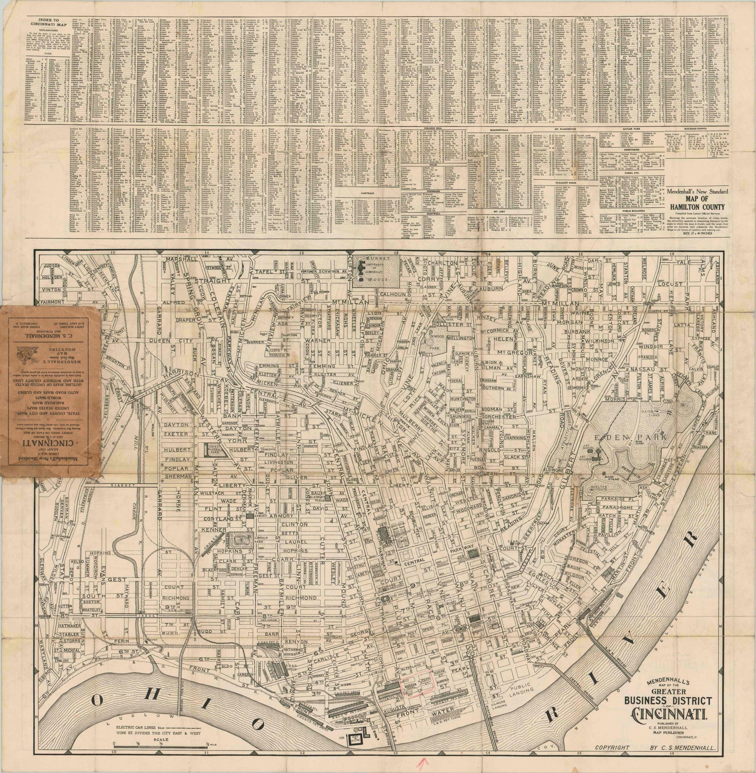
This fascinating map provides a detailed overview of Cincinnati, Ohio in the late 1920’s. Electric railways are highlighted in green atop a dense street plan, with railroads, canals, ward boundaries, township limits, and section lines all defined according to the legend in the lower right. Major industries, public buildings, parks, cemeteries, and recreation sites are also identified where applicable.
Scattered neighborhoods are labeled with large areas of undeveloped land between, while an inset map in the lower left shows a long finger of annexed territory along the Ohio River. Of particular interest here is Anderson’s ferry, in constant operation since 1817.
The verso shows a large scale map of Cincinnati’s business district, in addition to a comprehensive street index. The map was created and published locally in 1928 by C.S. Mendenhall – one of numerous editions issued in the 1920’s and 1930’s that catalog the development of the ‘The Queen City.’ This issue appears to be particularly scarce, with no sales records online or catalog entries in OCLC.
Map Details
Publication Date: 1928
Author: C.S. Mendenhall
Sheet Width (in): 32.00
Sheet Height (in): 33.00
Condition: B-
Condition Description: Pocket map formerly folded into 40 segments, with heavy wear and numerous repairs along old fold lines. Several areas have minor image loss, and there are also a number of stains within the image. Despite the defects, the map remains almost entirely intact and retains its original paper covers.
Out of stock