Mendenhall’s Guide and Road Map of Ohio
$325.00
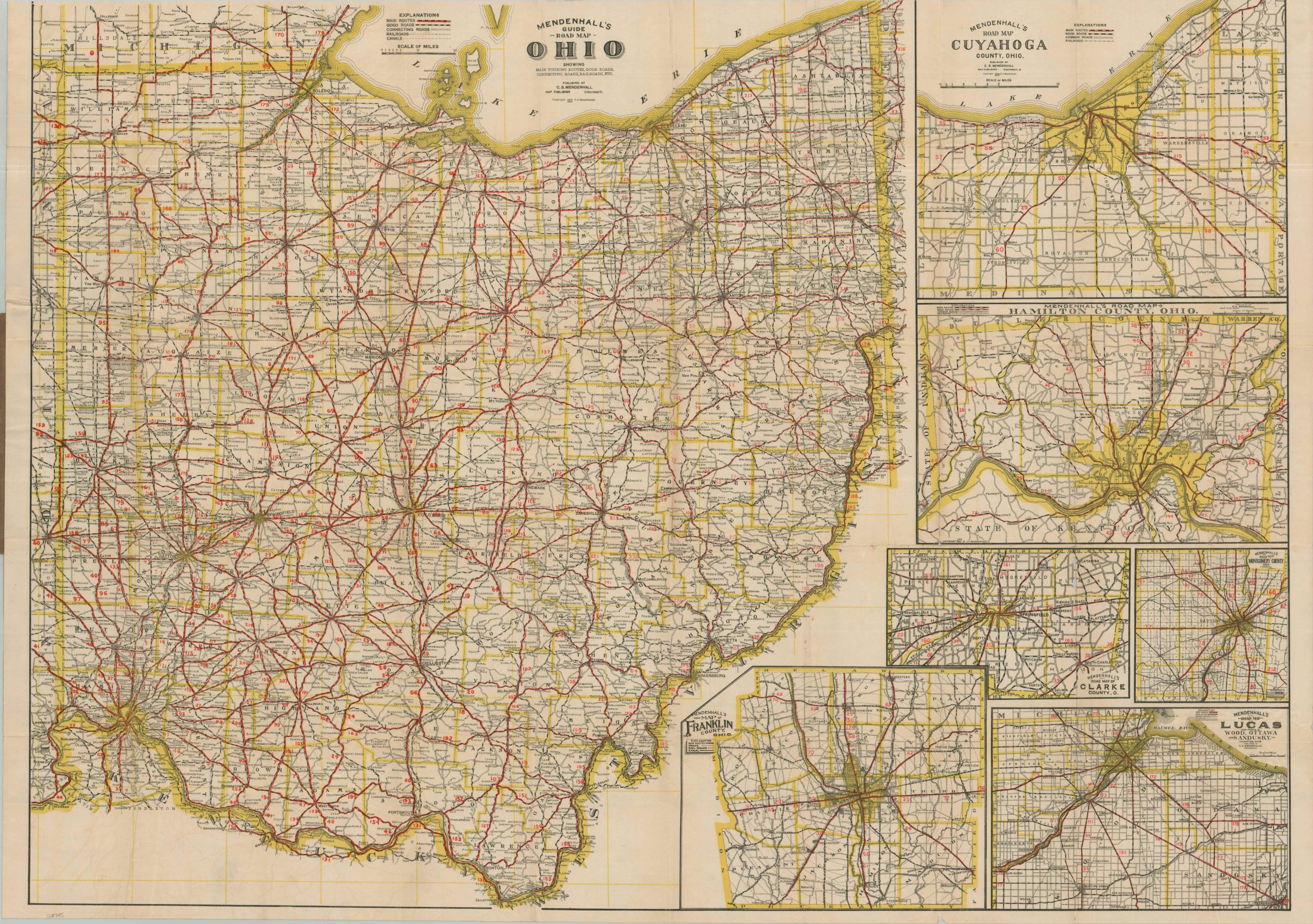
The Main Routes of Ohio during the Good Roads Era.
1 in stock
Description
This fascinating Progressive-era road guide to Ohio was published by the Cincinnati-based firm of C.S. Mendenhall & Co. in 1913. A brightly colored image highlights the ‘Main Routes’ across the Buckeye State in red, while county and state borders are colored in yellow. Good roads, connecting roads, railroads, and canals are also noted, presenting a complete overview of the available transportation infrastructure. Inset plans highlight the same details, at a larger scale, around the major urban areas like Columbus, Dayton, Cincinnati, Cleveland, and Toledo.
The map stands at a fascinating juncture in the development of automobile tourism in the early 20th century. Mendenhall’s guides were designed for relatively short-distance travel, as his recommended routes (numbered in red) don’t generally exceed 100 miles. As the road networks, travel infrastructure, and automobile technology improved, interstate tourism began to dramatically increase in popularity. The same year as publication, the nation’s first transcontinental auto route, the Lincoln Highway, was officially dedicated. It bisected Ohio between East Liverpool and Van Wert, though that span is covered by several (or none) of the highlighted ‘Main Routes’ within the image.
Established in Cincinnati and active from the 1880s through the 1910s, C.S. Mendenhall was a pioneering mapmaking firm that played a vital role in transitioning American travelers from the bicycle craze of the Gilded Age to the era of the automobile. While competitors like Rand McNally focused on national expansion, Mendenhall became a regional authority on the Midwest and pockets of the East Coast and Southern states. His detailed maps were usually accompanied by road guides that provided text-based itineraries between specific points, often incorporating local conditions (as in this case).
Map Details
Publication Date: 1913
Author: C.S. Mendenhall
Sheet Width (in): 38.25
Sheet Height (in): 28.00
Condition: B+
Condition Description: Color printed map on a large single-sided sheet, folded and attached to original brown paper wraps (moderately worn). Accompanying guidebook is present, but separated. Map shows several splits along folds (repaired on verso), plus some seam abrasions that result in very minor image loss. About good condition overall.
$325.00
1 in stock