Mendenhall’s Guide and Road Map of Ohio
$295.00
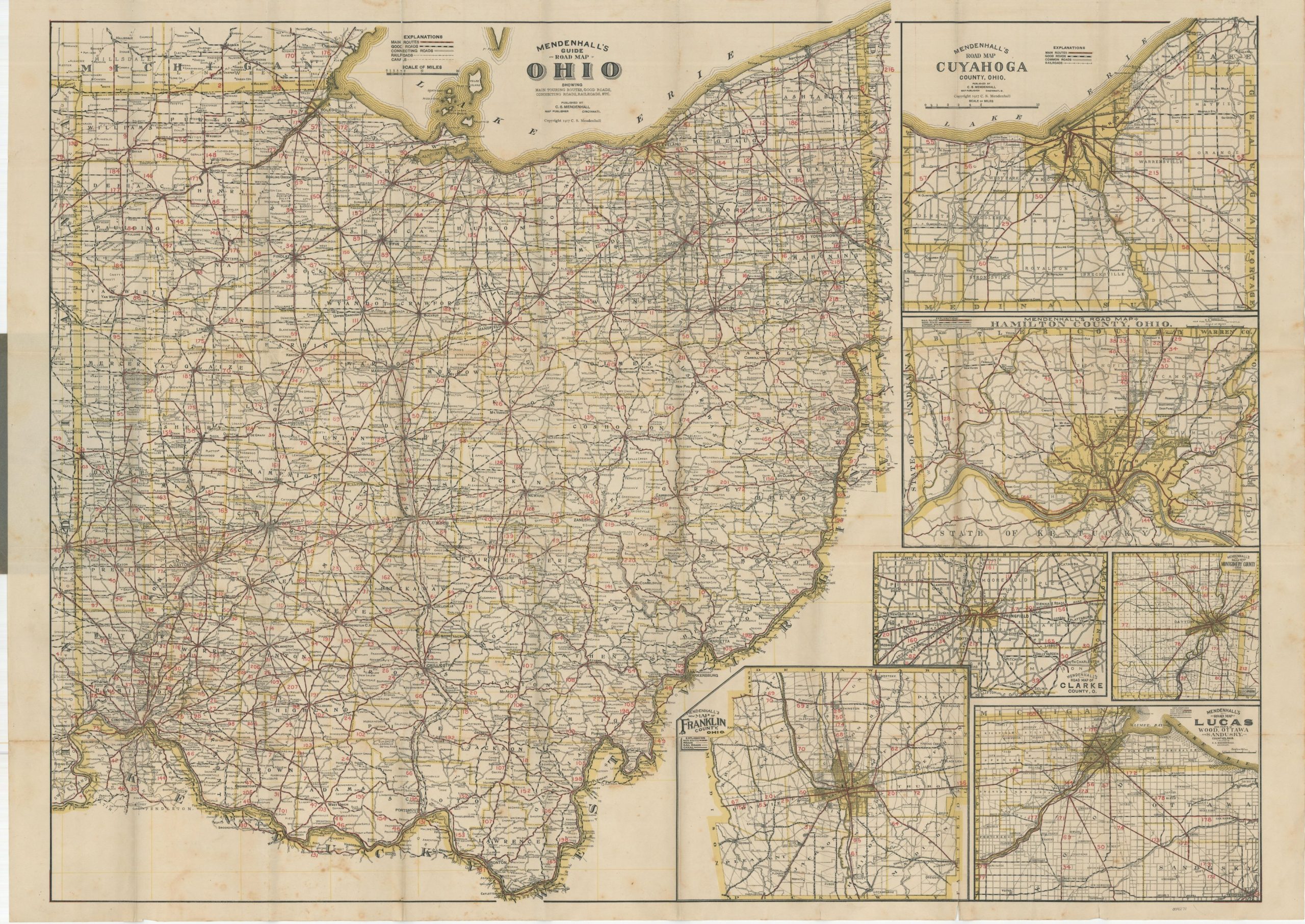
Tremendously detailed early road map of Ohio by C.S. Mendenhall.
1 in stock
Description
This comprehensive guide to Ohio provides everything an intrepid motorist would need to traverse the roads of the Buckeye State in 1917. A large folding road map shows the major transportation routes divided into Main Routes (numbered 1 through 221), Good Roads, and Connecting Roads, with railroads and canals also depicted for good measure.
Six detailed inset maps show the most heavily populated counties like Cuyahoga (Cleveland), Hamilton (Cincinnati), and Franklin (Columbus). Fine yellow lines divide the image into 25-mile increments, allowing for easy and approximate calculations of distances between points. Only 2 pages of the original 68 page guidebook remain affixed to the front cover, though it includes the recommendation “A Good Map and Guide is One Half the Equipment for the Tour.”
Published in Cincinnati by C.S. Mendenhall in 1917. Scarce, with only three copies noted in OCLC at the Newberry Library, Cincinnati History Library, and Ohio Historical Society
Map Details
Publication Date: 1917
Author: C.S. Mendenhall
Sheet Width (in): 39.5
Sheet Height (in): 28
Condition: B+
Condition Description: Pocket map folded into 50 panels and affixed to original stiff gray paper wraps. Only two pages of the original guide also remain stapled to the front cover. Moderate wear along fold lines, including toning, small spots of separation at fold intersections, and tears along fold lines that have been repaired on the verso. A few small edge tears remain, and there is light scattered discoloration visible in the margins and throughout the image, most evident in the lower center.
$295.00
1 in stock