Mendenhall’s Guide and Road Map of North-Western Indiana
$350.00
An early road map linking Indianapolis to Chicago.
1 in stock


Description
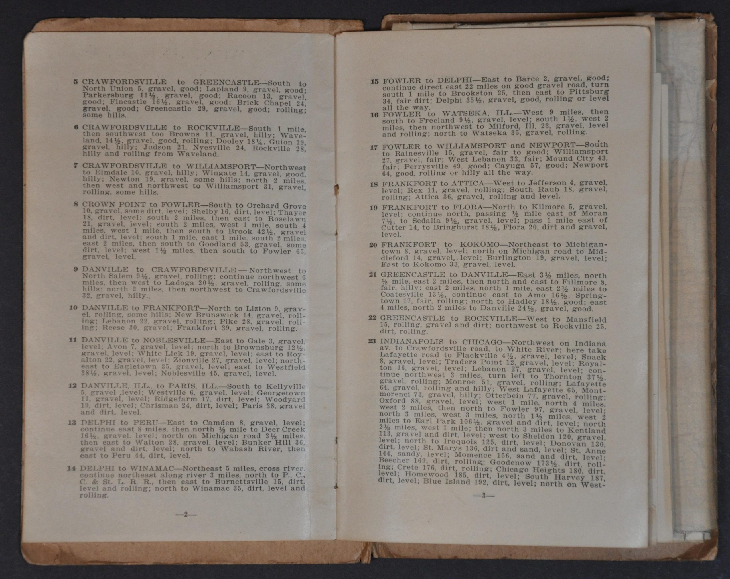
This rare pocket map of northern Indiana and eastern Illinois was designed, engraved, and published in Cincinnati by C.S. Mendenhall in 1905. Common, Good, and Main Roads between Indianapolis and Chicago are shown according to the legend in the upper left, though little information is provided on what distinguishes one type of surface from another.
Main Touring Routes, outlined and described in the accompanying 12-page guide, are numbered and circled and red. While counties are bordered with a thicker line, yellow blocks of 25 miles square are outlined throughout the image, providing a handy reference for approximate distances. Railroads, train stations, and towns/villages are also labeled throughout.
C.S. Mendenhall’s Cincinatti-based firm was a prolific publisher of city plans and road maps for areas across the Midwest and East Coast. Operating mainly from the 1880s into the late 1910s, Mendenhall’s maps are an interesting reflection of the evolution of road usage from carriages to bicycles and then automobiles. An advertisement on the last page of the guide shows the company headquarters in the Excelsior Building.
The map is uncommon on the market and in institutional collections. It is listed only once in WorldCat, at the Indiana State Library. OCLC 247720793
Map Details
Publication Date: 1905
Author: C.S. Mendenhall
Sheet Width (in): 25.5
Sheet Height (in): 39
Condition: A-
Condition Description: Large pocket map folded into original stiff paper wraps (front cover separated, but present, and includes the 12 page stapled guide). Numerous spots of clean separation and a few small holes along fold lines, as well as a few areas of toning and edge tears, but overall in good to very good condition. Blank on verso.
$350.00
1 in stock