Mendenhall’s Guide and Road Map of New Hampshire
$200.00
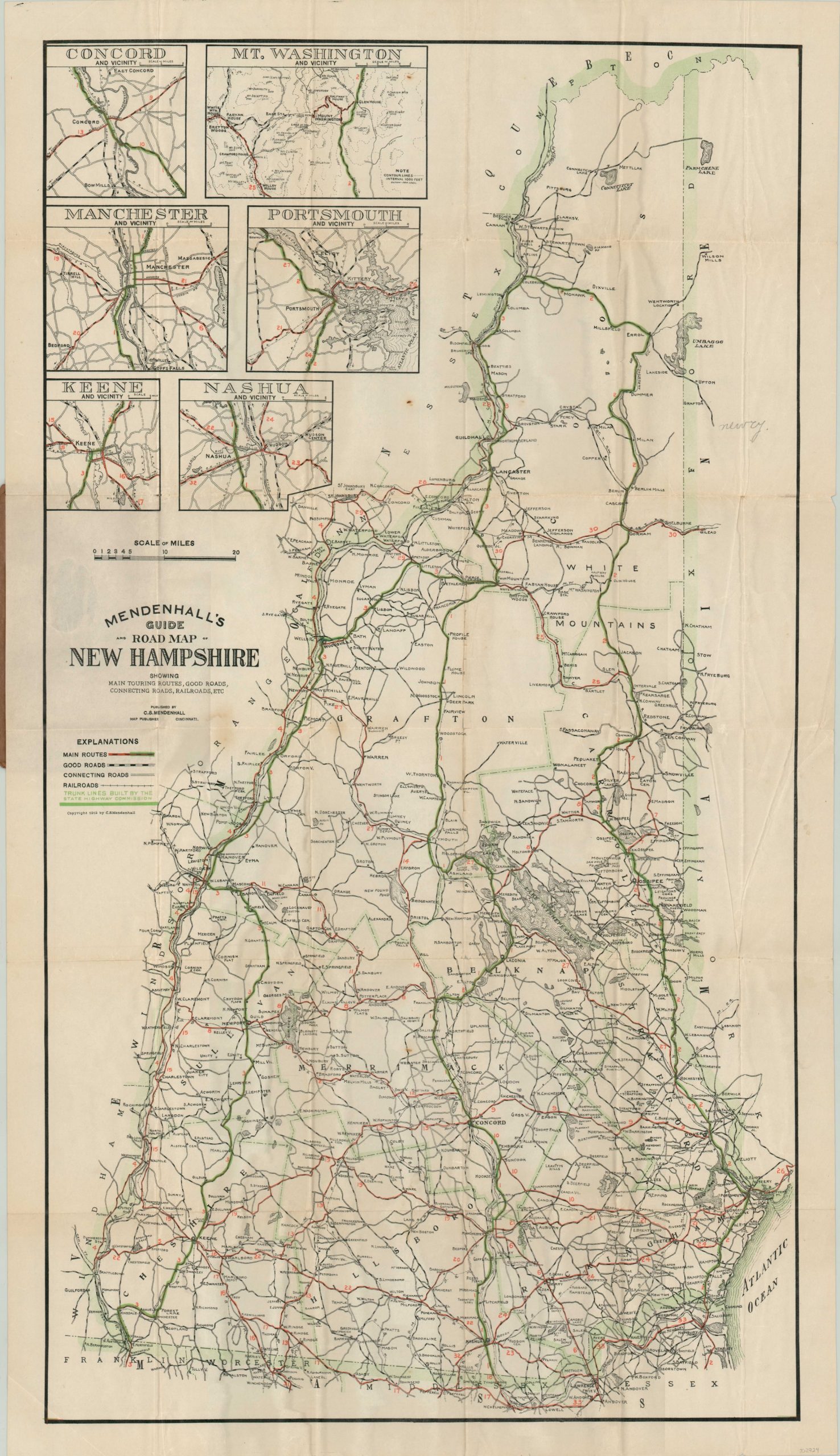
Early road map of New Hampshire showing the state’s trunk line highway system.
1 in stock
Description
The New Hampshire legislature first adopted plans in 1909 to modernize and improve three important north-south routes through the state. They were nearing completion by the time this map was published three years later, and are noted as Routes 1, 2, and 3 and highlighted in green within the image.
Main roads, good roads, and connecting roads are also identified according to the legend below the title block. Even so, ‘good’ roads might be a misnomer, as James Garvin from the New Hampshire Division of Historical Resources notes, “In 1915, virtually all roads in New Hampshire were gravel or water bound macadam, the latter being roads with wearing surfaces of crushed stone and stone dust, wetted and rolled but not otherwise cemented.”
Rain made many of the roads virtually impassable, and it wouldn’t be until the 1920’s that asphalt or other bindings became commonplace. Each route (33 in total) is numbered individually and described in the accompanying guidebook. Designed and published in Cincinnati by C.S. Mendenhall in 1912.
Map Details
Publication Date: 1912
Author: C.S. Mendenhall
Sheet Width (in): 21.50
Sheet Height (in): 37.75
Condition: B+
Condition Description: Formerly folded into 36 panels and affixed to brown paper covers. Moderate wear and creasing along former fold lines, including numerous small holes at the fold intersections that have been repaired on the verso. A large separation in the center of the sheet has also been repaired. A bit of extraneous wrinkling in the center right and lower left corner. Includes 22 page guide with tears at the stapled binding. Remains in good condition overall.
$200.00
1 in stock