Mem-O-Map of Japan and Korea
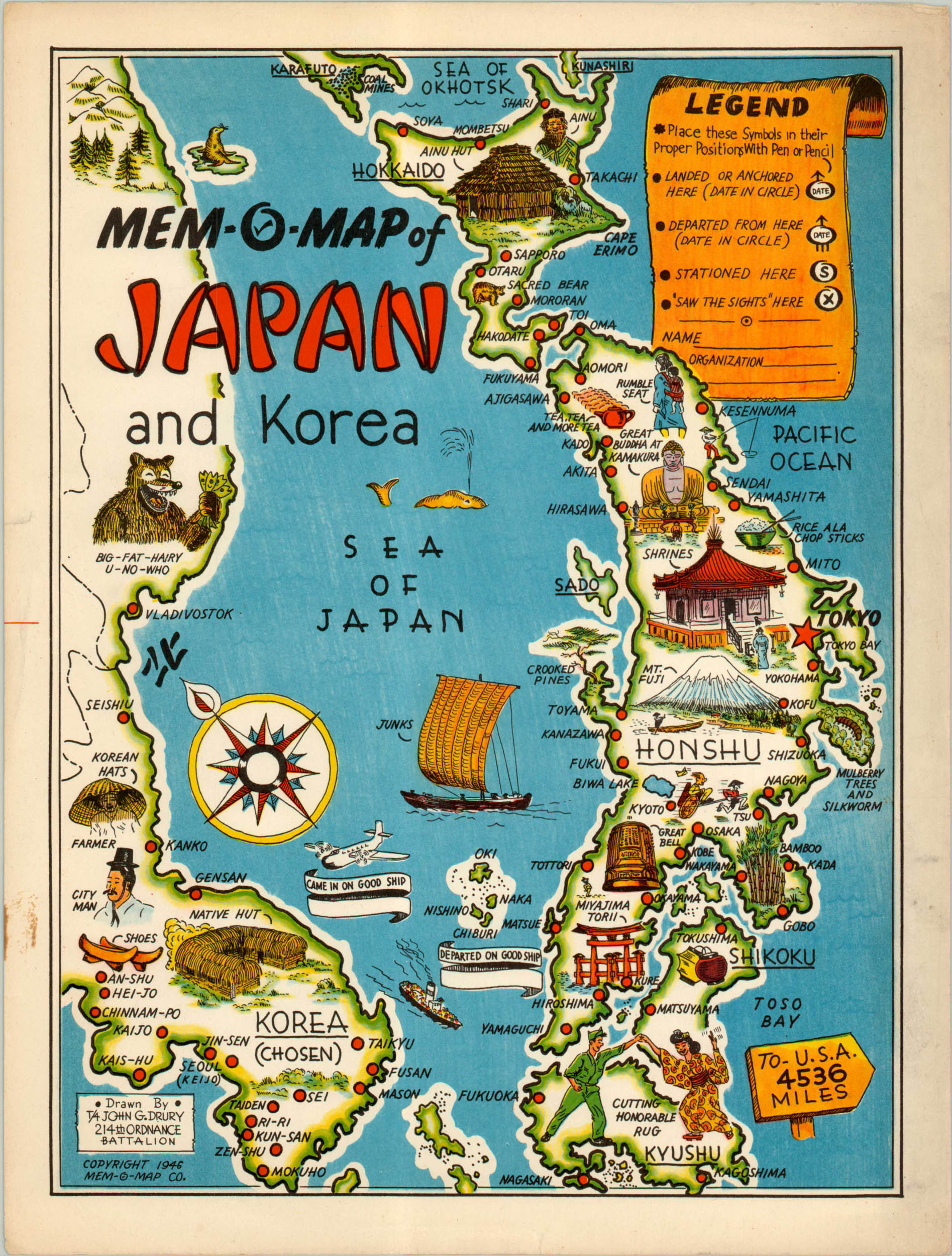
Excellent example of Drury’s Mem-O-Map of Korea and Japan, published shortly after the end of WWII.
Out of stock
Description
One of a set of five maps that includes Europe, Okinawa, Oahu, and the Philippine Islands, this map of Korea and Japan is an amusing and idealized representation of the region. The maps were designed by John Drury, who served for two years in the Pacific Theater and aimed to create a tool for fellow servicemen to revisit their experiences, but without the horrendous imagery associated with the war.
Such experiences included dancing with the locals, or “cutting honorable rug.” Army stereotypes provide comedic relief for the audience alongside illustrated reminders of the spectacular culture and scenery. A legend in the upper right provides an area for customization, with spaces for sights seen, name and organization, as well as symbols for landing, departure, and station sites.
To learn more about John Drury’s Mem-O-Maps, check out my blog post here.
Map Details
Publication Date: 1946
Author: John Drury
Sheet Width (in): 9.5
Sheet Height (in): 12.5
Condition: A
Condition Description: The map is a bright example with marginal soiling and a couple of tiny tears also confined to the blank margins.
Out of stock

