McLeod County Minnesota
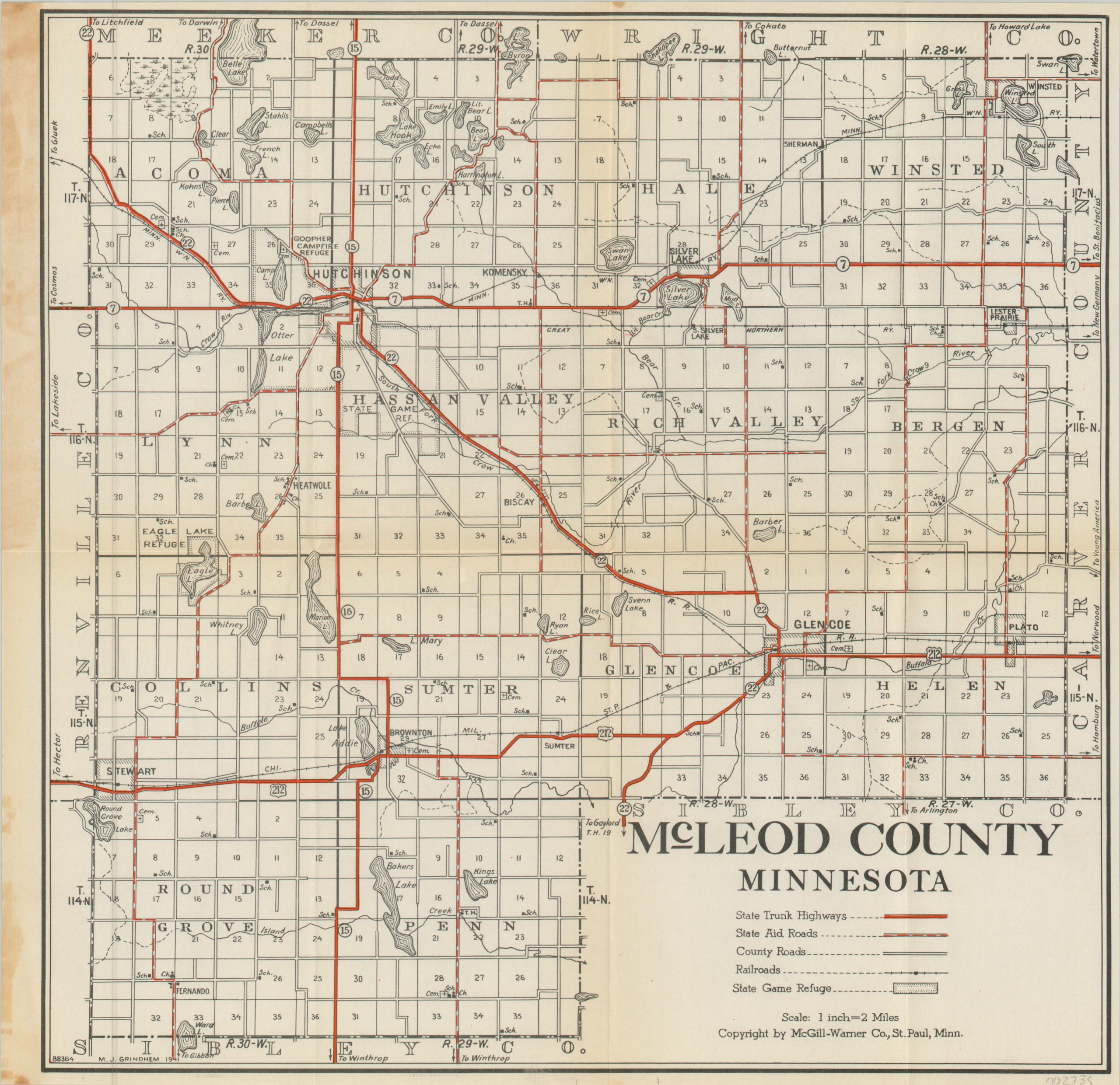
Pocket map of McLeod County, Minnesota published around the U.S. entry into WWII.
Out of stock

Description
This starkly legible road map of McLeod County, Minnesota was drawn by M.J. Grindhem in 1941 and was published in St. Paul by the McGill-Warner Company, successors to the Minnesota Map Publishing Company (according to the front cover). It depicts the network of trunk highways, state aid roads, and county roads available to the touring motorist or local farmer.
Railroads and game refuges are also depicted, along with schoolhouses, cemeteries, and churches. Numerous lakes are shown scattered across the county – just a few of the many more which give Minnesota its nickname, “The Land of 10,000 Lakes.”
Map Details
Publication Date: 1941
Author: McGill Warner Co.
Sheet Width (in): 13.5
Sheet Height (in): 13.25
Condition: A-
Condition Description: Pocket map originally issued folded into 8 segments. Original paper covers present, but separated. Creasing along original fold lines and moderate discoloration along the vertical centerfold and left margin.
Out of stock