Marseille
$100.00
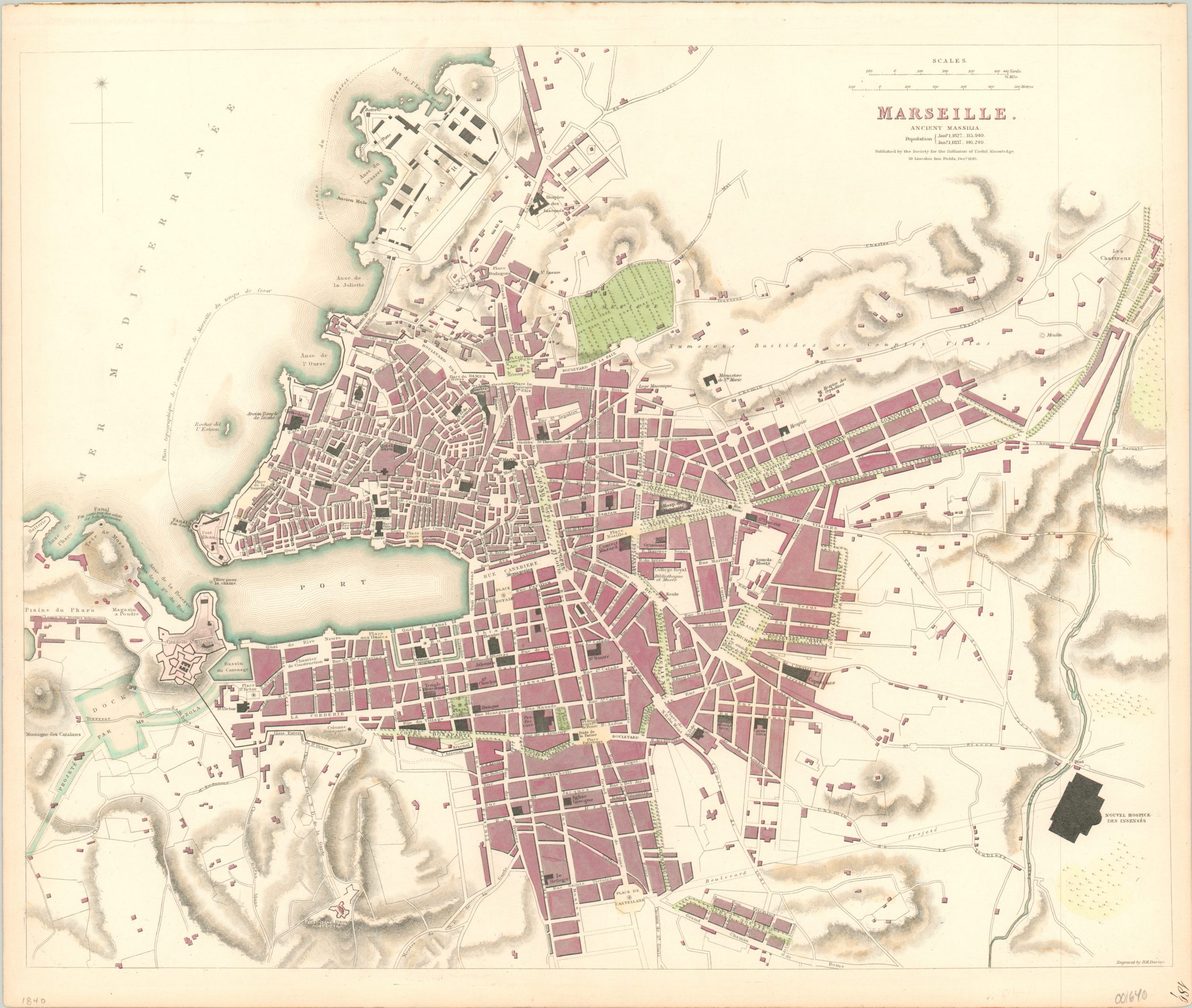
Detailed city plan of Marseille published by the SDUK.
1 in stock
Description
This finely engraved city plan of Marseilles shows the city in the middle of the 19th century, when it was growing in importance thanks to increasing maritime commerce with the French Empire in North Africa. The large port, flanked by two forts, can be seen connecting to a proposed canal in the lower left. Most city blocks are stylized, but the outlines of a few notable structures such as churches, hotels, hospitals and public buildings are shown and labeled.
The map was engraved by B.R. Davies and published in London by the Society for the Diffusion of Useful Knowledge (SDUK) in 1840. The SDUK was an organization that operated between 1826 and 1848 which focused on the publication and distribution of inexpensive learning material for the general public. It was thought that the ability to self-educate in the lower and middle classes would contribute to public order and advance the high minded ideals of Western science and civilization. The maps the organization produced are some of the most detailed, practical, and accessible maps of the mid-19th century.
Map Details
Publication Date: 1840
Author: SDUK
Sheet Width (in): 16.10
Sheet Height (in): 13.60
Condition: B+
Condition Description: Slightly toned outer edges and several areas of faint discoloration visible on the right side of the sheet. Modern hand color.
$100.00
1 in stock

