Marion County
$110.00
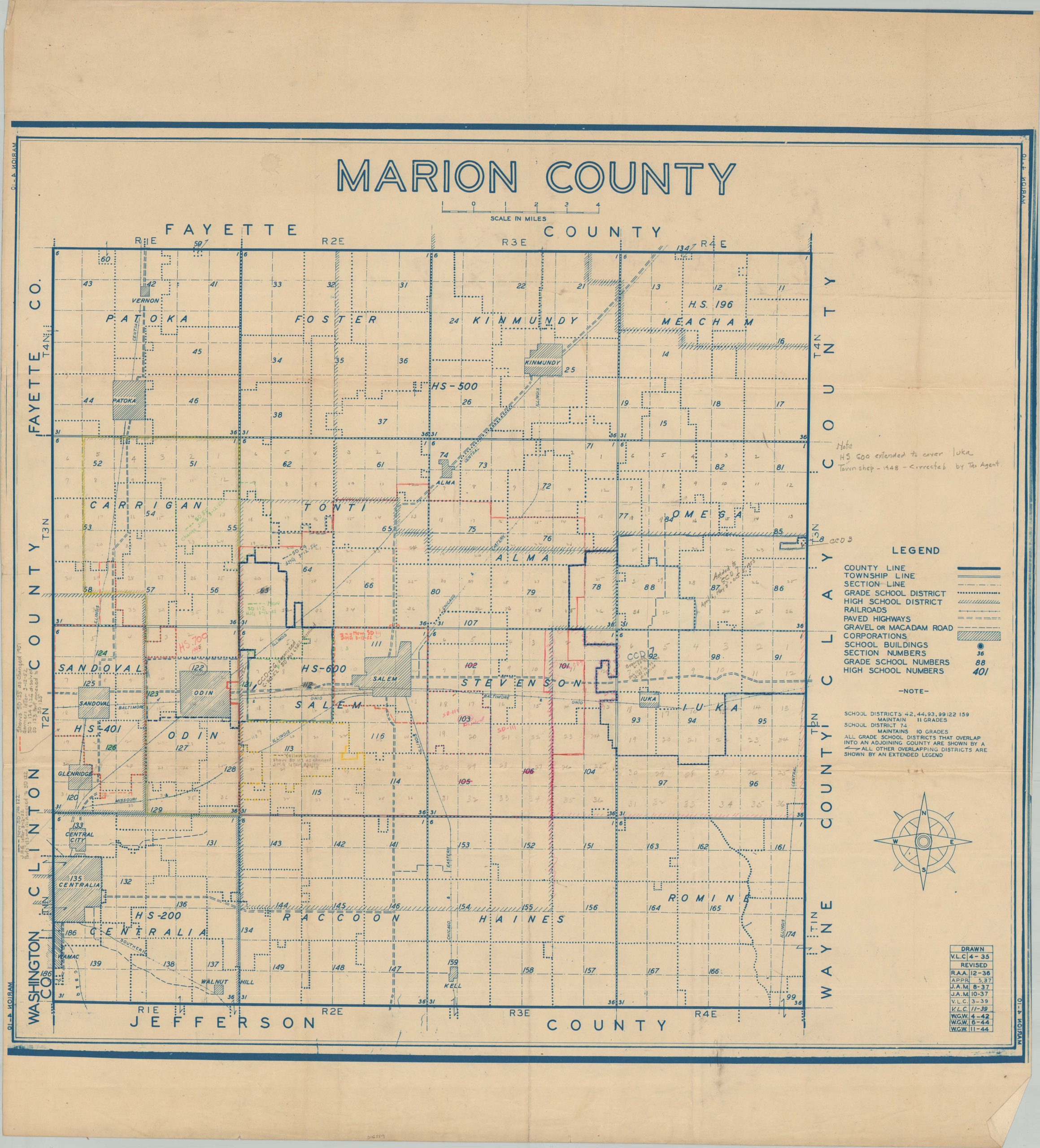
Marion County, Illinois during the mid-20th century.
1 in stock
Description
This interesting plan of Marion County, Illinois provides a detailed overview of the county’s school districts, transportation routes, and boundary lines. Towns and townships are labeled, along with railroads and adjacent counties. A table in the lower right indicates the map was originally drawn in 1935, with revisions performed regularly through 1944. Manuscript annotations indicate further use in redesignating school districts into the early 1950s.
At the time, both Salem (the county seat) and Sandoval were considered ‘sundown towns’, where it was unsafe for African-Americans to remain after sunset. Likely compiled by the Illinois Department of Revenue Property Tax Division, based on information provided on similar contemporary maps.
Source: Medium
Map Details
Publication Date: c. 1953
Author: Illinois Department of Revenue Property Tax Division
Sheet Width (in): 32.25
Sheet Height (in): 35.75
Condition: B+
Condition Description: Blueprint style map on a single-sided sheet with soft creasing along old folds. Manuscript annotations throughout in a variety of pencil and ink shades. Scattered soiling and spotting and narrow margins along the edges, probably as issued. Good to very good condition overall.
$110.00
1 in stock