Maps Illustrating Ancient History
$95.00
“We feel assured that these maps and notes will be of practical and suggestive value to teachers in directing the map work of their pupils.” – Introduction
1 in stock


Description
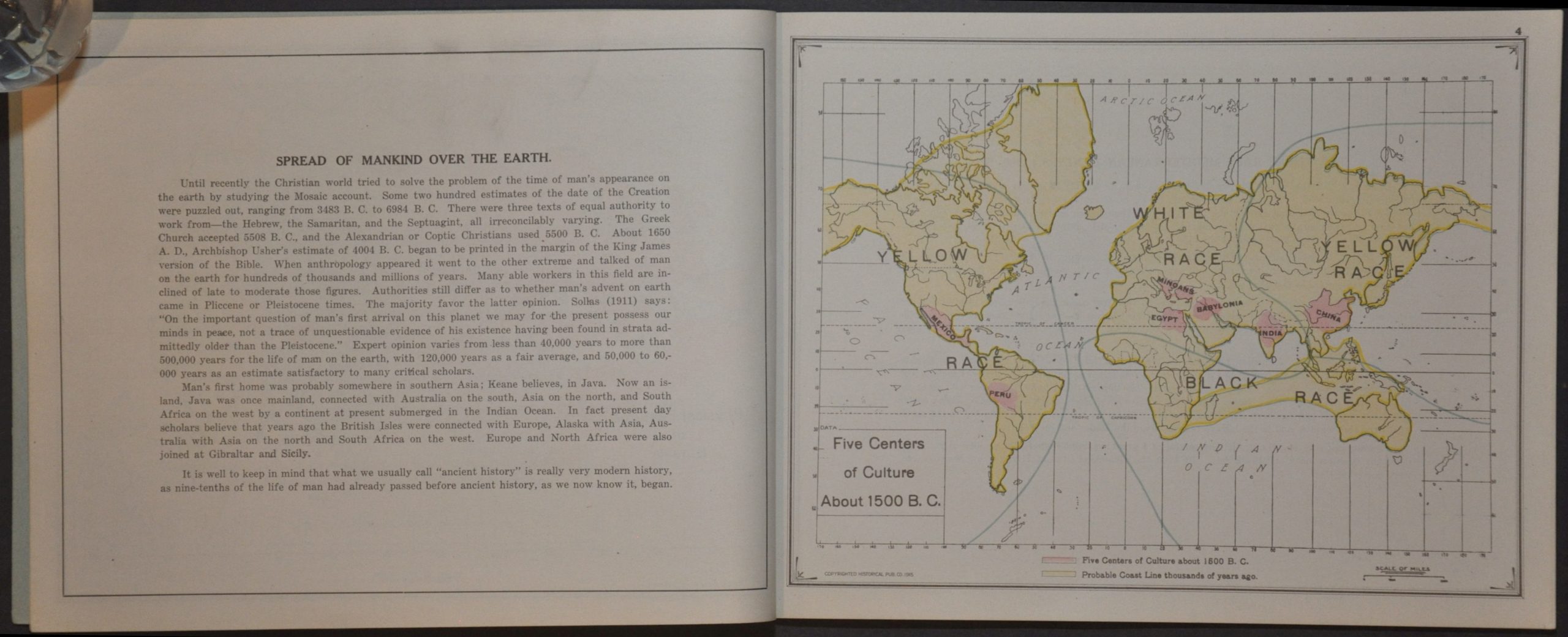
This interesting educational aid offers a high-school level historical guide to the history of the Old World from about 1500 B.C. to the Age of Charlemagne. The contents begin with a brief description of the physical features of Eurasia, followed by a racial map of early man noting ‘Five Centers of Culture’ (though 7 are highlighted and labeled). These are followed by a generalized chronology that well-represents 20th-century Western perceptions of civilization and the ‘progress’ of mankind.
The volume was authored by J.G. Iliff and E.G. Foster and published in 1915 by the Historical Publishing Company of Topeka, Kansas. According to text on the cover, it was intended for use with Foster Historical Outline Maps – blank pages and outline maps by which students would transmit geography lessons.
Map Details
Publication Date: 1915
Author: J.G. Iliff and E.G. Foster
Sheet Width (in): 10.5
Sheet Height (in): 8.25
Condition: A
Condition Description: 48 pp. atlas (24 single-page color maps) bound with staples in original blue paper wraps. Light toning and wear, consistent with age and use. Very good condition overall.
$95.00
1 in stock