
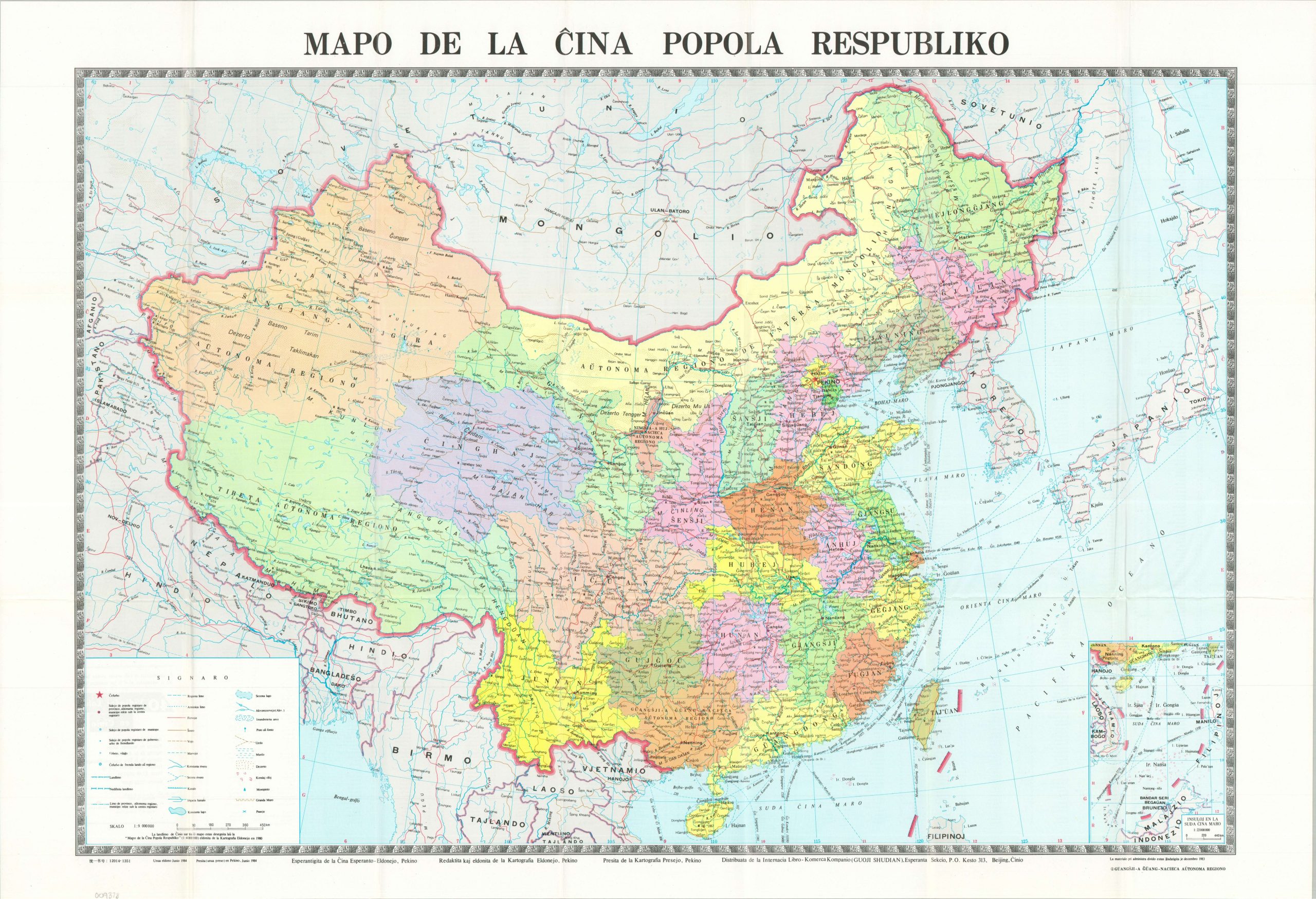
Mapo de la Ĉina Popola Respubliko [Esperanto Map of China]
$200.00
An uncommon 1980s political map of China, published in Esperanto.
1 in stock
Description
This rather straightforward map of China, issued in 1984, provides a detailed and comprehensible overview of the country. Provinces are brightly highlighted in lithographed color. Major population centers, geographic features, and elements of the transportation network are explained in the legend, lower left. The first three dashes of the Nine-Dash Line, marking China’s territorial claims across the vast majority of the South China Sea, can be seen in the lower right and are continued in a nearby inset.
What makes this particular map special is the language in which it was published: Esperanto. Created in 1887 by Polish ophthalmologist L. L. Zamenhof, Esperanto was designed as a politically neutral, easy-to-learn auxiliary language to foster international peace and understanding. In the 1980s, under Deng Xiaoping, China began to soften its political animosity towards the West, and Esperanto publications were a means of promoting Chinese geographic and political ideas through “soft diplomacy.”
Map Details
Publication Date: 1984
Author: la Cina Esperanto-Ligo [Chinese Esperanto League]
Sheet Width (in): 30.30
Sheet Height (in): 21.00
Condition: A
Condition Description: Single-sided political map printed on glossy paper, folded, and inserted into original green paper covers. A bit of creasing along the folds, but overall in very good to near fine condition.
$200.00
1 in stock