Mapa Samochodowa Polski
$90.00
Intriguing double sided map of Communist Poland published in a particularly tumultuous year.
1 in stock


Description
One side, this map of Poland presents a modern transportation outline of the country. A border comprised of a myriad of road signs encloses a basic political map with roads, railroads, ferry routes, and numerous levels of border crossings indicated throughout. The last refer to areas accessible only to those of particular nations, emblematic of the ongoing Cold War.
Despite the Communist presence there, at the time of publication Poland was undergoing a gradual process of Westernization, with foreign loans assisting greatly in development. (The multiple languages in the accompanying legend indicate the map was, at least in part, intended for a Western audience). However, in the year the map was issued (1976), market destabilization and increases in food prices led to significant waves of unrest.
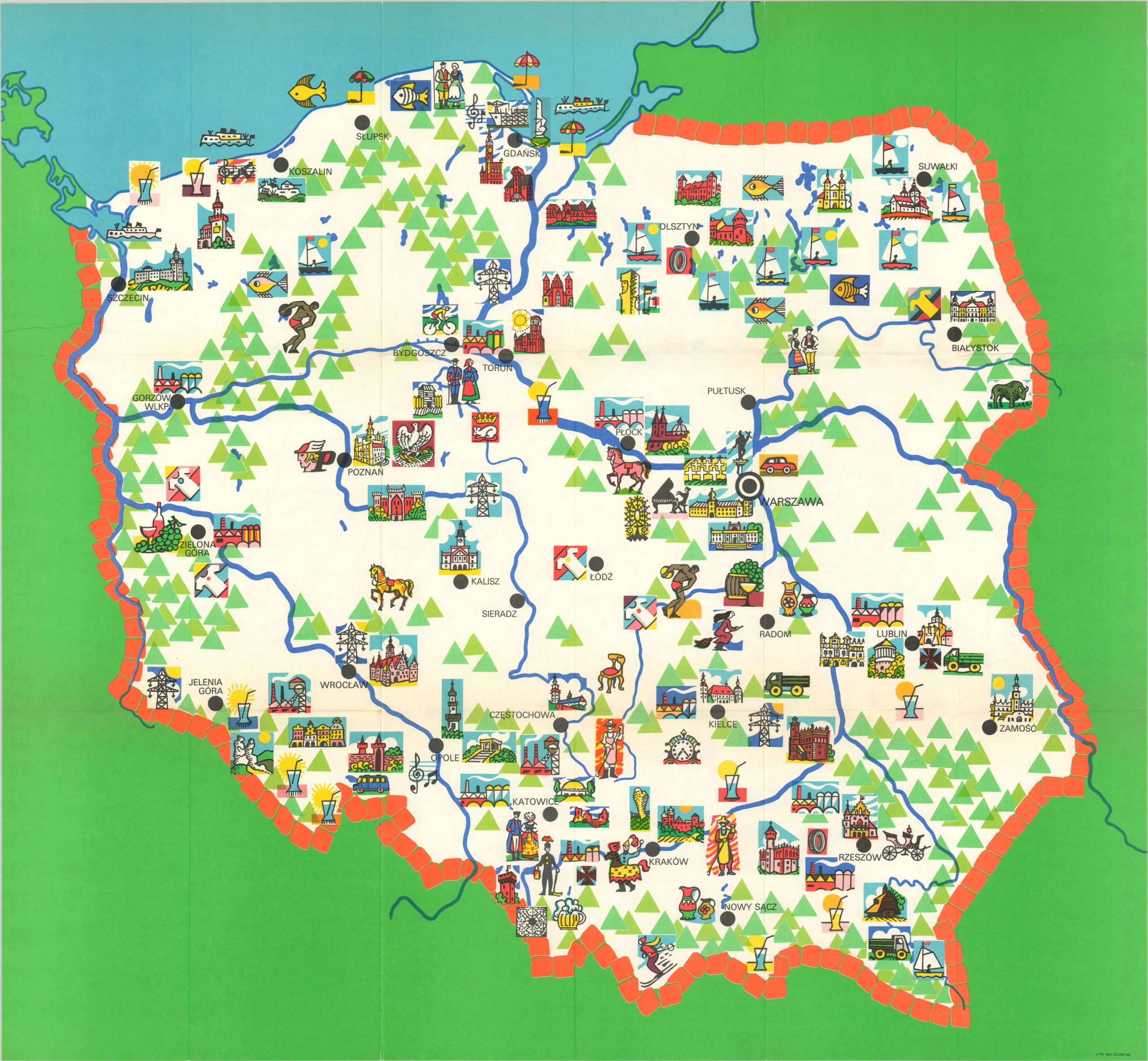
The verso of the map presents a bright, idyllic pictorial overview of the country, with simple illustrations of major landmarks, recreational activities, and local industries. The original envelope is included (see photo).
Map Details
Publication Date: 1976
Author: Krystyna Zalewska
Sheet Width (in): 30.40
Sheet Height (in): 27.90
Condition: A
Condition Description: Minor creasing and wear along originally issued fold lines, otherwise in near fine condition. Comes with original pictorial wrappers.
$90.00
1 in stock