Map Showing the Proportion of Deaths from Consumption
$75.00
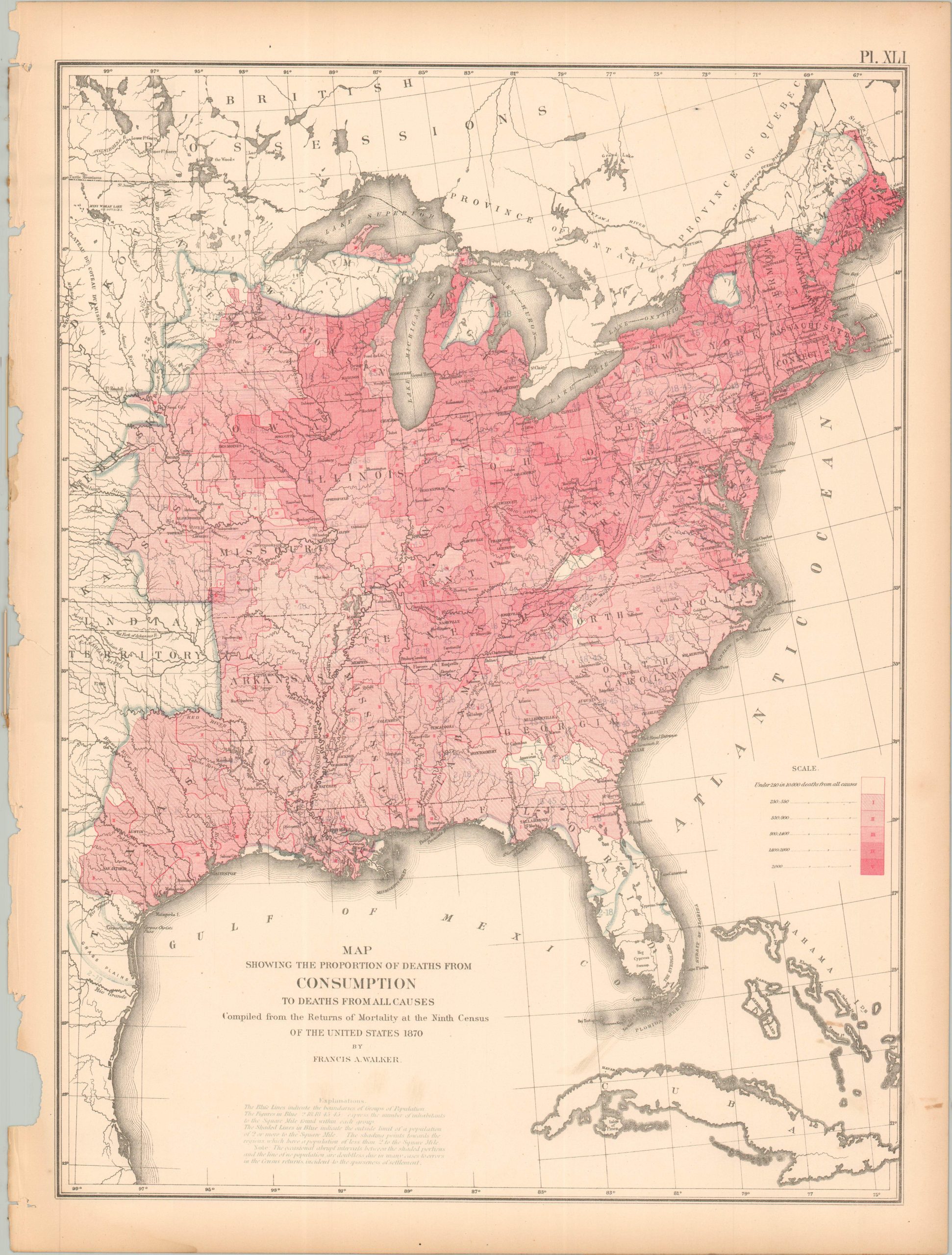
Mapping the ‘Great White Plague.’
1 in stock
Description
This striking map of the Eastern United States starkly highlights the concentrations of the leading cause of death at the time – tuberculosis. It was called consumption because the disease literally seemed to consume the patient from the inside out. The darkest shade shows areas where (at least) one in five perish from the wasting disease. Dense population centers in the Northeast were among the most susceptible regions, though much of the nation was obviously afflicted by the endemic disease.
The sheet was originally issued as part of The Statistical Atlas of the United States Based on the Results of the Ninth Census, 1870, compiled by Census Superintendent Francis A. Walker. Lithographed by Julius Bien and published in 1874. The atlas serves as the ultimate 19th-century “data portrait” of a reunified nation, meticulously synthesizing geography, climate, and demographics into a visual manifesto of America’s industrial and economic potential.
Map Details
Publication Date: 1874
Author: Francis A. Walker
Sheet Width (in): 16.25
Sheet Height (in): 21.75
Condition: B
Condition Description: Lithographed sheet on somewhat brittle paper. Moderate marginal wear including a ragged upper edge, toning, damp staining in the lower left, and a few small closed tears
$75.00
1 in stock