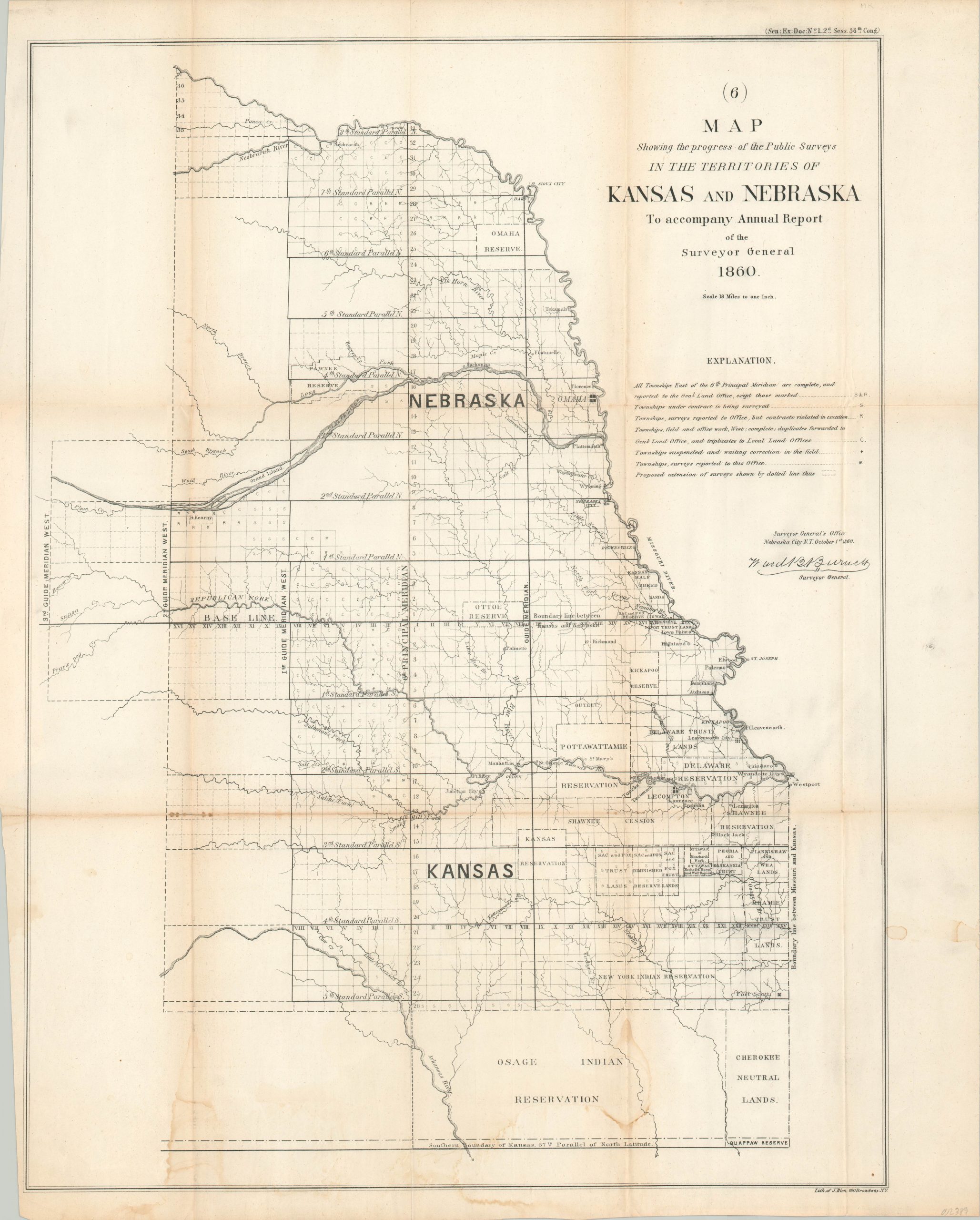
Map Showing the progress of the Public Surveys in the Territories of Kansas and Nebraska
$150.00
Contested settlement in the Nebraska and Kansas territories.
1 in stock
Description
Despite the turmoil engulfing the nation and its political systems immediately before the Civil War, the work of the federal government had to continue, even for the surveyor’s of the General Land Office. For this region in particular, the preceding several years had been the battleground for an ongoing conflict over slavery known as Bleeding Kansas. By 1860, the year this map was published, peace had largely settled across the western portions of the Nebraska and Kansas Territory, but it would not be long before fighting would erupt once more.
The map itself shows the progress of public surveys in the area – some of the earliest along this particular stretch of the Missouri River. Progress is reported with small letters in each township, described in further detail by the accompanying legend below the title. The image also includes Native American reservations, forts, settlements, and simple geographic details.
Created by Surveyor General Ward Burnett and published in a Senate Report by the Government Printing Office in 1860.
Map Details
Publication Date: 1860
Author: Ward Burnett
Sheet Width (in): 20.90
Sheet Height (in): 25.60
Condition: B
Condition Description: Creasing and faint discoloration along original fold lines, and a bit of scattered damp staining along the bottom third of the image. Trimmed left edge and a small tear has been repaired on verso. Remains in good condition overall.
$150.00
1 in stock

