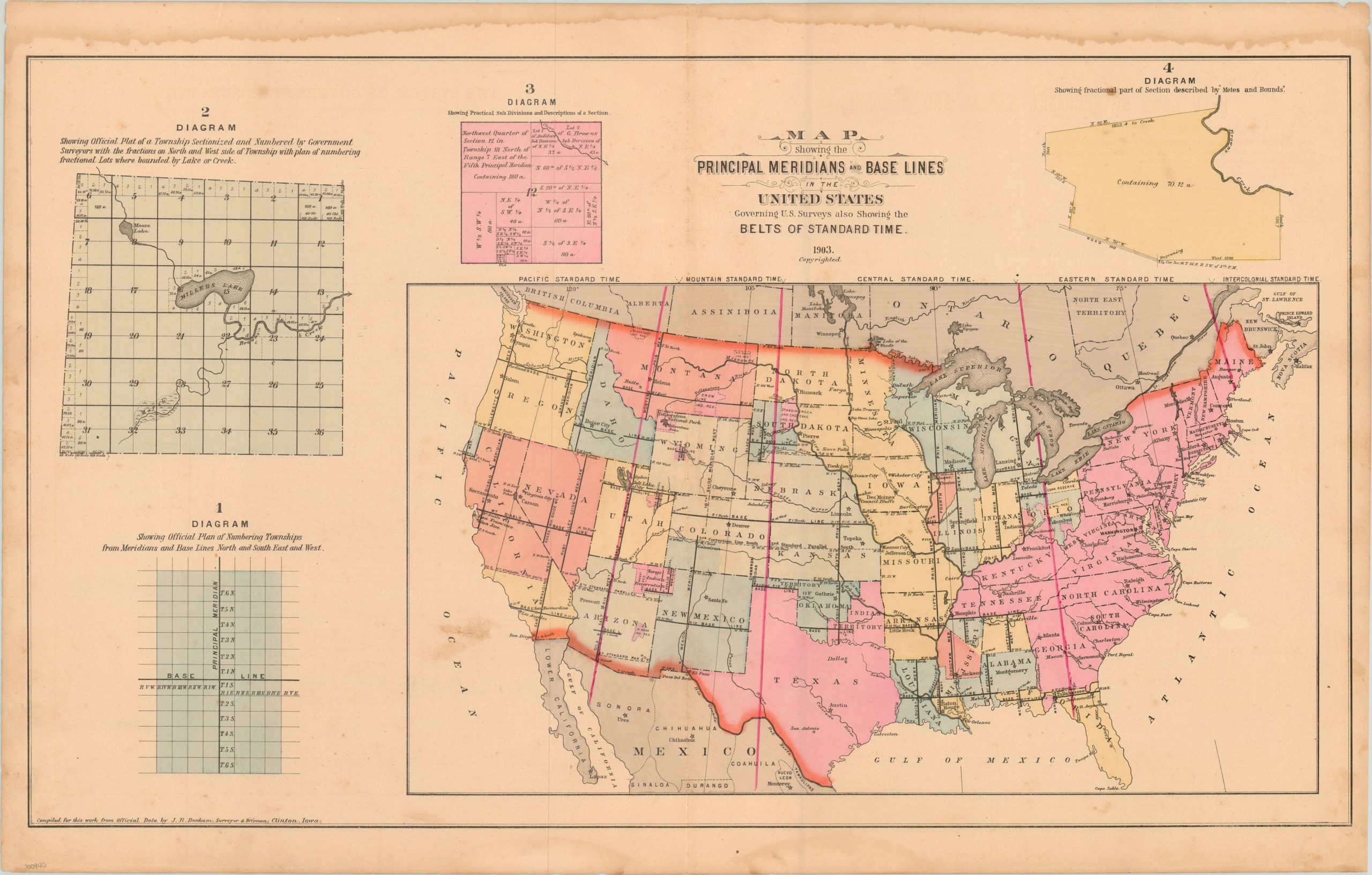
Map Showing the Principal Meridians and Base Lines in the United States
Early 20th century cartographic overview of the land survey process.
Out of stock
Description
This colorful map of the United States shows the various surveys that have taken place throughout the country up to 1903. Base lines, meridians, Indian reservations and international boundaries all play an important role in this process and have been highlighted accordingly. Bold red lines also indicate time zones, though these would not be formally implemented until the Standard Time Act of 1918. Surrounding the primary map are four small diagrams that show different organizational details about surveying, sub-dividing, and fractional plots.
The image was designed by J.R. Dunham for inclusion in many county atlases published throughout the late 19th and early 20th century centuries. It would have been a useful reference during America’s great period of westward migration.
Map Details
Publication Date: 1903
Author: J.R. Dunham
Sheet Width (in): 29.30
Sheet Height (in): 18.50
Condition: B
Condition Description: Damp stains in the outer margins and several spots of soiling visible within the image. A few small tears in the sheet, but remains very presentable.
Out of stock