Map Showing the Movements of the Church of Jesus Christ of Latter-Day Saints…
Original price was: $800.00.$500.00Current price is: $500.00.
Mapping the trek of the Mormon pioneers.
1 in stock


Description
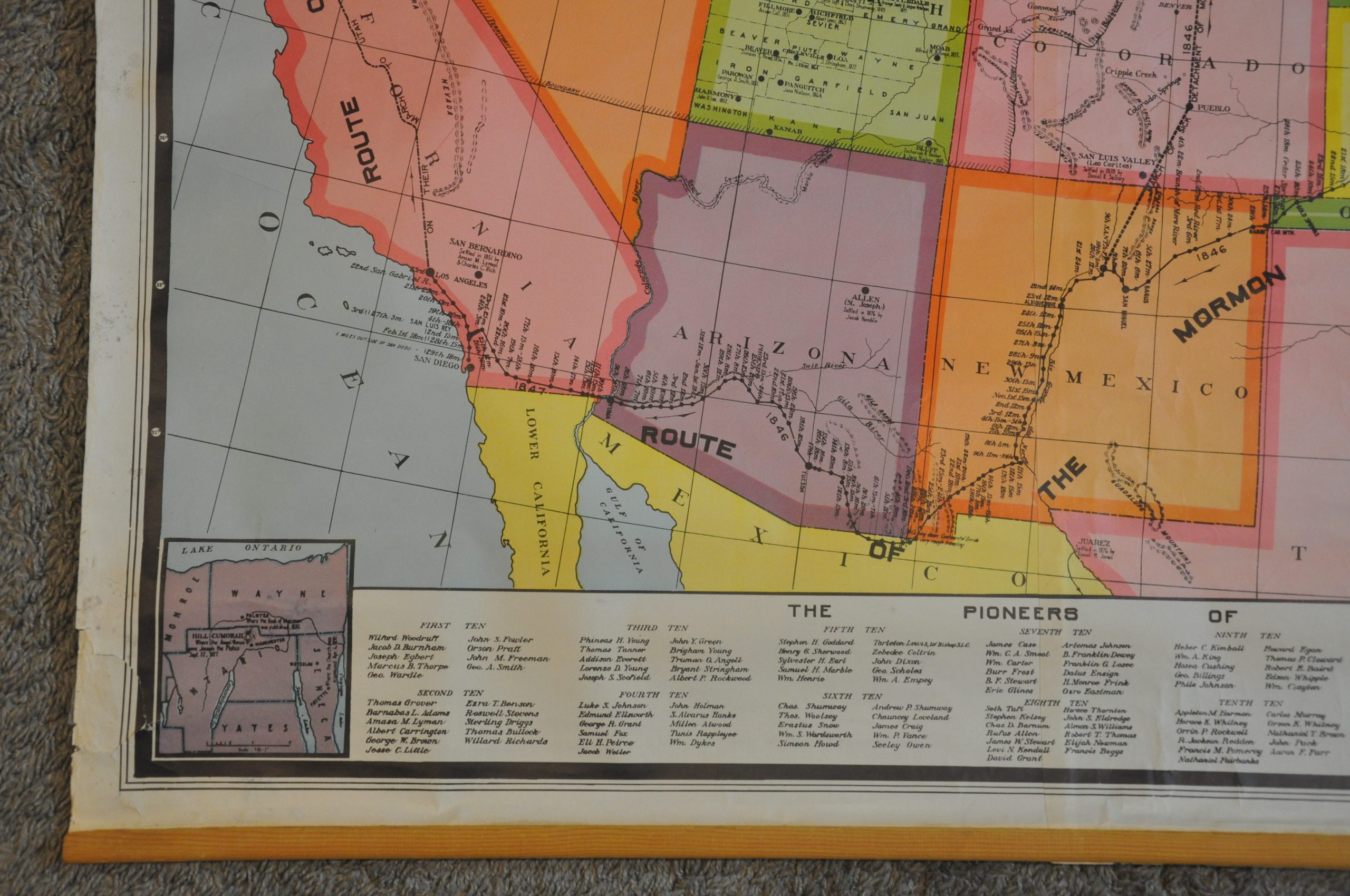
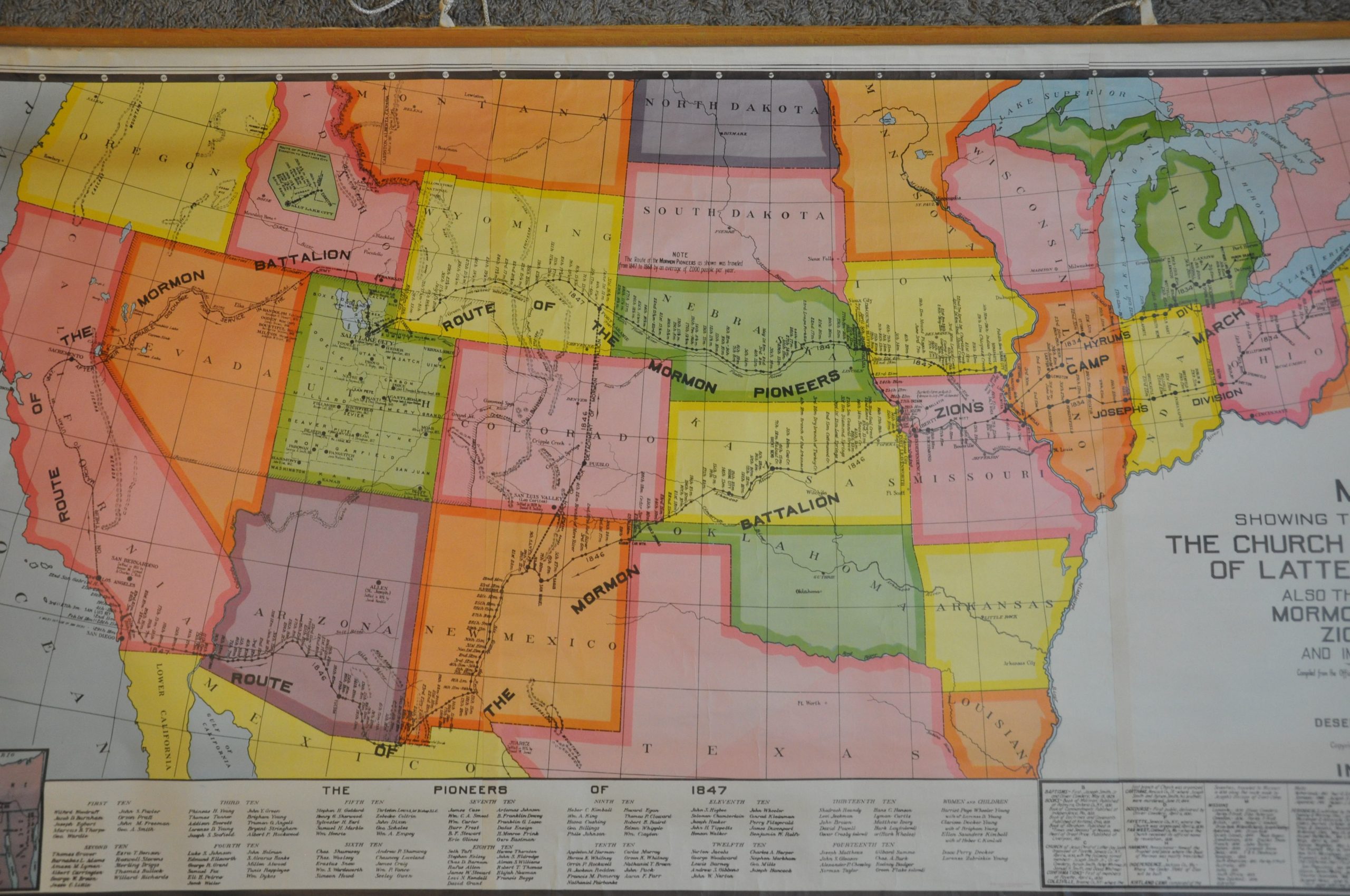
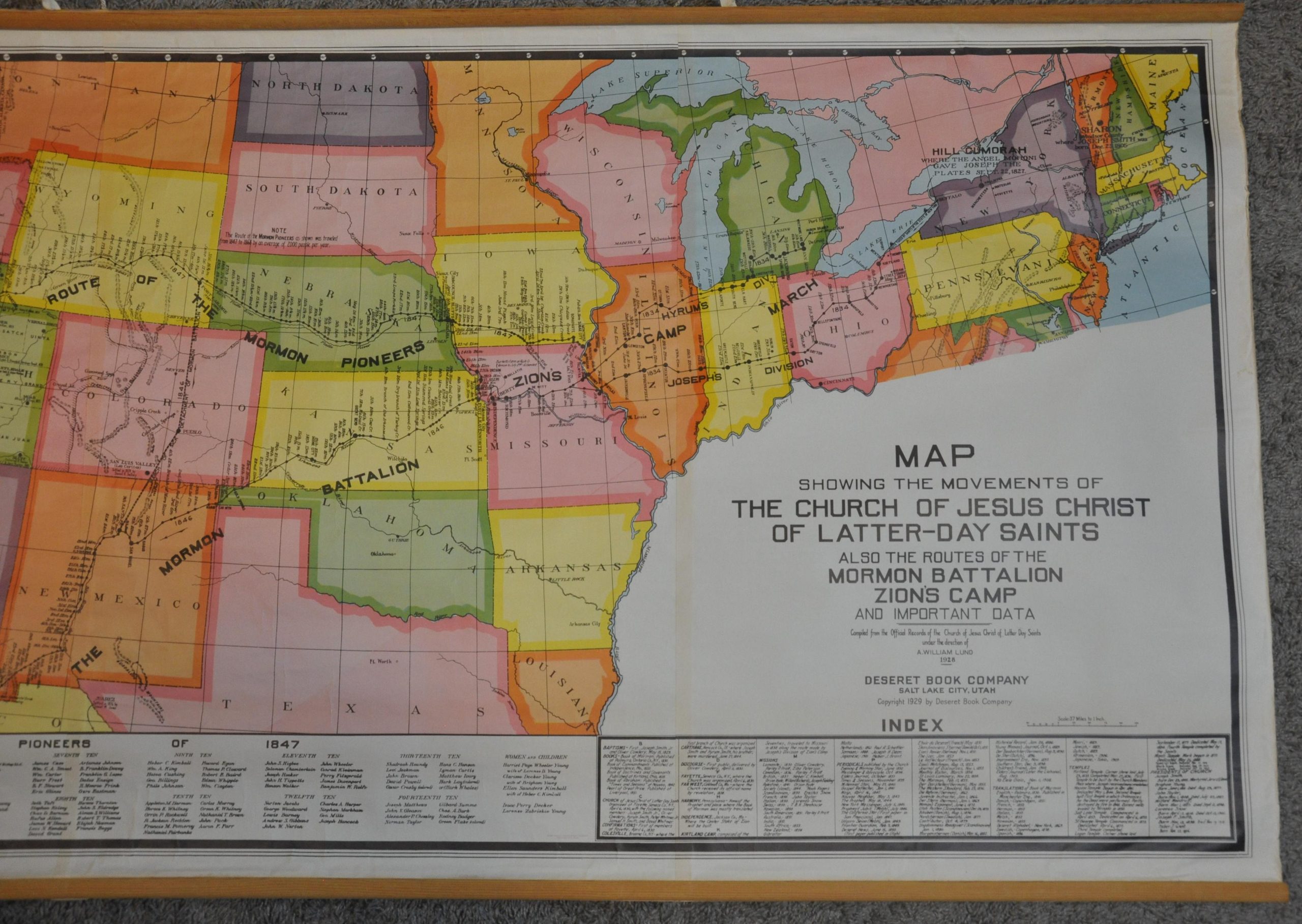
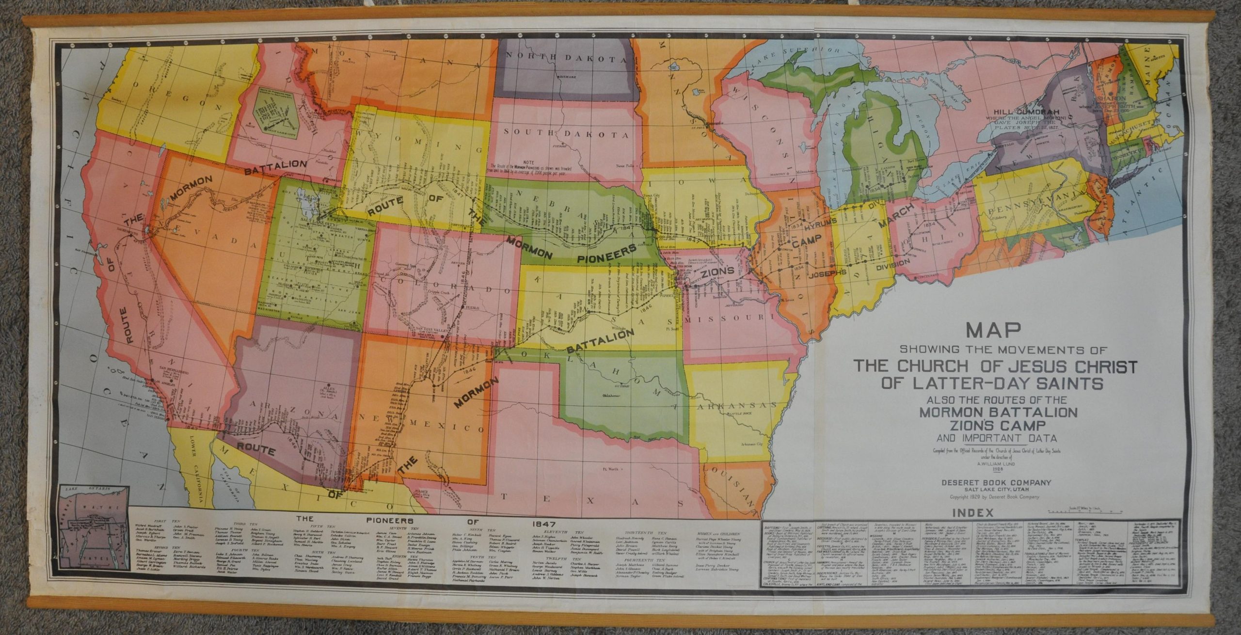
This large and brightly colored map of the northern and western United States was compiled under the direction of A. William Lund and published by the Deseret Book Company in Salt Lake City, UT in 1929. Designed to be hung on a wall for easier scrutiny, the image presents an engaging and comprehensible overview of the various routes taken West by Mormon pioneers during the mid-19th century.
Encampments are noted and dated along each path, which traverse hundreds of miles across the Midwest and Great Plains to the Great Salt Lake Valley and beyond. Scattered topography is depicted in hachure and a handful of geographic features and major settlements are named, but otherwise the geographic data is sparse. The lower left corner shows an inset of the area in New York around Hill Cumorah, “where the Angel Moroni gave Joseph the Plates”, according to the corresponding annotation. An index of important locations and LDS concepts, as well as a list of the pioneers of 1847, can be found at the bottom of the sheet.
Map Details
Publication Date: 1929
Author: A. William Lund
Sheet Width (in): 58.5
Sheet Height (in): 28.5
Condition: B+
Condition Description: Three sheets adhered along vertical seams and affixed to original wooden rollers. Moderate wear, wrinkling, and scattered discoloration visible on the right and left sides, mostly confined to the margins. Several closed tears, the largest about 3", in the lower left have been repaired on the verso. The image retains its vibrant original printed color and overall remains in very good condition.
Original price was: $800.00.$500.00Current price is: $500.00.
1 in stock