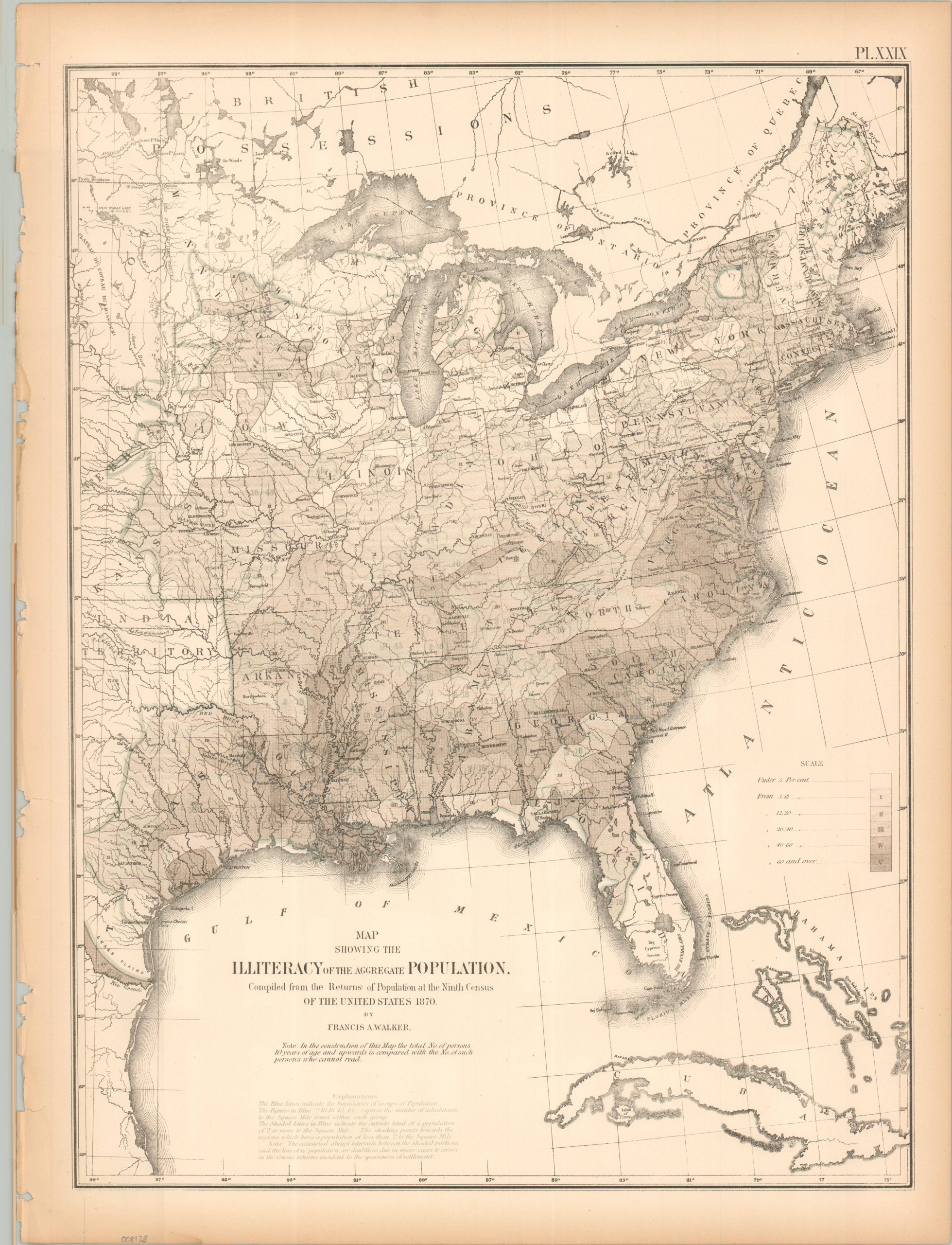
Map Showing the Illiteracy of the Aggregate Population
$60.00
The distribution of illiteracy during the Reconstruction Era.
1 in stock
Description
This intriguing analytical map of the eastern United States highlights the distribution of illiterate residents (ages 10 and up), from less than 5 percent (white) to in excess of 60 percent (darkest shade). No effort is made to account for race or sex.
The map was originally issued as part of The Statistical Atlas of the United States Based on the Results of the Ninth Census, 1870, compiled by Census Superintendent Francis A. Walker. Lithographed by Julius Bien and published in 1874. The atlas serves as the ultimate 19th-century “data portrait” of a reunified nation, meticulously synthesizing geography, climate, and demographics into a visual manifesto of America’s industrial and economic potential.
Map Details
Publication Date: 1874
Author: Francis A. Walker
Sheet Width (in): 16.25
Sheet Height (in): 21.75
Condition: B
Condition Description: Lithographed sheet with moderate marginal wear, including toning, a ragged left edge, a few repaired tears, and chipped corners.
$60.00
1 in stock