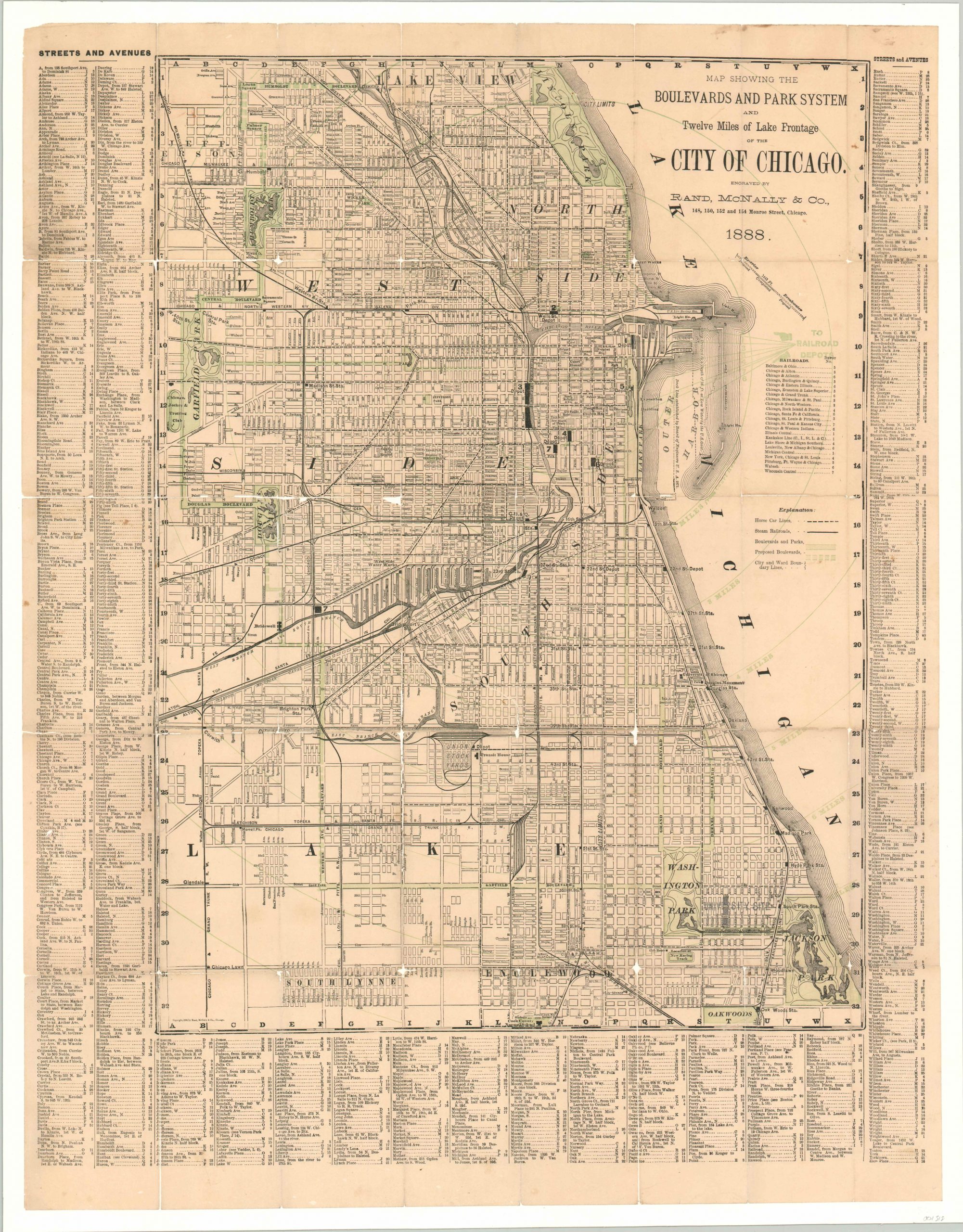
Map Showing the Boulevards and Park System and Twelve Miles of Lake Frontage of the City of Chicago
$195.00
Locally issued map of Chicago showing the city at a formative period at the end of the 19th century.
1 in stock
Description
Chicago developed much of it’s current character in the years immediately following the Great Fire of 1871. The construction of high rise office buildings coupled with new technology in urban transportation saw the spread of suburbanization, and the concentration of economic activity in the Loop. The city’s interconnected system of parks and boulevards, it’s “Emerald Necklace”, played a significant role in this process as well. Though it’s organization preceded the fire by several years, development preceded apace afterwards; as each park commission hired it’s own designers and builders.
This map, published by Rand McNally in 1888, shows the system just five years before Chicago was to host the Columbian Exposition. Completed and proposed parks and boulevards are noted in green, while steam railroads (cable cars) and horse car lines are shown in black.
The image presents a fascinating snapshot of the city at the end of the 1880’s. Prominent buildings in the Loop are individually labeled, and the complex network of transportation routes will soon be upended by the electric streetcar. The map predates Grant Park and the Illinois Central Railroad still dominates most of the Lakefront, which shows the old system of piers and breakwaters. A stamp between Washington and Jackson parks indicates a “University Site” – the location of the forthcoming University of Chicago Hyde Park Campus.
Map Details
Publication Date: 1888
Author: Rand McNally
Sheet Width (in): 21.60
Sheet Height (in): 27.75
Condition: B-
Condition Description: Originally issued folded into 24 panels, the map has been mounted onto linen for preservation and stability. Considerable fold wear has resulted in separation and some spots of image loss, especially at fold intersections. The color has also faded somewhat. Despite the flaws, the map presents well and further deterioration will be prevented by the linen.
$195.00
1 in stock