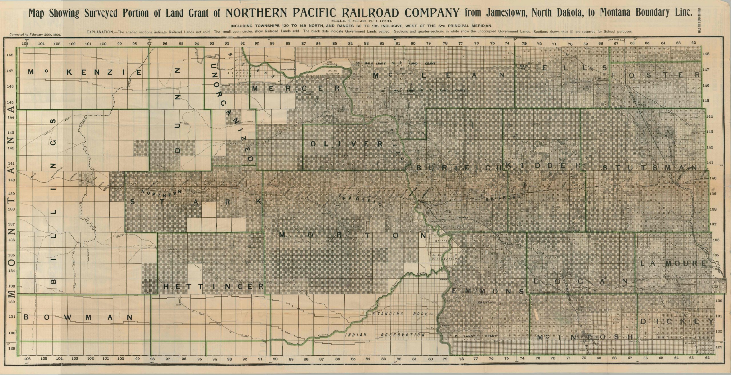
Map Showing Surveyed Portion of Land Grant of Northern Pacific Railroad Company from Jamestown, North Dakota to Montana Boundary Line.
$300.00
Rare map from the late 19th century advertising the sale of Northern Pacific grant lands in North Dakota.
1 in stock
Description
Congress chartered the Northern Pacific Railway in 1864 to connect the Great Lakes with Puget Sound. By the time the transcontinental railroad was completed almost two decades later, the company had acquired nearly 40 million acres in land grants from the federal government. Much of this land was sold in Europe to pay for the cost of construction, and maps such as this were used extensively to promote railroad holdings along the route.
This particular example was issued in 1896, and shows the Northern Pacific Railroad in North Dakota between Jamestown and the Montana border. Shading and small circles and dots highlight land ownership and occupation status, with the federal policy of granting alternating tracts visibly shown. School townships, military facilities, and Native American reservations are also outlined and labeled. The progress of sale reflects the contemporary policies of the Northern Pacific, which sold large lots at wholesale prices to alleviate the tax burden and earn quick profits. This would change in the early 20th century, after decades of immigrants (many hailing from Scandinavia and used to the cold weather) and their productivity increased land prices significantly.
The verso features extensive text, photographs, and tables of statistics lauding the climate, geography, and economic possibilities in North Dakota. Advertisements show ‘agricultural and grazing’ land available as cheap as $1.00/acre, not including the freely available land grants provided by the federal government. It also includes a map of the entire Northern Pacific network and a bird’s eye view ‘in the badlands of the Little Missouri.’
Published by the Northern Pacific Railroad in 1896 – a fascinating and ephemeral map documenting ‘The American Dream’ of many immigrants from the late 19th century.
Map Details
Publication Date: 1896
Author: Northern Pacific Railroad
Sheet Width (in): 46.75
Sheet Height (in): 24.00
Condition: B
Condition Description: Originally issued folded into 36 segments, now flattened. Moderate creasing and wear along fold lines, including several areas of separation that have been repaired with archival tape. Even so, minimum image loss has occurred through the horizontal centerfold of the map. A few small edge tears remain. Overall in good condition, especially for something this ephemeral.
$300.00
1 in stock

