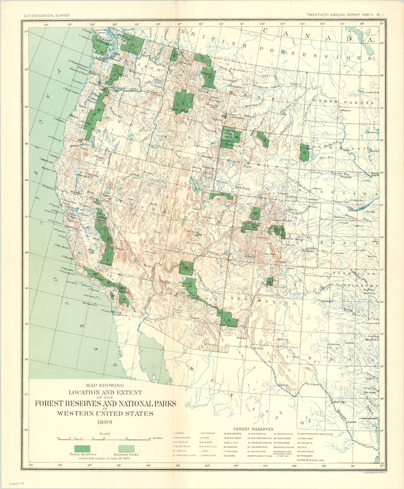
Map Showing Location and Extent of the Forest Reserves and National Parks in Western United States
Topographical map of the western United States highlighting National Parks and forest reserves.
Out of stock
Description
Depicting the area west of the Great Plains and Texas, this map presents the National Parks and forest preserves under government administration in 1899. Thirty-six separate forest reserves are listed, most of which are concentrated along the west coast. Only two national parks are listed; Yosemite and Yellowstone. The latter was established in 1872 and was the first national park in the United States, and considered by many to be the first national park in the world. Yosemite was dedicated in 1890, along with Sequoia National Park, which is interestingly omitted from the map. Mt. Rainier National Park was dedicated shortly before publication, in March of 1899, but is also not included.
As is typical with maps published by the U.S. Geological Survey, topographical information and water systems are provided in great detail, but population centers are sparse. An important reminder of the vast natural beauty and promise the West would hold for generations.
Map Details
Publication Date: 1899
Author: U.S. Geologic Survey
Sheet Width (in): 15.75
Sheet Height (in): 19
Condition: A+
Condition Description: The map is in pristine condition, with no visible defects. Fold lines as originally issued, but no tearing or loss.
Out of stock

