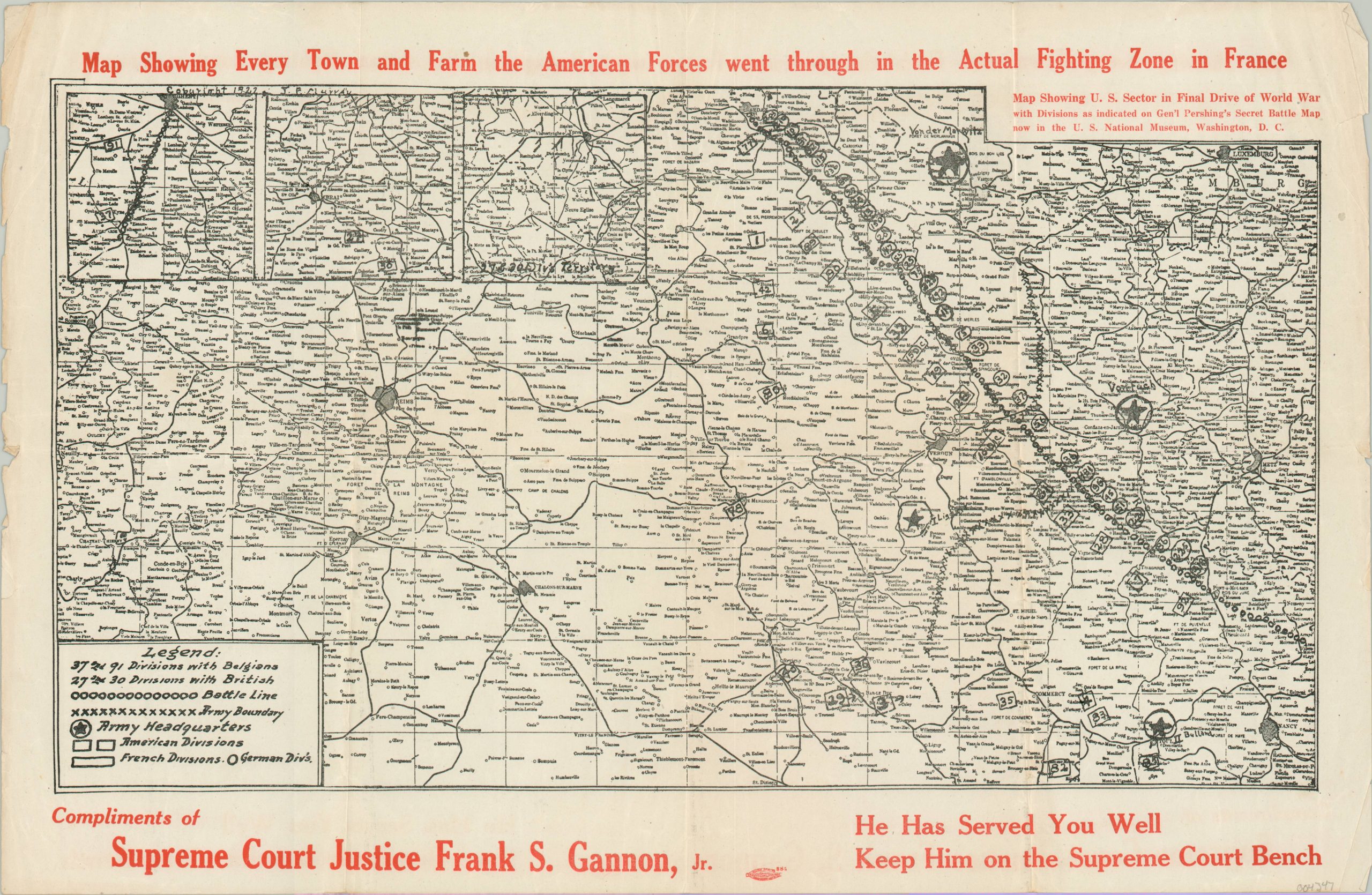
Map Showing Every Town and Farm the American Forces went through in the Actual Fighting Zone in France
Ephemeral map combining military service with politicking.
Out of stock
Description
This map was distributed in 1922 to aid in the campaign of New York State Supreme Court Justice Frank S. Gannon, Jr. First elected to the bench the year prior, Gannon (probably a veteran) hoped that the success of American troops during World War I would help his chances for re-election.
The image shows a portion of Pershing’s ‘Secret Battle Map’ of U.S. unit dispositions in France at the time of the Armistice. Division locations, battle lines, and army headquarters are sketchily overlaid atop the base map and three insets are included in the upper left. The bold claim that it shows every town and farm through which American troops passed seems…suspicious, to say the least.
Map Details
Publication Date: c. 1922
Author: Frank S. Gannon, Jr. [U.S. War Department]
Sheet Width (in): 16.75
Sheet Height (in): 10.75
Condition: B+
Condition Description: Moderate wear visible along the outer edges of the sheet, generally confined to the margins in the form of wrinkling and a few small tears. Light creasing along old fold lines and some toning on the verso that does not affect the image.
Out of stock