
Map Showing Cotton Growing Regions of the United States and Mexico
$125.00
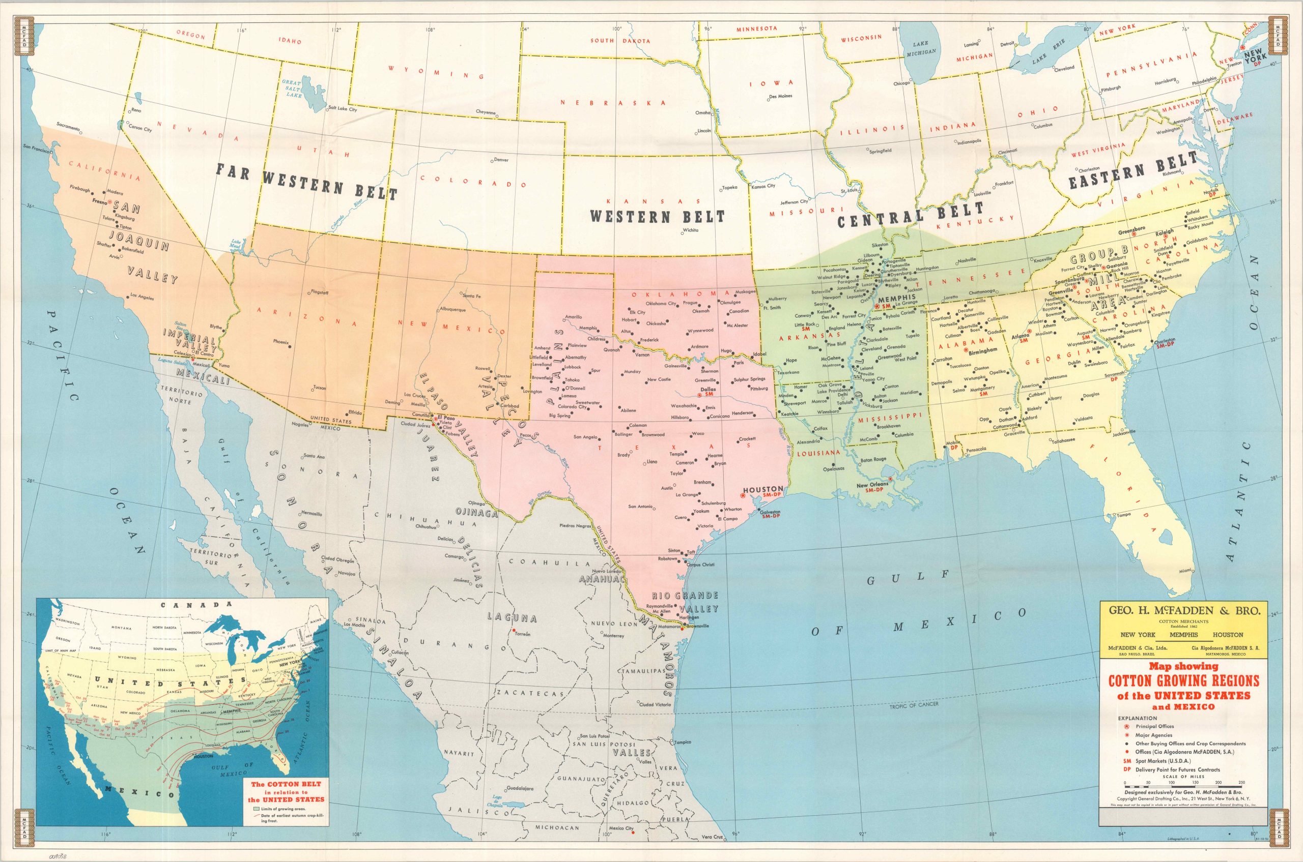
Mid-century map of America’s Cotton Belt.
1 in stock
Description
This fascinating map of the southern United States and northern Mexico captures the last gasps of King Cotton’s supremacy among America’s textile manufacturers. It was created by the General Drafting Company in 1951 on behalf of George H. McFadden & Brothers, one of the continent’s largest cotton merchants. The recent outbreak of the Korean War led to a boom in commodity prices, while the nascent status of synthetic materials had not yet undermined the market.
The image highlights four different geographic belts, stretching from coast to coast and as far south as Mexico City. Elements of the McFadden firm’s infrastructure are identified according to the legend in the lower right corner. Offices, agencies, markets, and subsidiary operations are noted throughout. An inset in the lower left shows the limits of cotton growing in the U.S.
Map Details
Publication Date: 1951
Author: General Drafting Company, Inc.
Sheet Width (in): 37.90
Sheet Height (in): 24.75
Condition: A
Condition Description: Color printed map on a single-sided sheet, creased along old folds. Very good condition overall.
$125.00
1 in stock