
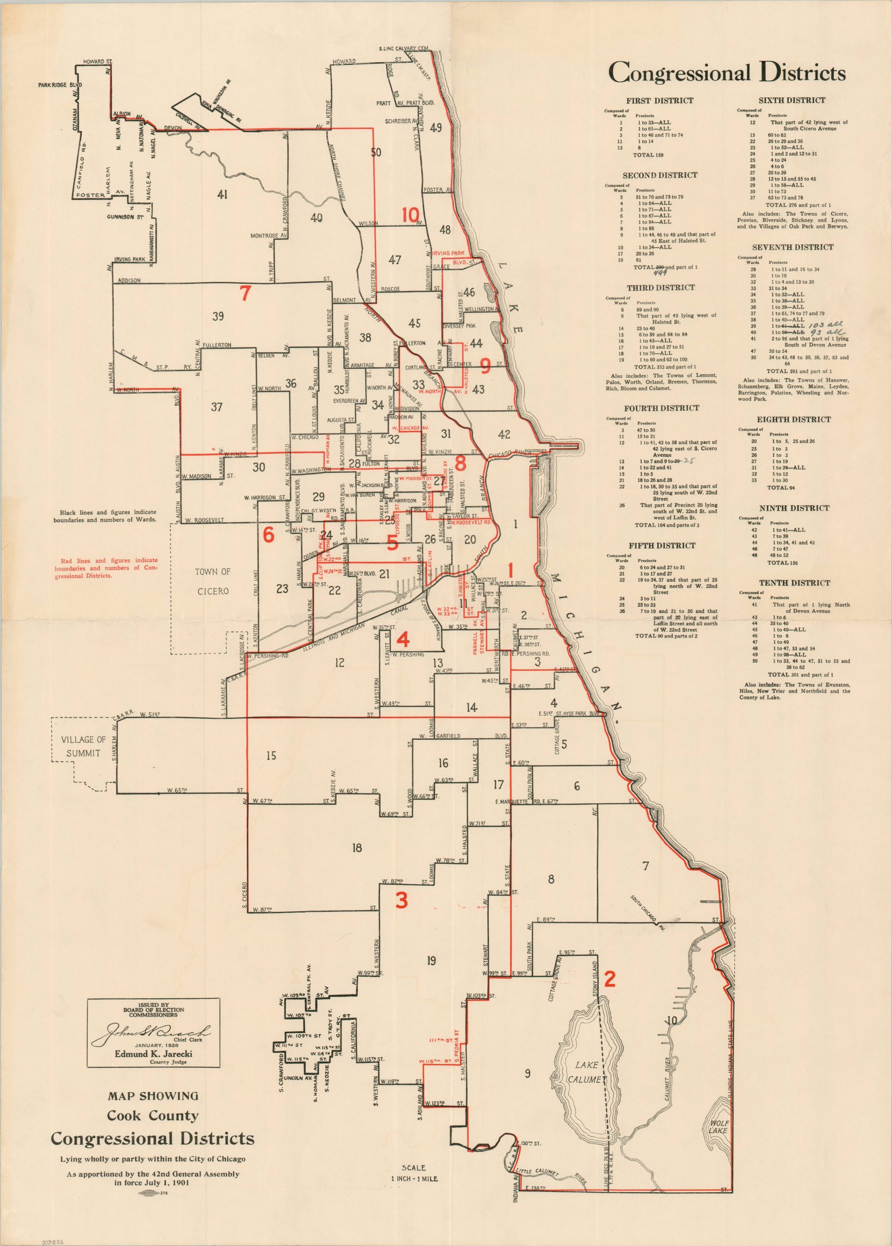
Map Showing Cook County Congressional Districts
$500.00
The beginnings of Congressional gerrymandering in Illinois.
1 in stock
Description
This simple, but informative map of the area around Chicago was published by the Cook County Board of Election Commissioners in 1928. Congressional districts lying wholly or partly within the city are numbered and outlined in red. Corresponding wards and precincts for each are listed in the upper right. Portions of ten of the state’s twenty-five total districts (at the time) were located in and around Chicago. According to a historical study done for the Illinois General Assembly,
“The 1901 reapportionment was not downstate’s Armageddon, as the final redistricted map gave Cook County’s population its fair share of seats. However, the idea of permanently limiting the big county’s representation had been planted in downstaters minds, and county members from both parties saw limitation implementation as the best defense against future reapportionments — that is, if there were any future reapportionments…From 1901 to 1955, the Illinois legislature refused to reapportion and redistricting legislative districts in the state, despite the fact that the 1870 constitution explicitly provided for decennial reapportionment of representative districts based on population.”
Map Details
Publication Date: 1928
Author: Cook County Board of Election Commissioners
Sheet Width (in): 20
Sheet Height (in): 28
Condition: A-
Condition Description: Single-sided broadsheet with light soiling and toning along the outer edges (see scan) and creasing along two old folds. Very good condition overall.
$500.00
1 in stock