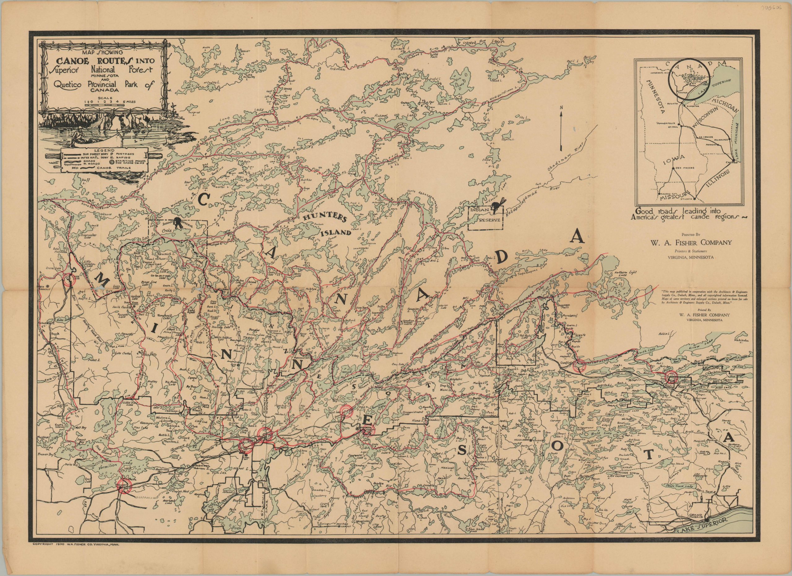
Map Showing Canoe Routes into Superior National Forest
One of the earliest maps issued by W.A. Fisher of the canoe region along the Minnesota border.
Out of stock
Description
Focused largely on Canada (but lauding America’s greatest canoe regions), this early recreation map shows hundreds of miles of available canoe routes through Quetico Park and Superior National Forest, on the border between Minnesota and Canada. Practical information such as portages, rapids, and launching points are provided, in addition to an inset map showing the best roads that lead to the region.
Although the area looks well served by these early automobile routes, in reality northern Minnesota was largely undeveloped and such excursions required an intrepid angler or canoeist. W.A. Fisher was one such enthusiast who dedicated much of his life to exploring and mapping the waters along the border. He founded a publishing firm in Minnesota 1922 that continues to create maps of the region to this day.
Map Details
Publication Date: 1930
Author: W.A. Fisher
Sheet Width (in): 30.30
Sheet Height (in): 22.00
Condition: B+
Condition Description: Minor discoloration and creasing along fold lines. Some intersections exhibit minor image loss from wear.
Out of stock

