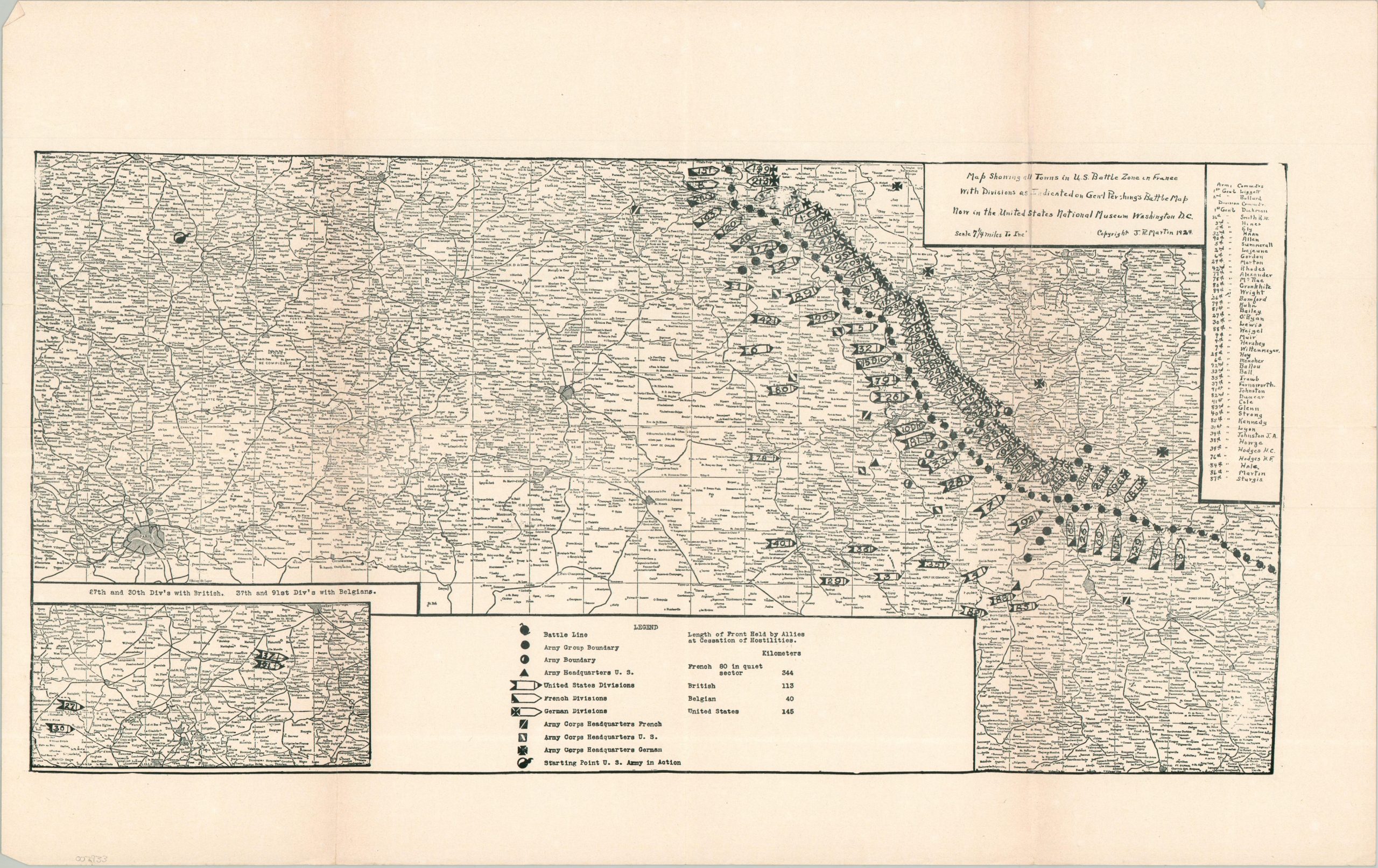
Map Showing all Towns is U.S. Battle Zone in France with Divisions as Indicated on Gen’l Pershing’s Battle Map now in the United States National Museum Washington, D.C.
$250.00
Recounting America’s involvement in WWI on the fifth anniversary of the ceasefire.
1 in stock
Description
This rare map, attributed to J.R. Martin and copyrighted in 1924, pinpoints the location of American, French, and German divisions along the Western Front at the end of World War I. A base map replicated from General Pershing’s iconic battle map has been updated to show divisional numbers, the locations of army headquarters, and the names of individual commanders. An inset in the lower left notes the activity of several American units in Belgium.
The map is scarce on the market and in institutional collections. The only listing in WorldCat (at the Wisconsin Historical Society) notes the distributor as the Northwestern National Bank in Minnesota. Their example is noted as being distributed at the 1925 National American Legion Convention in Omaha. OCLC # 935938727 ; Similar map at the Pritzker Museum, with the annotation “To preserve the memories and incidents of our association in the Great War.”
Sources: OCLC; Smithsonian Institute;
Map Details
Publication Date: 1924
Author: J.R. Martin
Sheet Width (in): 21.75
Sheet Height (in): 13.90
Condition: B+
Condition Description: Single sided black & white map, printed on a somewhat thin sheet of glossy paper. Creased and moderately worn along old folds and light wear in the margins. Good to very good condition overall.
$250.00
1 in stock