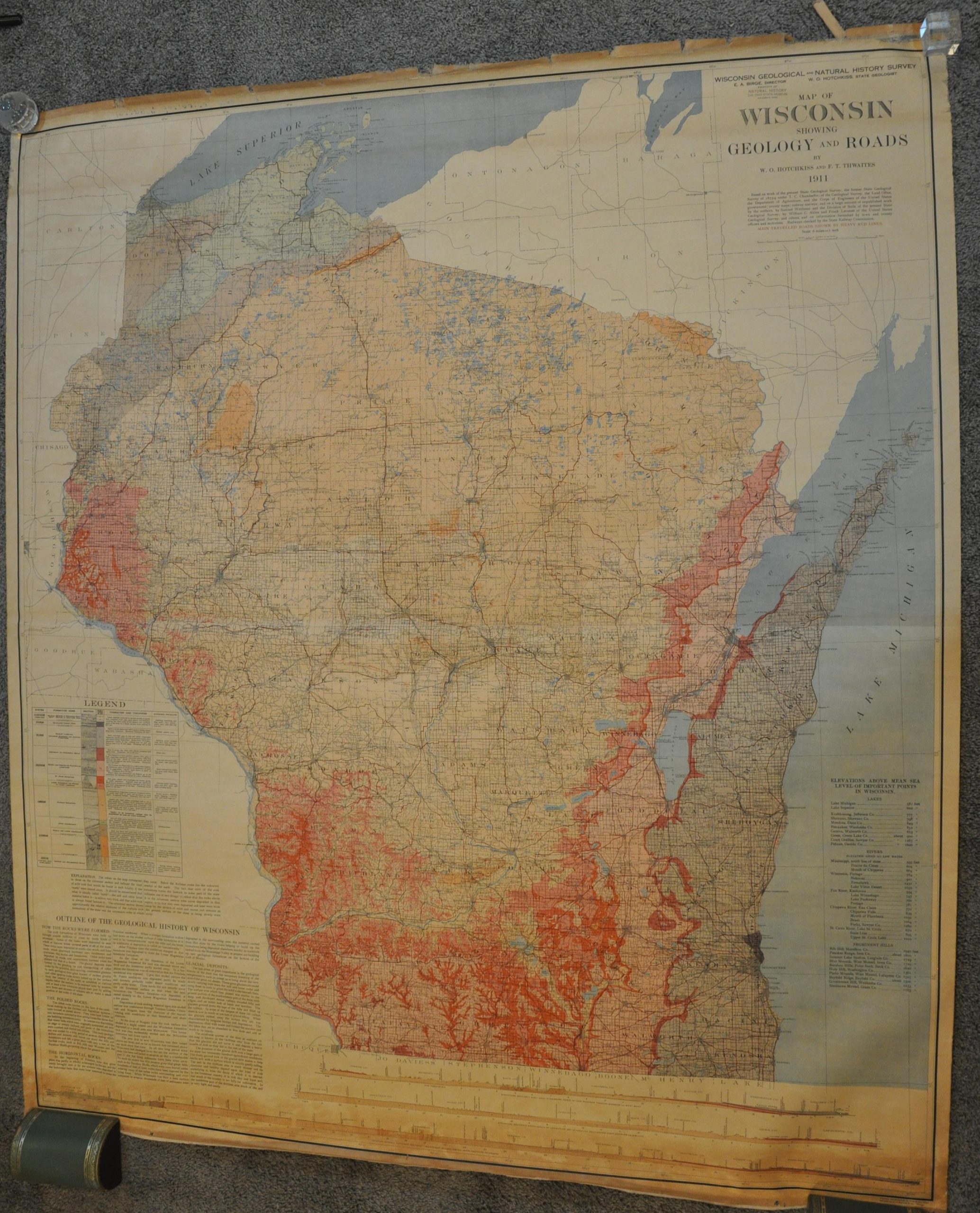
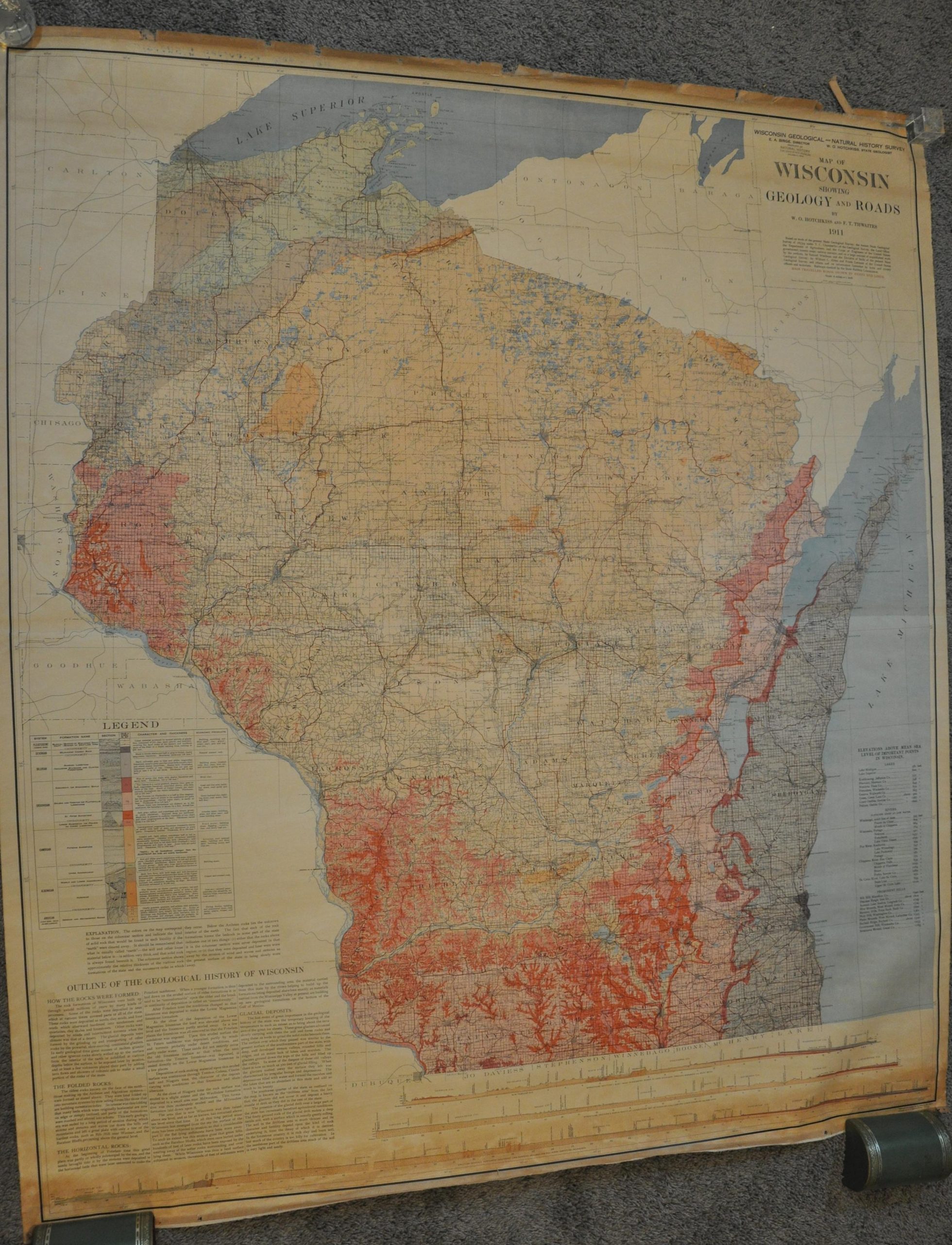
Map of Wisconsin Showing Geology and Roads
$450.00
Dual-purpose wall map of Wisconsin from the early 1910s.
1 in stock


Description
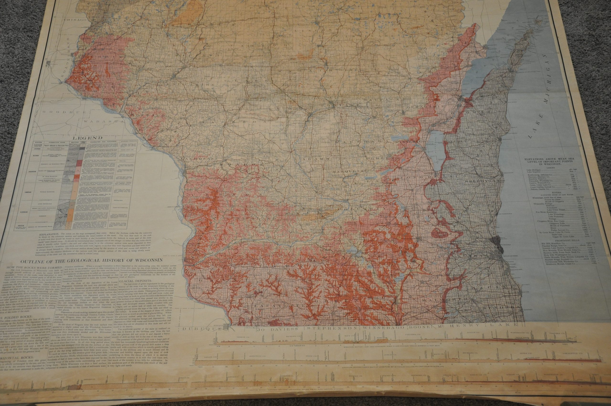
“The colors on the map correspond to the columnar section and indicate the kind of solid rock that would be found in each locality if the “earth” were cleared away.” Text, lower left.
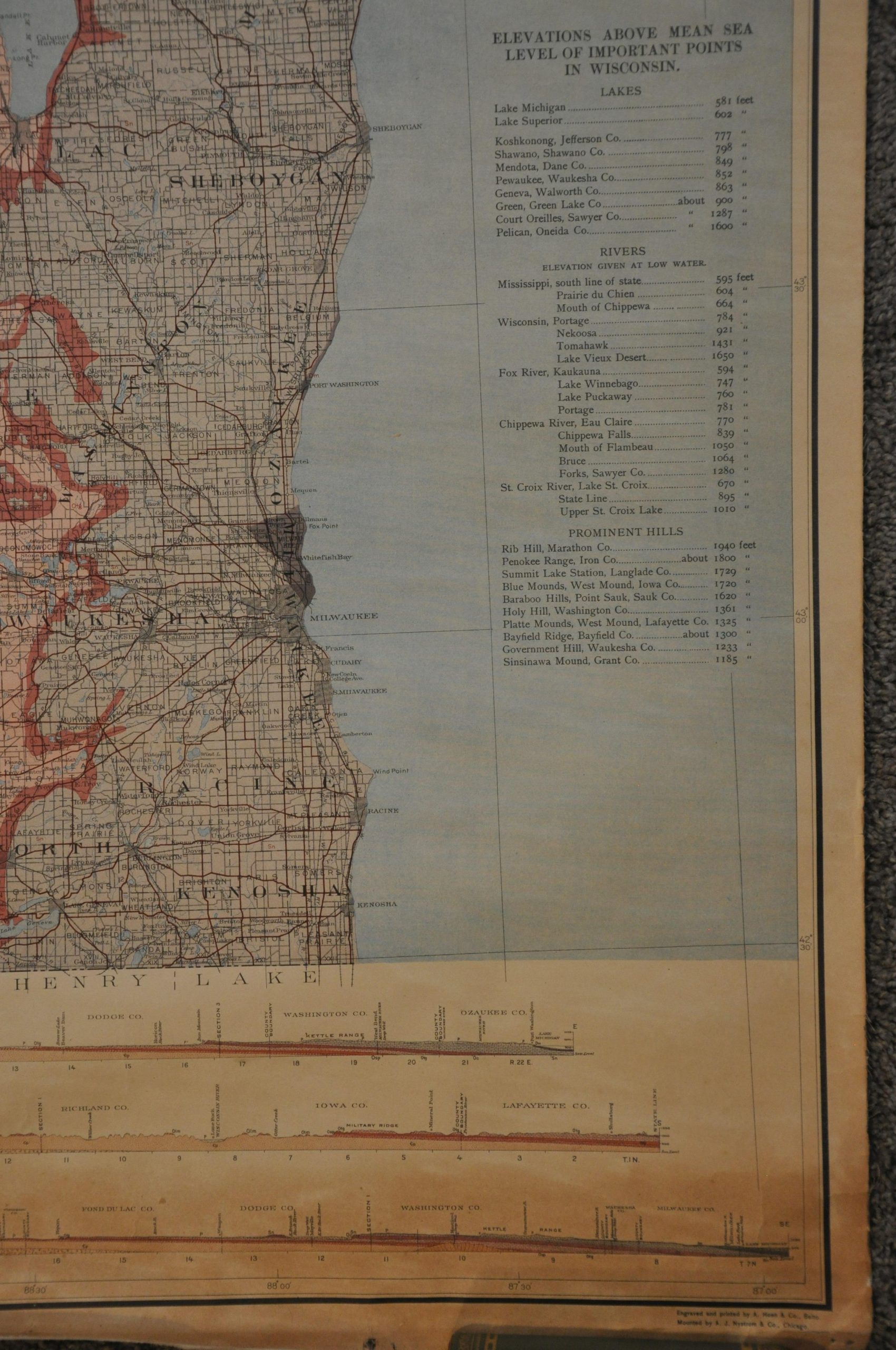
This impressive map of Wisconsin was published in 1911 by the state’s Geological and Natural History Survey. Vibrant shades of red, pink, and orange highlight various geologic systems, with a detailed legend in the lower left outlining the characteristics, economic products, and formation names of each strata. Immediately below is a brief geological history, adjacent to a large multi-part cross-section of the entire state.
Also of interest are the ‘main traveled roads’, emphasized in bold red lines. Though the number of vehicles in Wisconsin had increased to over 20,000 from 1900-1911, the state lacked any formalized system of road network until the introduction of the numbered highway system in 1917. Little information is provided on the usability of such roadways and only a small fraction were likely paved.
The map was designed by prominent geologists Fredrik Turville Thwaites and William Hotchkiss, the latter of whom also served on the state’s first highway commission. Engraved and printed by Auguste Hoen & Co. in Baltimore. Mounted by A.J. Nystom & Co. in Chicago.
Map Details
Publication Date: 1911
Author: W.O. Hotchkiss and F.T. Thwaites
Sheet Width (in): 54
Sheet Height (in): 62
Condition: B+
Condition Description: Two large sheets joined at a horizontal seam and mounted to original linen, missing the original wooden rollers. The upper and lower margins are a bit tattered from where formerly affixed. The adjacent 4" of the sheet has also moderately toned from oxidization. The vast majority of the map is fully intact and in good condition.
$450.00
1 in stock