Map of Warren County, Pennsylvania
$300.00
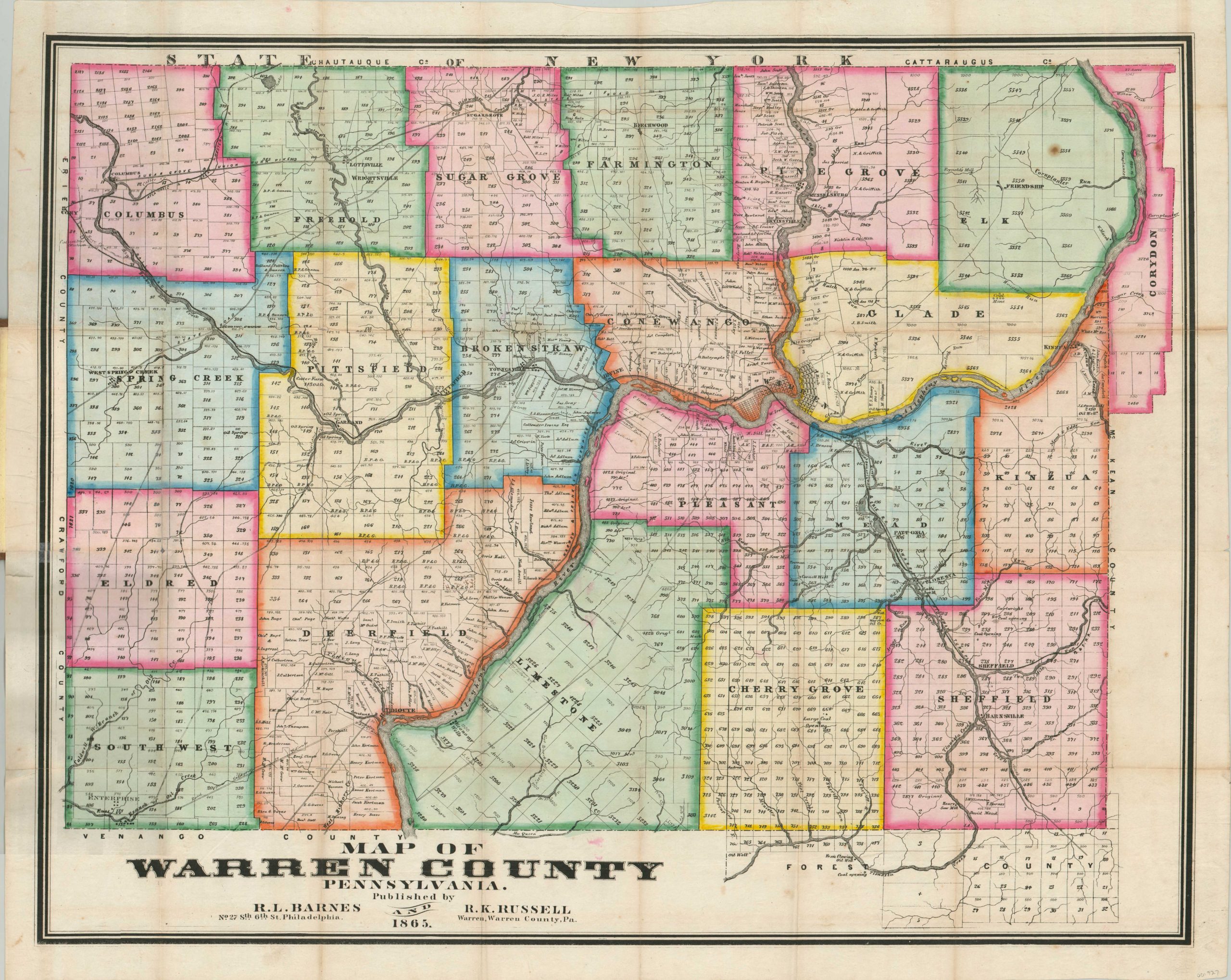
Detailed Civil War-era pocket map of an oil rich county in Pennsylvania.
1 in stock
Description
This fascinating real estate map was published during one of the earliest oil booms in the nation’s history. Warren County, Pennsylvania was home to the second well drilled specifically for the extraction of crude oil (1859) and quickly became a hotspot for the readily available sources on the banks of the Allegany River. Oil production centered around Tidioute (lower left) and by July 1860, more than sixty wells were under construction throughout the county.
This map, published less than five years later, shows the ongoing rush to extract the resources from Pennsylvania’s soil. Apart from individually labeled oil wells and refining facilities, the map also identifies coal fields, mines, roads, and railroads. Individual property owners are listed within lots, along with the acreage, where applicable.
The map was designed by R.L. Barnes and R.K. Russell and published in Philadelphia in 1865. The map is one of several printed by W.F. Geddes covering the oil district of Pennsylvania – an advertisement for the others can be seen on the inside front cover.
Map Details
Publication Date: 1865
Author: R.L. Barnes & R.K. Russell
Sheet Width (in): 30.5
Sheet Height (in): 24.6
Condition: B+
Condition Description: Issued folded into 28 panels and affixed to original brown cloth covers. Moderate wear along fold lines, including several areas of separation that have been repaired on the verso, and small holes at fold intersections. One tear has been repaired on the map's image, where it is bound to the covers. A few small spots of foxing in the upper right, and minor discoloration visible along certain fold lines. Remains in good condition overall, with vibrant original hand color.
$300.00
1 in stock