Map of Twin Cities
$95.00
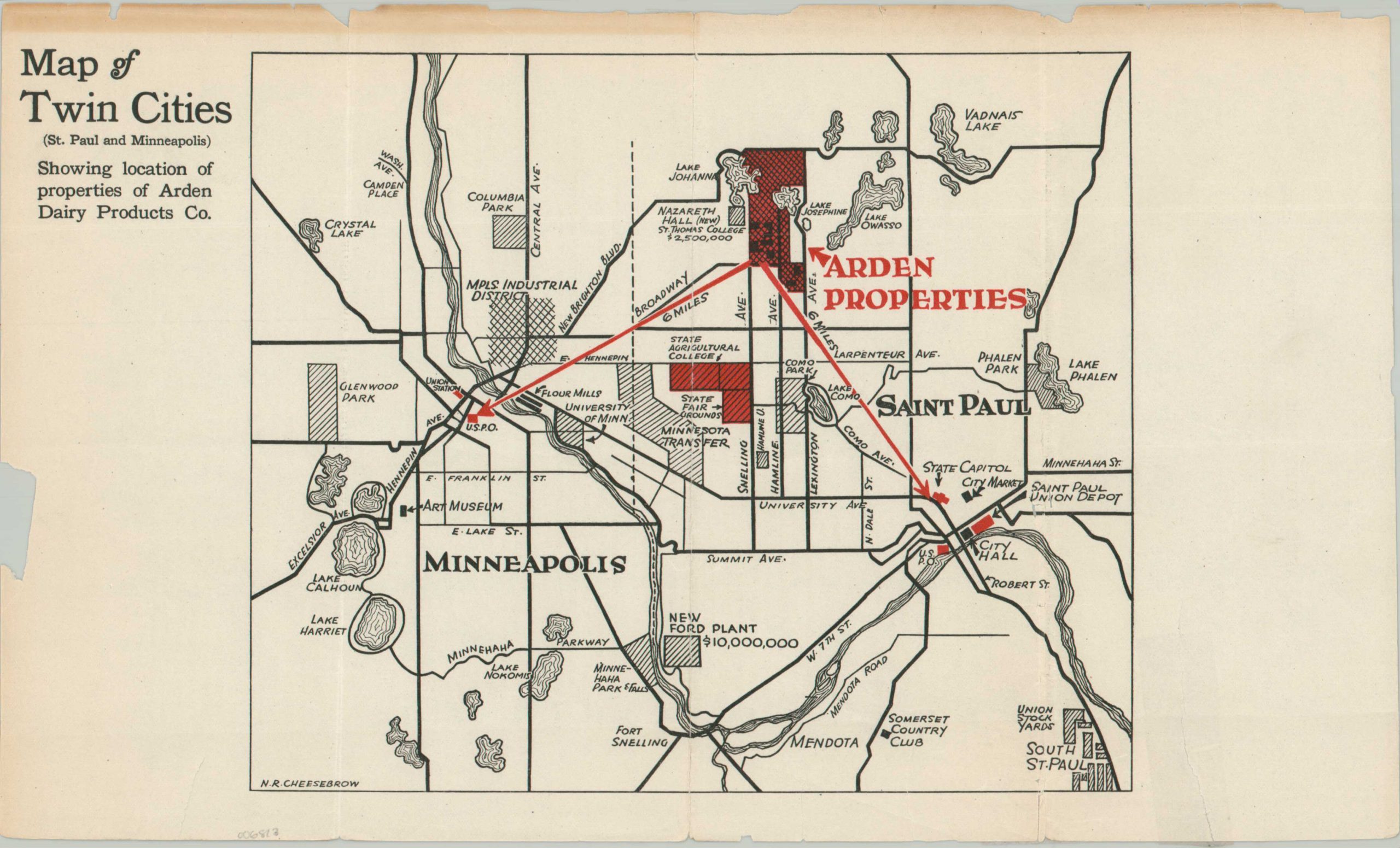
Six miles to the post office or the state capitol!
1 in stock
Description
This simple map of the Twin Cities was cleverly designed to highlight the excellent location occupied by Aarden Dairy Products Company. The firm may refer to the hobby farm started by Senator Joseph Hackney in 1906 – this would further explain the content. Bright red arrows highlight a mere six-mile distance between the (vastly exaggerated) property and 1. the Minneapolis Post Office/Union Station and 2. the state capitol building/City Hall/Post Office in St. Paul. Millions of dollars in nearby construction are noted, as well as numerous parks, the industrial district, train depots, and other local amenities.
Signed by the questionably named N.E. Cheesebrow in the lower left and dated by the presence of the ‘new’ Nazareth Hall, completed in 1923 and curiously attributed to St. Thomas, rather than Northwestern. Today, much of the former Arden properties comprise the desirable suburb Arden Hills.
The map is scarce and noted in only one example in WorldCat as of April 2025, at the Minnesota Historical Society Library. OCLC #605983979
Map Details
Publication Date: c. 1924
Author: N.R. Cheesebrow
Sheet Width (in): 13.75
Sheet Height (in): 8.4
Condition: B
Condition Description: Creased and moderately worn along three vertical folds. Several spots of separation and one small irregular tear repaired on the verso with archival materials. Further wear, toning (see scan), and numerous small tears along the outer edges, confined to the margins. Fair to good condition overall.
$95.00
1 in stock