
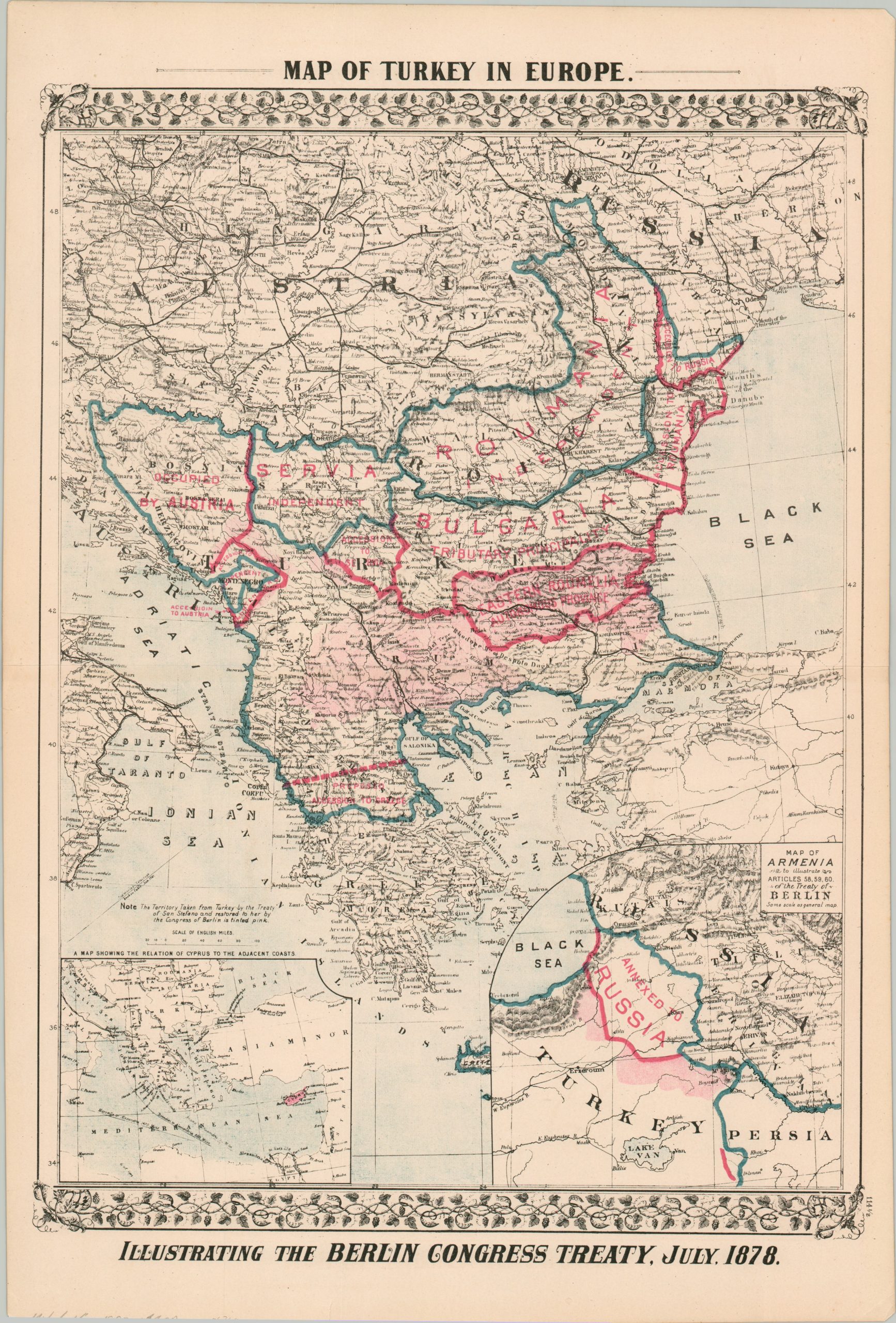
Map of Turkey in Europe Illustrating the Berlin Congress Treaty, July, 1878
Outlining the peace terms of Russia’s victory over the Ottoman Empire.
Out of stock
Description
This interesting map highlights the decline of Ottoman power in Europe during the 19th century. A devastating loss in the Russo-Turkish War of 1877-1878 resulted in the international recognition of several Balkan states, including Bulgaria, Romania, Serbia, and Montenegro. These are outlined and labeled respectively within the image. Transferred territory is shaded in pink, with Russia, Greece, and Austria enjoying most of the spoils of war. Insets in the lower corners show the relation of Cyprus to the adjacent coasts (left) and the region of Armenia annexed by Russia.
Published in Philadelphia by Samuel Augustus Mitchell around 1880
Map Details
Publication Date: c. 1880
Author: Samuel Augustus Mitchell
Sheet Width (in): 15.1
Sheet Height (in): 22.4
Condition: A
Condition Description: Color printed map disbound from Mitchell's New General Atlas. Light wear along the outer edges of the sheet, including small tears and faint toning. Very good condition overall. Blank on verso.
Out of stock