
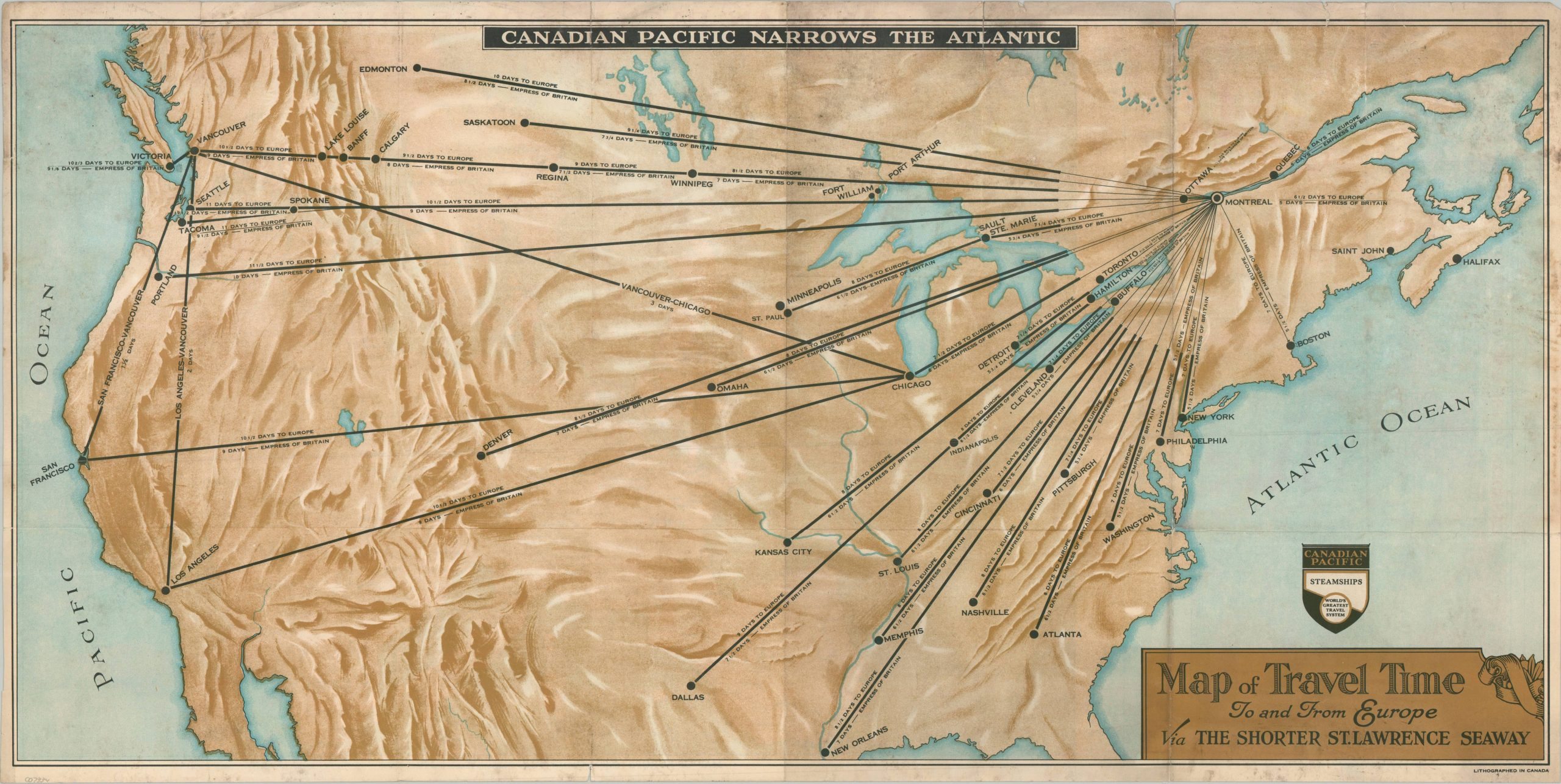
Map of Travel Time to and From Europe via the Shorter St. Lawrence Seaway
$195.00
Travel to Europe via the St. Lawrence Seaway!
1 in stock

Description
“The Canada Pacific Narrows the Pacific” exclaims this persuasive, abstract folding map of the United States and Canada. Major departure points across both countries are connected to Montreal via a series of bold route lines; each indicating its approximate travel time. Even from San Francisco, it’s possible to reach London via the Empress of Britain in a mere 20 days! It’s implied these speeds are as fast, or better, than the more popular departure point of New York, though generally, they were not.
There are two maps present on the verso. The primary image shows a simple outline map of Europe with the steamship routes and ports of call of the Canada Pacific, while a secondary inset shows the global lines. The title proclaims “Canada Pacific Spans the World – The World’s Greatest Travel System.”
Map Details
Publication Date: 1933
Author: Canada Pacific
Sheet Width (in): 30.5
Sheet Height (in): 15.4
Condition: B-
Condition Description: Double-sided color printed map, with heavy surface soiling on both sides and lacking the original paper covers. Two irregular tears along the outer edges have been repaired with archival tape , though a few small clean splits remain. Fair to good condition overall.
$195.00
1 in stock