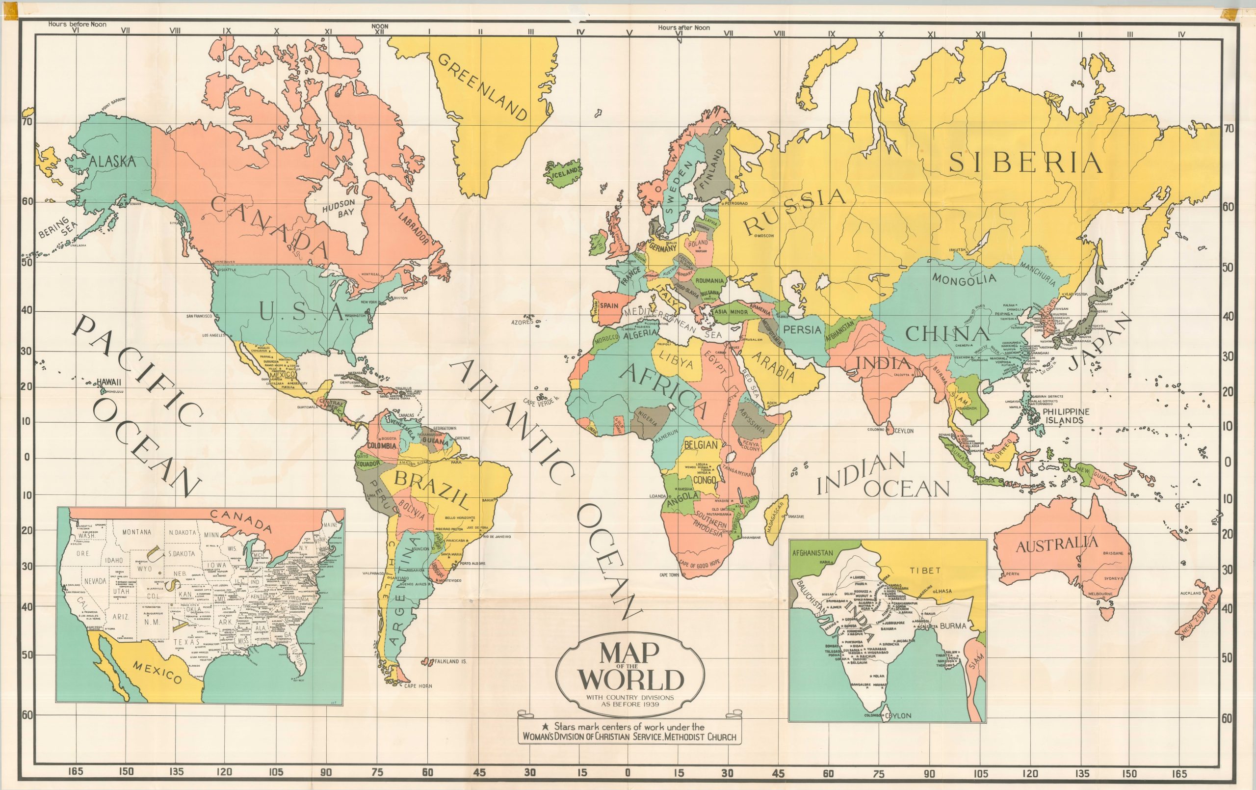
Map of the World With Country Divisions As Before 1939
The global footprint of Methodist Evangelism around World War II.
Out of stock
Description
This large and colorful wall map proudly displays the global achievements of the Methodist Church’s Woman’s Division of Christian Service. The organization focused on both domestic and international missionary efforts, holding its first annual meeting in 1940. The map was issued a few years later, presumably before the national borders across Europe were redefined after World War II.
Bright splashes of color present ‘country divisions as before 1939’, according to the subtitle. The inclusion of Armenia is notable and likely reflects solidarity with the local Christian population. Dozens of cities are named and starred, representing a center of work for the Woman’s Division of Christian Service. Insets in the lower present the United States and India, evidently two regions dictating particular emphasis and resources.
An archive of the Women’s Division of Christian Service annual reports is available online.
Map Details
Publication Date: c. 1943
Author: Woman's Division of Christian Service Board of Missions
Sheet Width (in): 68
Sheet Height (in): 42.5
Condition: B+
Condition Description: Huge color printed map, creased along old folds and toned on the (blank) verso. Old tape along the upper margin, with a piece in the center missing and pulling some of the marginal surface with it. A few edge tears and light wear, consistent with age, but overall in good to very good condition.
Out of stock