
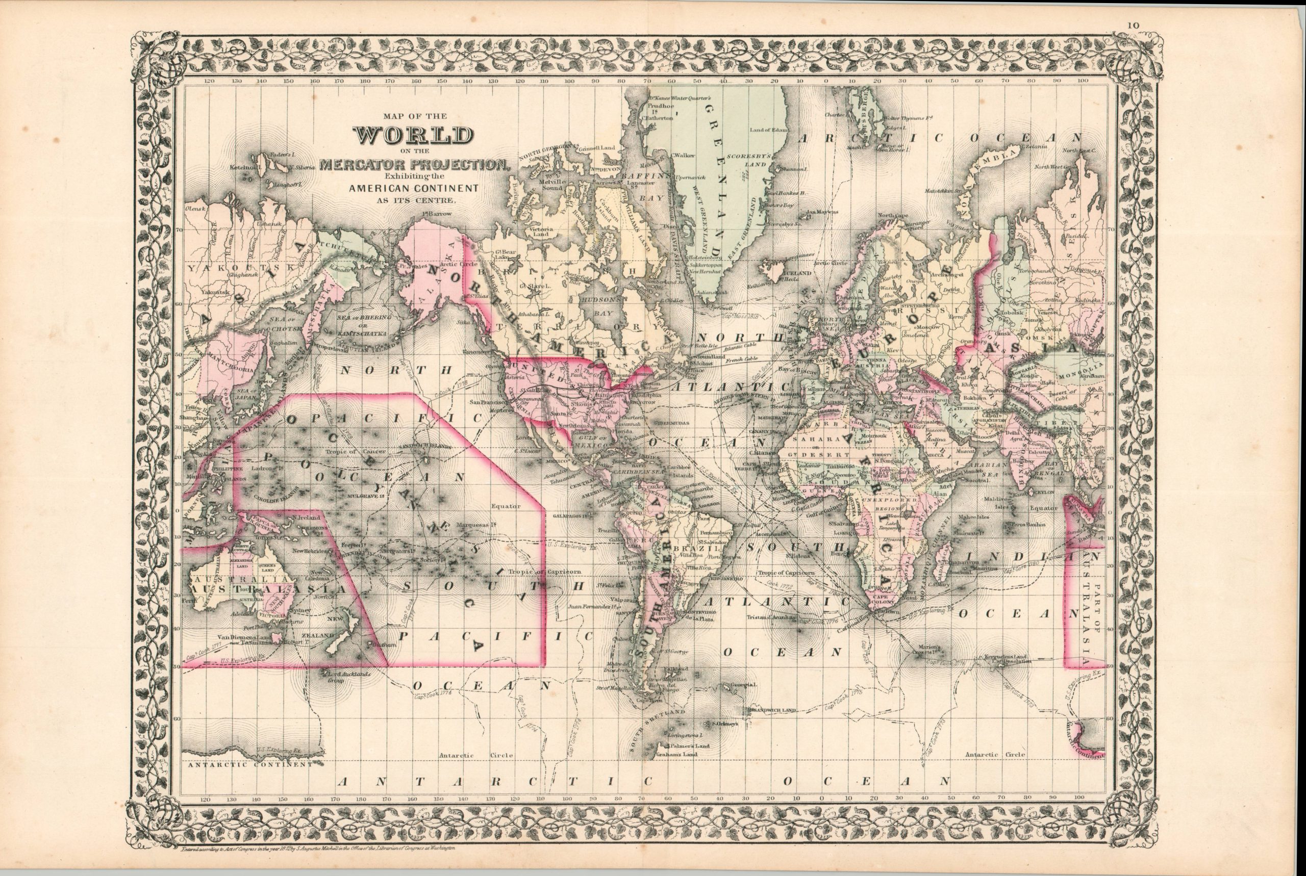
Map of the World on the Mercator Projection
$95.00
Exhibiting the American Continent at its Center.
1 in stock
Description
This engaging map presents the world near the start of the Second Industrial Revolution; when urbanization, mass production, and revolutions in communication and transportation motivated rapid change in social and political structures. Modern steamship routes juxtapose sharply with the tracks of Cook, by that point almost a century old. The Transatlantic Cable and Transcontinental Railroads are also noted.
Attractive hand color delineates various political boundaries, from Unexplored Regions in the interior of Africa to the constituent states of the new German Empire and ‘Mantchooria’ in China (which includes Korea). An interesting variety of settlements, geographic features, and regional identities are labeled throughout the image. Of particular interest is the Winter Quarters of Elisha Kent Kane on Greenland, from the epic Second Grinnell expedition.
Map Details
Publication Date: 1872
Author: Samuel Augustus Mitchell
Sheet Width (in): 22.75
Sheet Height (in): 15.5
Condition: A-
Condition Description: Steel engraved sheet with attractive hand color on a somewhat brittle sheet of paper. Scattered foxing throughout. Several small tears in the margins. Good condition overall.
$95.00
1 in stock