Map of the World from the Best Authorities
$125.00
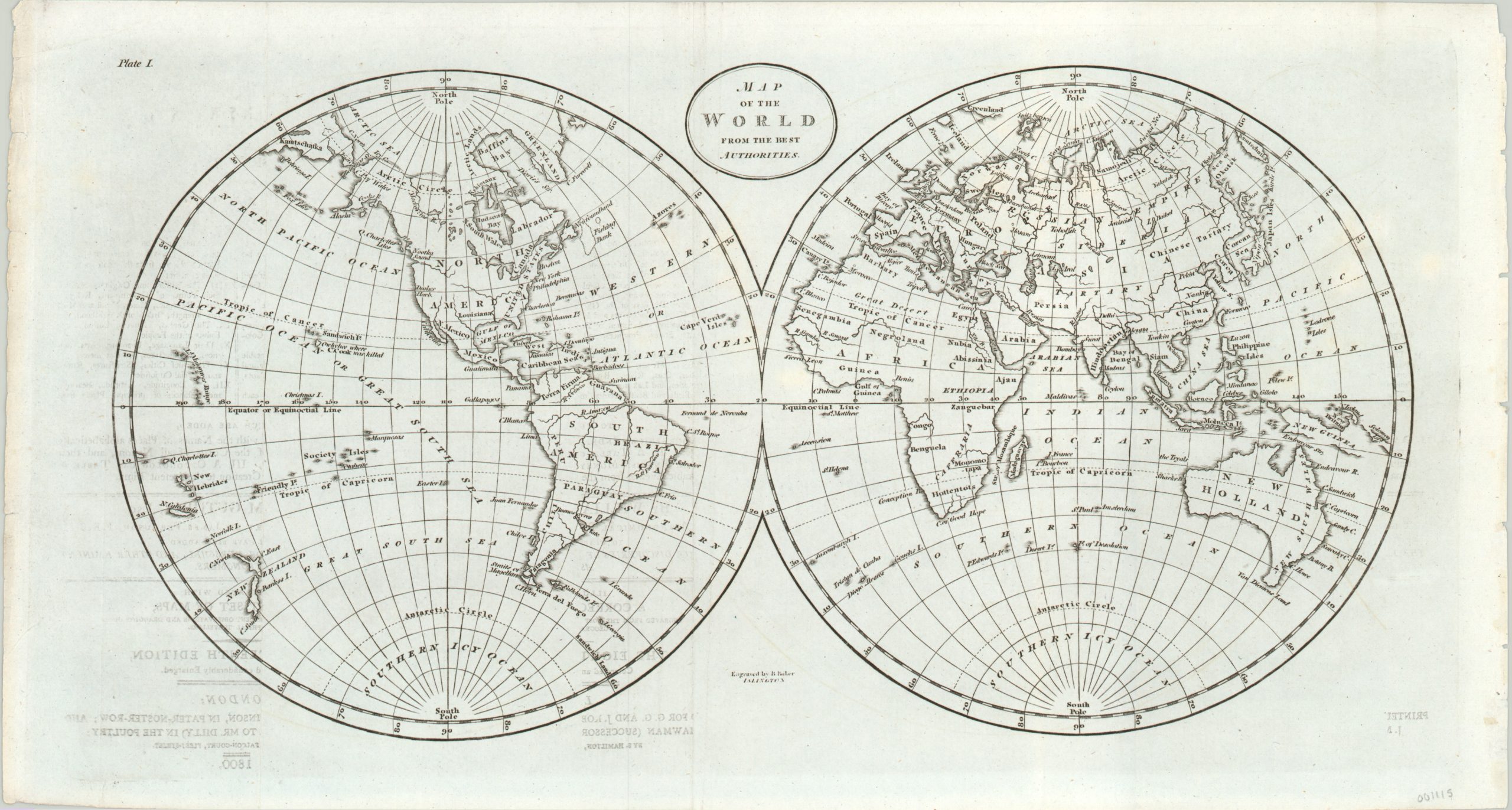
Late 18th century map of the world published in London.
1 in stock
Description
This double hemisphere map of the world provides an interesting global snapshot at the end of the 18th century. Most continental outlines are fully formed, though the southern coast of Australia (including attached Tasmania) is largely hypothesized.
Similarly, the vast majority of Pacific islands are accounted for, though there is some ambiguity in the coastline of New Guinea and the Solomons. Though the image shows the mythical Northwest Passage as definitively closed, the polar regions reflect the last great bastion untouched by man, and they would be a central focus of exploration throughout the coming century.
The map was first engraved by Benjamin Baker in 1794 – this particular example is a later re-issue from 1800.
Map Details
Publication Date: 1800
Author: Benjamin Baker
Sheet Width (in): 16.20
Sheet Height (in): 8.60
Condition: B+
Condition Description: Faint offsetting visible on the left side of the sheet and minor wear along the outer edges. Bright and clean sheet.
$125.00
1 in stock