Map of the Western States Showing Location of National Parks and National Monuments
$95.00
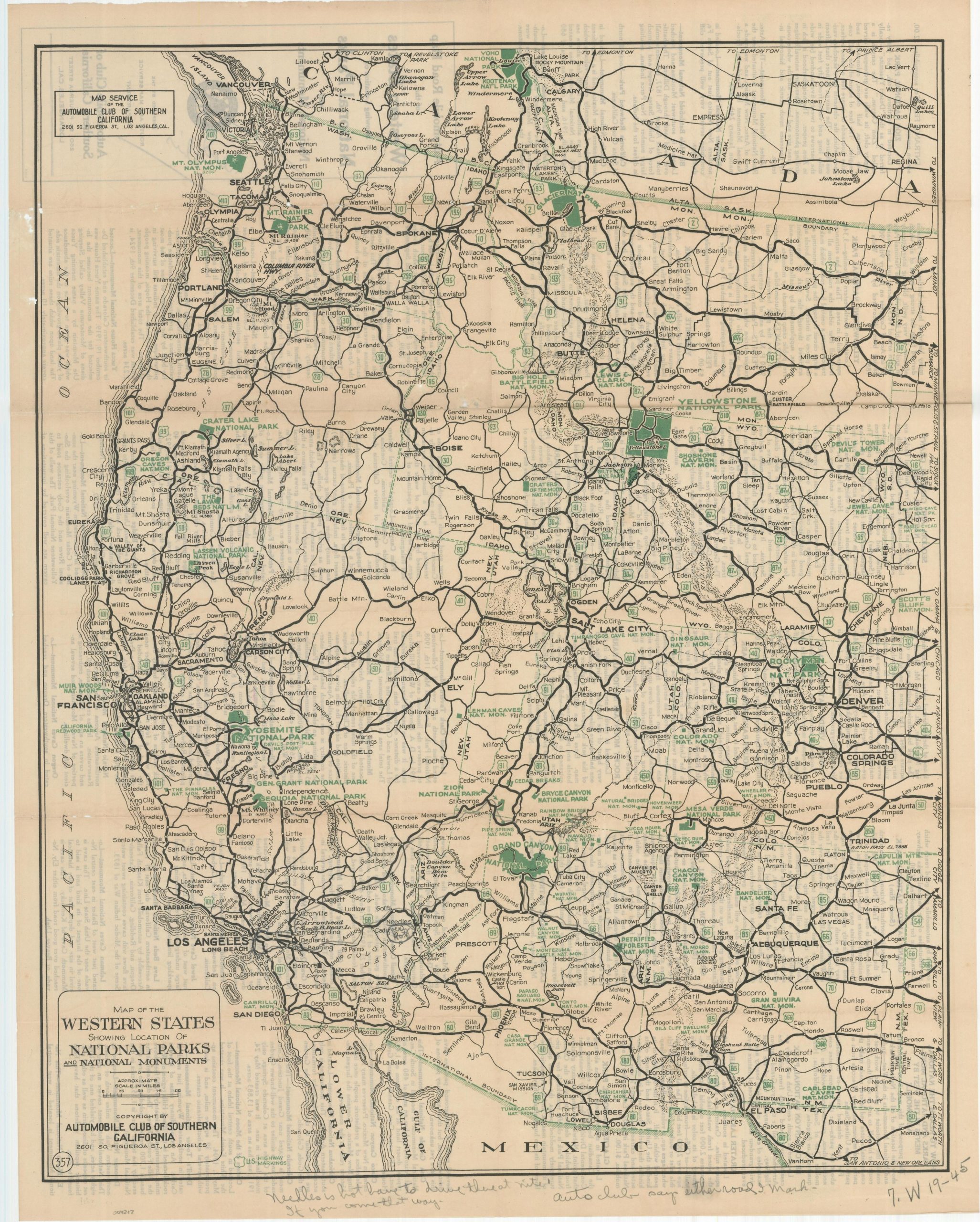
Road map to the National Parks of the western U.S., with old manuscript annotations.
1 in stock
Description
“The purpose of this map is to graphically show the location of all the National Parks – and National Monuments in the West – and to enable the motorist to plan and work out a route for himself, to any or all of them.” [Text on verso]
This interesting map of the western United States was published around 1930 in Los Angeles by the Automobile Club of Southern California. Bright green color identifies the numerous National Parks and National Monuments situated throughout the image. Primary motor roads are also shown with thick black lines, but railroads are omitted, reflecting the priorities of the publisher.
This particular example features manuscript annotations in pencil that provide two suggested routes between El Paso and Los Angeles. Text at the bottom of the page includes a cautionary note – “Needles is hot have to drive thru at nite [sic] if you come that way.”
Map Details
Publication Date: c. 1930
Author: Automobile Club of Southern California
Sheet Width (in): 18.5
Sheet Height (in): 23.5
Condition: B+
Condition Description: Creasing and moderate wear along originally issued fold lines, including small spots of abrasion that's resulted in minor image loss and faint discoloration. Manuscript annotations in pencil visible along the bottom of the sheet. Good to very good overall.
$95.00
1 in stock