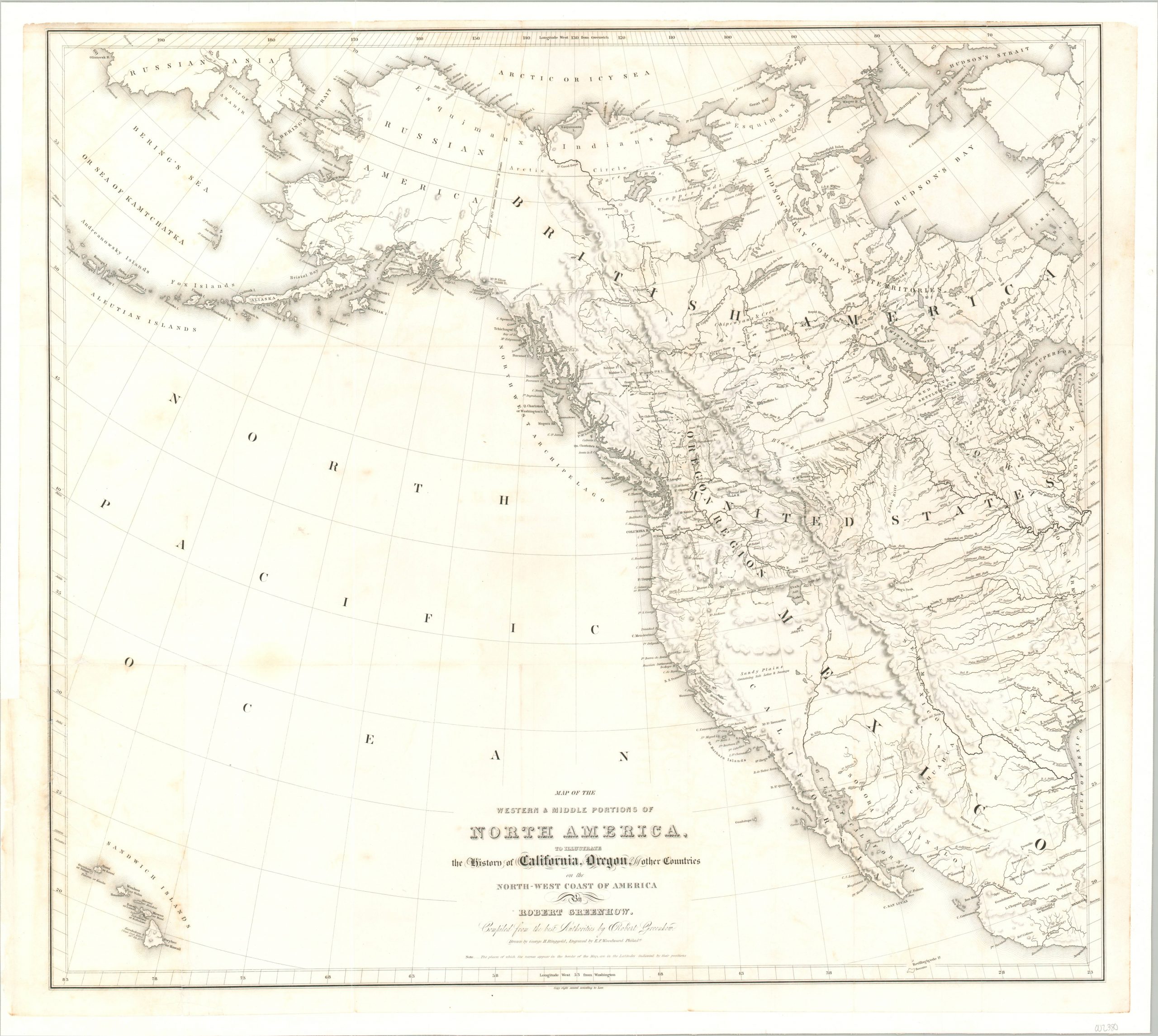
Map of the Western & Middle Portions of North America, to illustrate the History of California, Oregon, and the other Countries on the North-West Coast of America
One of the strongest proponents for America’s claims to Oregon.
Out of stock
Description
This spectacular map covering the western majority of the continent of North America, including Alaska and Hawaii, was published in 1844 to accompany Robert Greenhow’s important work, The History of Oregon and California. Greenhow was a scholar and historian who published his first book (and corresponding map) on the region in 1840, but ongoing developments necessitated the issue of an update in 1844, seen here.
As far back as 1818, the United States and Great Britain had agreed to peacefully share the Oregon Country (or Columbia District), which was largely occupied by fur traders and Native Americans. Increasing white settlement, domestic political pressure, and recognition of the land’s material wealth led both sides to maintain a keen interest, and it wasn’t until 1846 that a definitive treaty was signed establishing a permanent border along the 49th parallel.
Prior to that point, opinions on expansion into the region were divided in the United States. Many wanted to focus attention on the annexation of Texas, though Greenhow was of the opinion that much was to be gained in the Pacific Northwest.
In his map of the region, based largely on the 1840 issue, interior details largely reflect earlier explorations of John C. Fremont and Jedidiah Smith. The numerous ‘forts’ can be a misnomer – the majority were small, isolated fur trading posts rather than military encampments. Boundaries and treaty lines with Mexico and Great Britain are noted, though a portion of the northern border remains unfinished, as the boundary dispute remained an open question at the time.
The map was compiled by Robert Greenhow, drawn by George Ringgold and engraved in Philadelphia by E.F. Woodward. History of Oregon and California was published in Boston by Charles C. Little and James Brown in 1844.
Source: Sabin 28632. Wheat II, 184-185.
Map Details
Publication Date: 1844
Author: Robert Greenhow
Sheet Width (in): 27.00
Sheet Height (in): 23.90
Condition: A-
Condition Description: The fold-out map has been disbound and professionally cleaned, flattened and mounted on linen. A bit of soiling remains visible in the outer edges and the upper margin is a bit narrow, but remains in very good condition and ready for display. The accompanying travel volume, 482 pp. is not so lucky, and needs some TLC. Original marbled boards have separated and the spine is tattered. Contents are generally good, with loose endpapers and moderate spotting/toning throughout.
Out of stock

