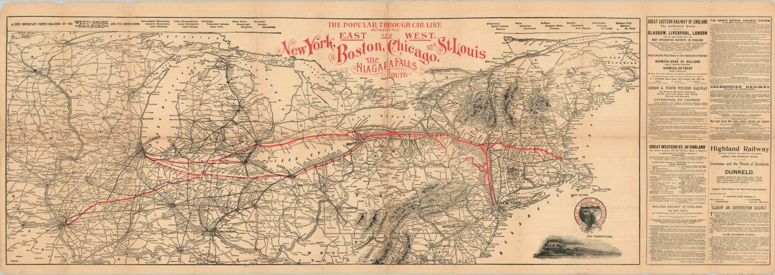
Map of the West Shore Railroad and Connections
$200.00
“The Popular Through Car Line Between the East and West.”
1 in stock
Description
Obtaining its name from the western shore of the Hudson River on which its track ran, the New York, West Shore and Buffalo Railway was the final iteration of several earlier companies designed to operate rail traffic from New York to Buffalo (though its terminal was in Jersey City). An 1885 bankruptcy led to its acquisition by the primary competitor, the New York Central Railroad owned by Cornelius Vanderbilt, and reorganization as the West Shore Railroad.
This map shows the West Shore route amid the broader network of the New York Central about 2 decades later. Lines extend as far west as Chicago and St. Louis, with an eastern extension serving Boston. The border at the top of the sheet lists ‘a few important points reached by the West Shore Railroad and its connections’, while panels of text on the right side present an interesting variety of advertisements for railways in the British Isles. The verso presents further advertisements, timetables, information for travelers, and a map showing the location of the principal offices of the West Shore Railroad in New York City.
Map Details
Publication Date: 1905
Author: West Shore Railroad
Sheet Width (in): 47.5
Sheet Height (in): 16.75
Condition: B
Condition Description: Map and timetable formerly folded in 28 double-sided panels. Moderate wear and discoloration visible along the former fold lines, including large areas of separation repaired with archival tape. Scattered soiling visible in the margins and a few spots within the image (see center left) and a few small edge tears remain in the outer margins.
$200.00
1 in stock


