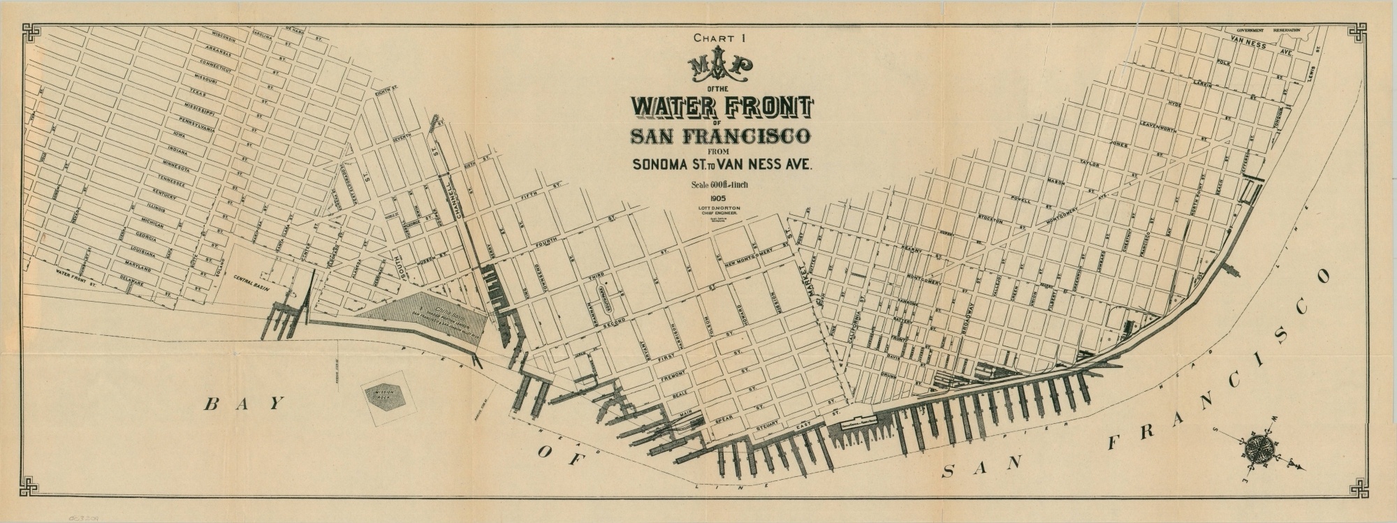
Map of the Water Front of San Francisco from Sonoma to Van Ness Ave.
$450.00
Uncommon street plan of San Francisco issued the year prior to The Great Earthquake.
1 in stock
Description
This fascinating map of San Francisco’s waterfront is oriented with southwest at the top in order to maximize the space on the sheet. Apart from street names and scattered measurements, little detail is provided in the interior. Emphasis is instead on the numerous piers, dockyard facilities, and transportation depots along the Bay of San Francisco.
Of particular interest are the Union Depot & Ferry House, Mission Rock, and China Basin. The last, comprised primarily of landfill, would eventually become a popular neighborhood of the same name and home to the San Francisco Giants.
The map was drawn by Carl Uhlis under the supervision of chief engineer Lott D. Norton and published, likely in a government report, in 1905. Significant updates would be required the following year, as the Great San Francisco Earthquake (and subsequent fire) would destroy much of the city, including large portions of the waterfront.
Map Details
Publication Date: 1905
Author: Carl Uhlis
Sheet Width (in): 29.25
Sheet Height (in): 11
Condition: B
Condition Description: Printed on thin paper with creasing and wear along former fold lines. Two 5" tears along vertical creases and 2 other 4" tears (see upper right) have been repaired on the verso with archival tape. A few small separations remain along the edges and fold intersections.
$450.00
1 in stock

