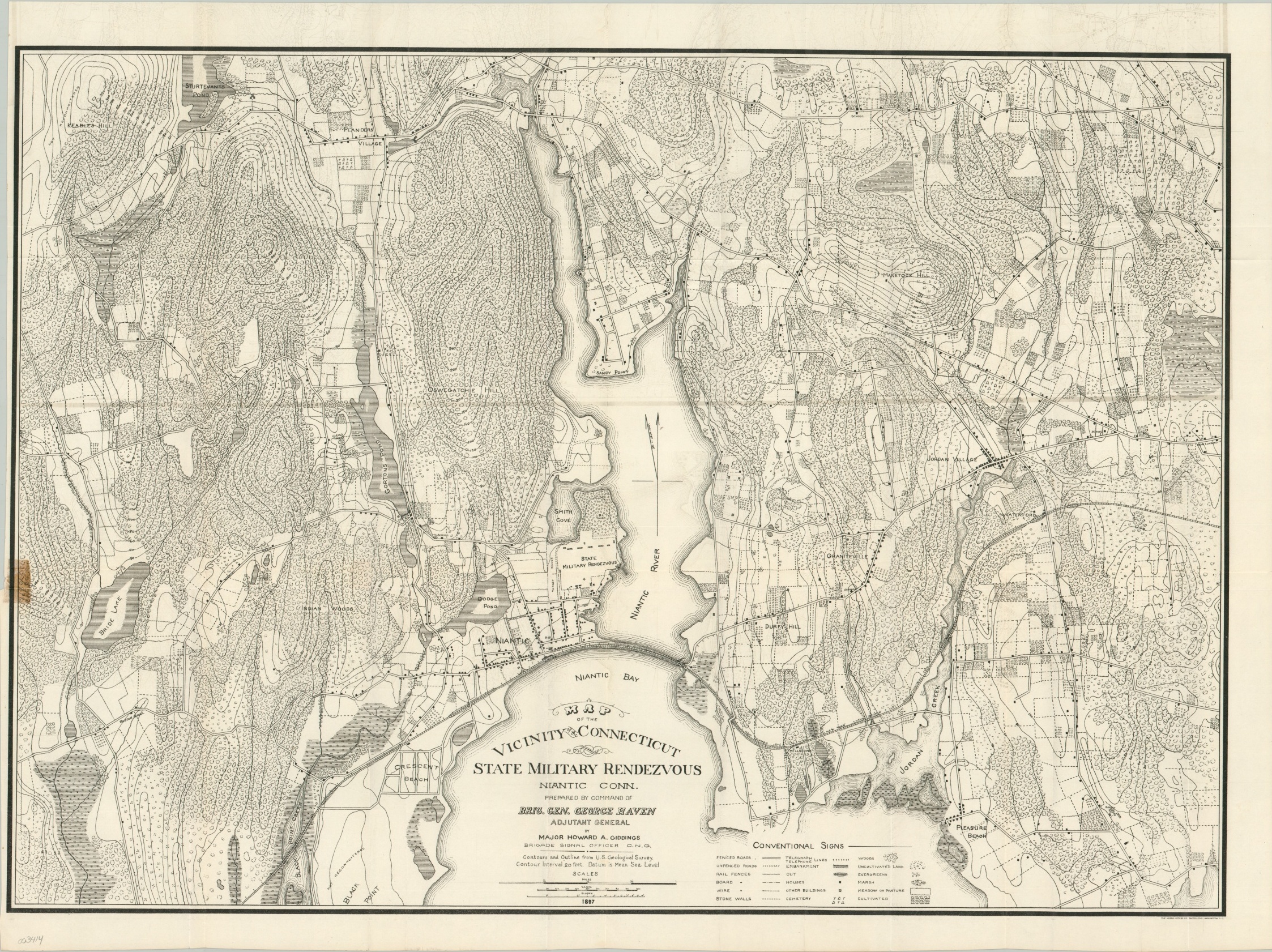
Map of the Vicinity of the Connecticut State Military Rendezvous
The preparedness of a state militia on the eve of the Spanish-American War.
Out of stock
Description
This detailed topographic map covering a portion of coastal Connecticut opposite of Long Island was created by Major Howard Giddings in 1897 and published the following year as part of The Organized Militia of The United States. Statement of the Condition and Efficiency for Service of the Organized Militia. From Regular Annual Reports, and Other Sources, Covering the Year 1897.
It shows the host site of the Connecticut State Military Rendezvous at Niantic and the surrounding territory. A comprehensive legend in the lower right identifies the various symbols used to identify geographic features, lines of transportation and communication, buildings, fences, and more.
Several National Guard units who attended the rendezvous would be subsequently enlisted to fight in the Spanish-American War, which broke out in 1898.
Map Details
Publication Date: 1897
Author: Howard Giddings
Sheet Width (in): 24.60
Sheet Height (in): 21.40
Condition: A-
Condition Description: Creasing and light wear along former fold lines, including a bit of faint offsetting within the image. Discoloration from old cellophane tape (now removed) visible in the lower left.
Out of stock

