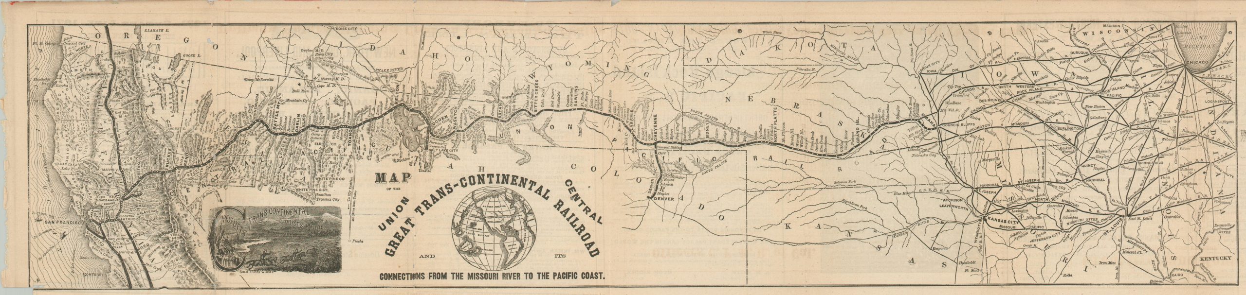
Map of the Union Central Great Trans-Continental Railroad
$325.00
Promoting the First Transcontinental Railroad just two years after completion.
1 in stock

Description
This early 1870s map of the Transcontinental Railroad was originally issued as part of the third edition of George Crofutt’s Trans-Continental Tourist Guide. Completed just two years prior to publication, the rail line connected America from coast to coast for the first time and opened a new avenue for westward settlement and tourism.
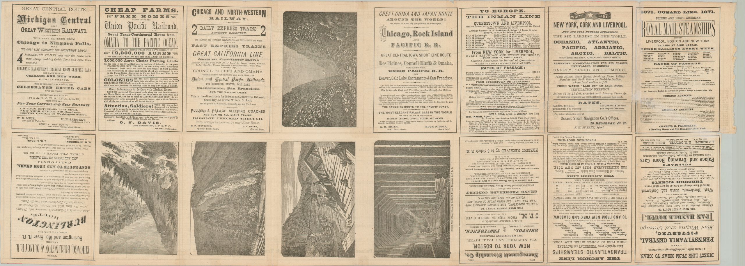
Dozens of stops are labeled along the route, with numerous connections offering passage to Denver, Chicago, Salt Lake City, St. Louis, and other important urban centers. Editorial telegrams (including an endorsement for Leland Stanford as President), a list of fares, and ocean-to-ocean timetables for the Union Pacific and Central Pacific (the two operators) are also provided. The verso offers a number of illustrated views of the dramatic scenery visible along the line, as well as several advertisements for other railroad and steamship companies.
Published in New York in 1871 by George A. Crofutt. After joining the Pike’s Peak Gold Rush, Crofutt fell in love with the American West and issued a series of popular guidebooks encouraging migration to the region.
Map Details
Publication Date: 1871
Author: George A. Crofutt
Sheet Width (in): 35.25
Sheet Height (in): 15
Condition: A-
Condition Description: Printed on thin paper that has separated at several areas along originally issued fold lines. Professionally repaired with Japanese tissue with very minimal image loss. Some light toning visible in a few places, but overall in very good condition.
$325.00
1 in stock