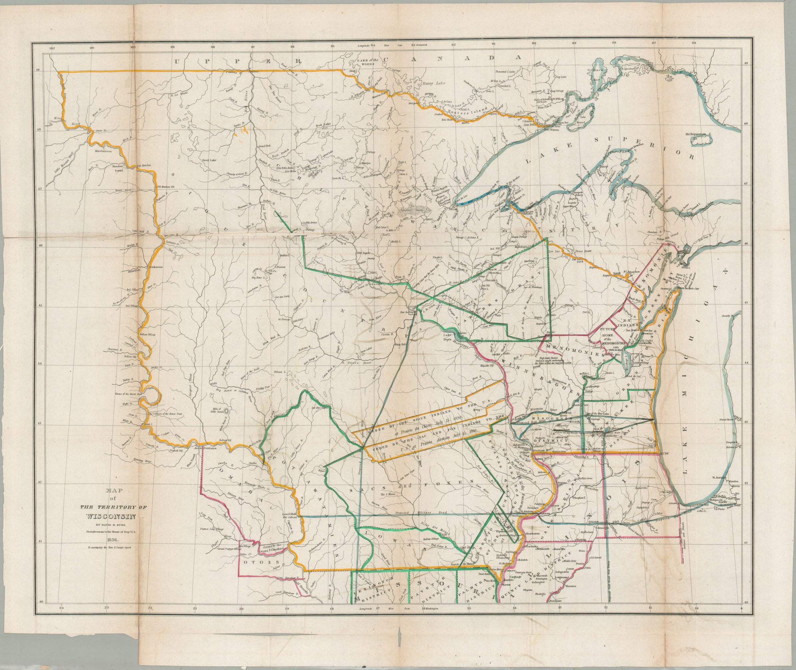
Map of the Territory of Wisconsin
One of the first printed maps of the newly formed Wisconsin Territory.
Out of stock
Description
This fascinating map of the Wisconsin Territory was published in 1836, the same year the vast region was formally incorporated by Congress. It shows a sparsely populated district that includes lands that would subsequently become parts of Missouri, Michigan, Minnesota, North Dakota, and South Dakota.
Numerous grants, land cessions, and Native American reservations are outlined in original hand color. Settlements, geographic features, and other locations of interest are labeled throughout. Indian villages are noted alongside railways, frontier fortifications, and planned military roads – the pacification of the indigenous population was largely completed with the Black Hawk War of 1832.
The image presents a largely open frontier, ready for settlement and development. The navigability of waterways is mentioned in several places and the emphasis on local industries is evident with the naming of mines, mills, and ‘great water power’ along the Rock River. The map was designed by David Burr, draughtsman to the U.S. House of Representatives, and was published to accompany a report “recommending the establishment of a government surveyor’s office west of Lake Michigan to survey the ceded lands and make them available for sale to settlers.” (Wisconsin Historical Society).
Map Details
Publication Date: 1836
Author: David Burr
Sheet Width (in): 23.75
Sheet Height (in): 28.25
Condition: B
Condition Description: Toning and soft creasing along originally issued fold lines. Several areas of separation have been repaired on the verso with archival material, though there has been some very minor image loss along a seam in the upper left. Offsetting from the original outline color visible in the lower right. A few small tears and splits in the lower margin and lower left, near the title block. About good condition overall.
Out of stock